
Palo Alto Baylands (Winter): Coast Casey Forebay
by Mary Ann Robertson & Julie Amato
In the winter, Coast Casey Forebay is a resting and foraging place for large flocks of water-loving birds. There is often a surprise here: an American Wigeon below the pump house, a Sora in the drainage ditch, a Wilson’s Snipe in a hidden pond. This short and easy trip is great for birders of all ages and abilities, offering you ample views of many birds gathered together in a single spot.
Trip Covers: December - February
Key Birds: ducks, shorebirds, Virginia Rail, Sora, Wilson's Snipe
How to Bird
The Forebay is a seasonal wetland south of Charleston Slough in the Shoreline at Mountain View regional park. It is a rectangular retention basin which collects water from storm drains for flood control. This trip covers a less than one-mile loop over paved and dirt trails around this forebay.
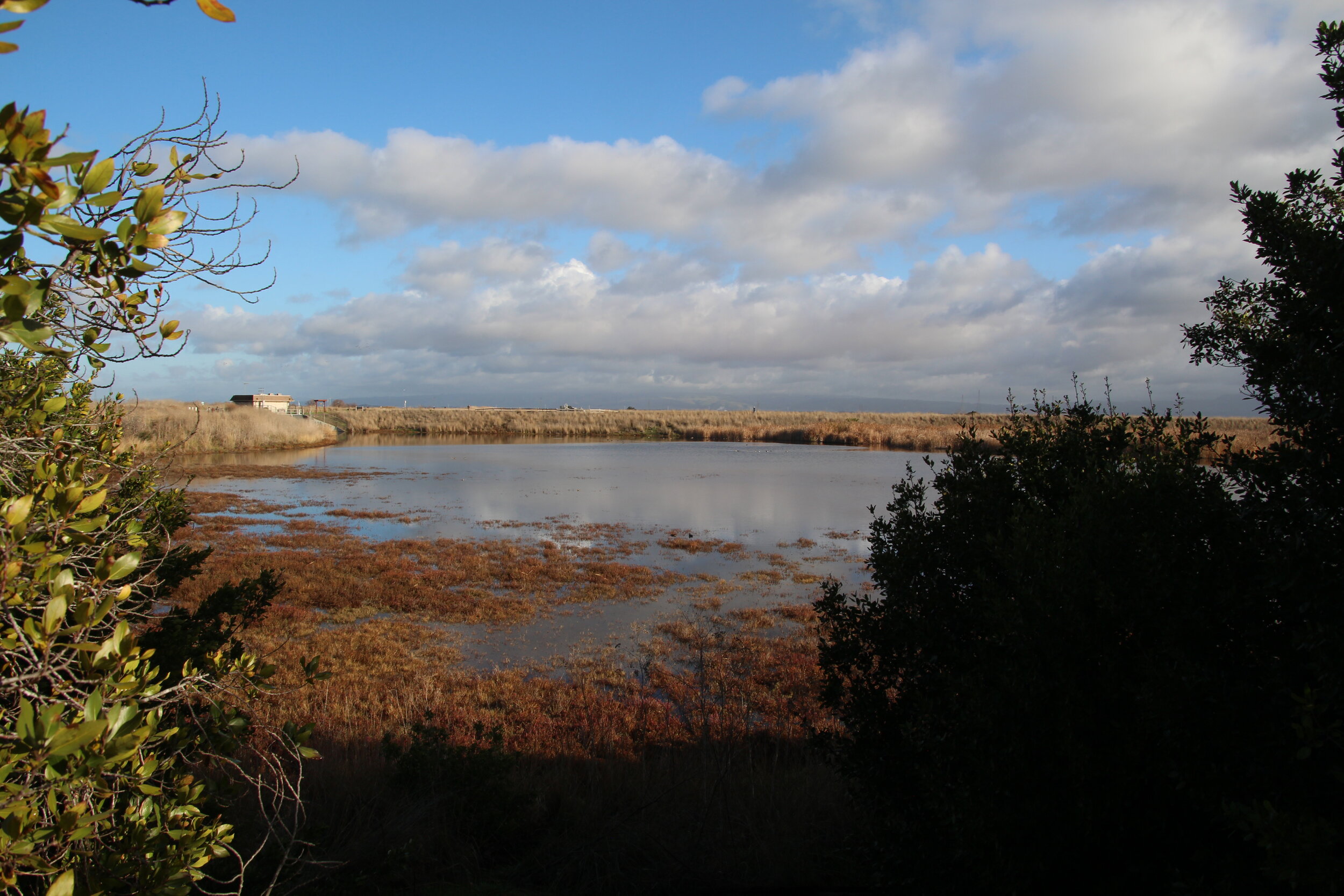
Coast Casey Forebay from bench near trailhead. Photo by Mary Ann Robertson.
Park along Terminal Boulevard. Proceed to the Trailhead at San Antonio Gate (#1 on Interactive Map), near the restroom, to go clockwise around the Forebay, as described in this guide. Alternatively, start at the end of Terminal to move in a counterclockwise direction along the route. If you are taking pictures, you may want to go counterclockwise in the morning and clockwise in the afternoon, to keep the sun behind you at the start of the trip.
From the restroom at the Trailhead, proceed north on the wide paved trail. As you walk along, look down into the Forebay on your right. During the rainy season there should be a lot of water in it. Because the basin is deep and wide, binoculars, a spotting scope, or a telephoto camera lens will be useful for close looks at the birds.

Dowitchers, Avocets, Godwits, and Gulls beneath the Pump House. Photo by Mary Ann Robertson.
The area with the most birds is below the Pump House (#2 on Interactive Map) at the northwest corner of the Forebay. Ducks, geese, gulls, dowitchers, peeps, stilts and avocets often spend time here foraging, preening, or resting.

American Wigeons with Black-necked Stilts. Photo by Mary Ann Robertson.
Sometimes American Wigeons are spotted here. The wigeon is a medium-sized dabbling duck which eats mostly plant material. The females have brown bodies with darker heads and smudges around their eyes. The males have a bright white crown stripe and a pale blue bill with a black tip. You can remember this by saying “the wigeon has a smidgen on its bill!”

American Avocets and Marbled Godwits in flight. Photo by Mary Ann Robertson.
If a raptor flies over the area, the birds will often fly up and circle around before resettling.
At the pump house, the trail splits and heads in two directions - the Adobe Creek Loop Trail continues north into Palo Alto Baylands, and the Bay Trail goes east towards Shoreline Lake.

Stream area, home of Gallinules and Soras. Photo by Mary Ann Robertson.
Turn right onto the Bay Trail to head towards Shoreline Lake. Continue along the trail to the stream-like area visible from the second Speed Limit 15 sign (#3 on Interactive Map) on the north side of the Forebay. Common Gallinules, Virginia Rails and Soras can sometimes be seen here. A bench is nearby (#4 on Interactive Map), and you can often see Song Sparrows flitting around the shrubs.
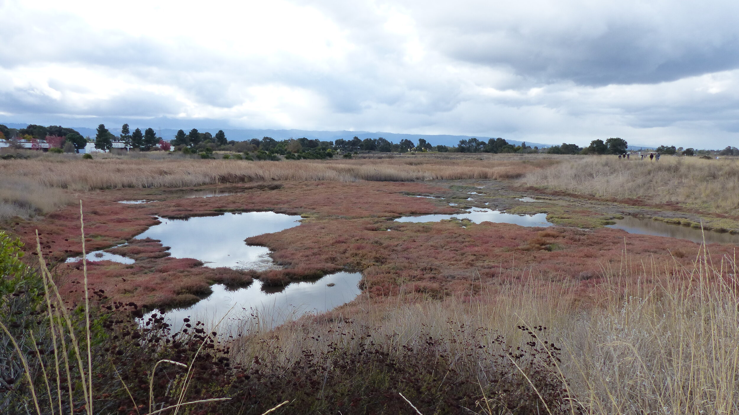
Northeast corner of the Forebay. Photo by Mary Ann Robertson.
After the stream, continue along the trail, then turn right at the junction before Shoreline Lake, heading south. After a short distance, take the dirt path on the right to the Overlook (#5 on the Interactive Map) at the northeast corner of the Forebay. You will see a salt marsh with pickleweed, cordgrass and salt grass, and several small ponds. Stilts, avocets, Killdeer, yellowlegs, and egrets like this area, alone or in pairs.
Yellowlegs are sandpipers and they are more solitary than most shorebirds. They eat invertebrates and small fish. As their name suggests, they have long bright-yellow legs. Two species are found in the area and can be hard to distinguish: The more common Greater Yellowlegs are larger than Lesser Yellowlegs and have a longer bill. Return to the main trail and continue south.
Throughout your walk, you will encounter many songbirds in the shrubs and grasses. White-crowned and Golden-crowned Sparrows are frequently seen and heard. Black Phoebes, Ruby-crowned Kinglets, and Yellow-rumped Warblers perch on branches and twigs, swooping out to catch insects in flight. Softly-calling flocks of Bushtits breeze through the dried stalks of plants, foraging seeds. Bewick’s Wrens buzz from bushes, unseen, and Anna’s Hummingbirds rest on branches, flashing dazzling pink heads or necks when caught by the sun. Keep your eye out for these small birds during your outing.
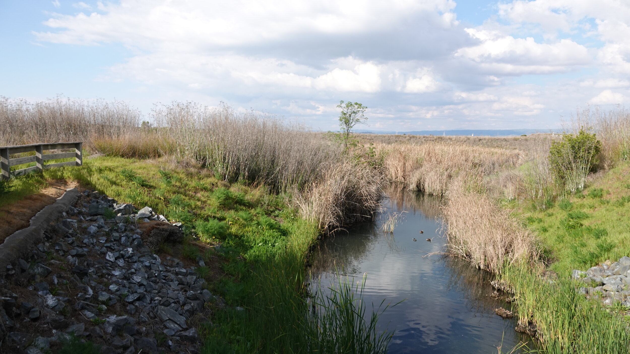
Drainage Ditch near the end of Terminal Blvd. Photo by Mary Ann Robertson.
When you reach the southeast corner of the Forebay, turn right, heading towards the end of Terminal Boulevard. You will see a Drainage Ditch (#6 on the Interactive Map) on your right. It contains water from the storm drains along Terminal and from neighboring office parks. Look for Mallards, Pied-billed Grebes, American Coots, Green Herons, and possibly a shy Sora.
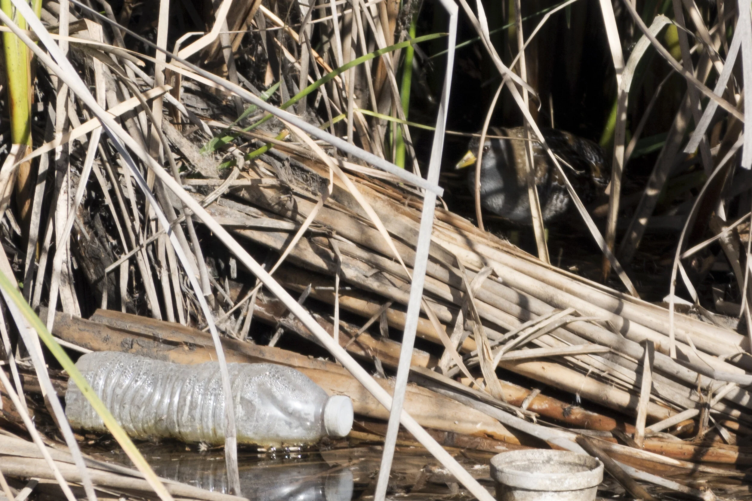
A Sora looks out from the reeds. Photo by Mary Ann Robertson.
The Sora is a type of rail. It winters in freshwater marshes and feeds primarily on seeds and invertebrates. Look for it along the edges of the water in the reeds, where it will sometimes pop out for a few seconds before returning to its hiding place. Its perky white tail reminds us of white-tailed deer!
A small tree towards the back of the ditch is often a perch for a Belted Kingfisher and Black Phoebes. The ditch sometimes has turtles and muskrats. Unfortunately, plastic and Styrofoam debris have also been seen in the water, reminding us not to litter.

A hidden pond along the dirt trail. Photo by Mary Ann Robertson.
After looking at the ditch, continue towards Terminal, where you will find a narrow single-file dirt path to the left of the ditch. Following this path through the grasses you’ll come upon a clearing and pond on the right on the south side of the Forebay. We call it the Hidden Pond (#7 on the Interactive Map). (The 1000-foot-long path can also be entered near the bench at the San Antonio trailhead.)
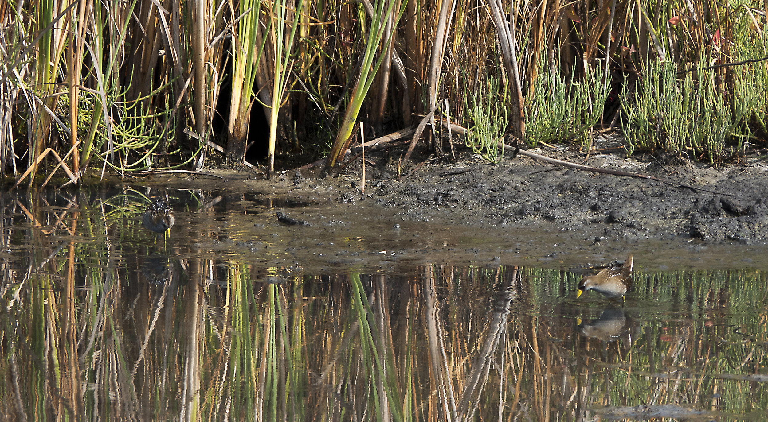
Two Soras at the Hidden Pond. Photo by Mary Ann Robertson.

Wilson’s Snipe at the Hidden Pond. Photo by Mary Ann Robertson.
At the pond, look for stilts, avocets, Killdeer, dowitchers, yellowlegs, egrets, and various ducks including Cinnamon Teals. Canada Geese may fly in and land on the pond. Soras and Wilson’s Snipes have also been seen here. The elusive snipe is a medium-sized sandpiper with a long bill, large eye, and heavily striped head. Females have longer bills than males.
Finish your outing by continuing along the dirt path to return to the trailhead, completing the loop around the Forebay.
Ready for More?
As you are walking this loop, look to your left. You will see lots of good birds in Charleston Slough, Pond A1, and Shoreline Lake. If time permits, Palo Alto Bayland’s Adobe Creek Loop Trail, the continuation of the trail that runs along the west side of the Forebay, also offers great birding. These are covered in our Self-Guided Field Trip: Charleston Slough and Adobe Creek in Winter.
Interactive Map
Directions
From US-101 in Mountain View, exit San Antonio Rd. Continue north to the end of San Antonio Rd then turn right onto Terminal Blvd. Park along Terminal Blvd. GPS: 37.433767, -122.099796
Parking: Paved street parking, two ADA parking spots
Fees: None
Public Transportation: Not available
Park Hours: Dawn to dusk
Facilities: Wheelchair accessible bathroom and drinking water available at the trailhead.
Trip Mileage: About 0.75 miles
Trail Conditions: A wide paved trail runs along the west, north, and east sides of the Forebay. A narrow dirt trail hugs the south side of the Forebay. This trail may become muddy after it rains - birders can take the paved pathway that borders the parking spaces on Terminal Boulevard instead. There is no elevation change.
Accessibility: There are two ADA parking spots, and a curb cut and path leading to the trailhead, at the San Antonio Gate. The trail entrance at the end of Terminal Boulevard is at grade with the paved path that runs along the north side of the road. All trails around the Forebay are wide and paved, except for the narrow packed-dirt trail that hugs the south side of the Forebay. As an alternative to taking this trail, birders can follow the main trail to the end of Terminal and return to the trailhead on the paved path that runs along the side of the road. The dirt path to the northeast overlook is wide but not at grade. Four benches are along the trip route.
Bikes: Permitted on the paved trails but not recommended for this trip.
Dogs: Dogs are not allowed on Shoreline trails; dogs on leash are allowed in Palo Alto Baylands. For this trip, this means that they are not allowed on the trails on the north, east, and south side of the Forebay. They are only permitted on leash from the San Antonio Trailhead to the intersection of Adobe Creek Loop Trail and the Bay Trail, on the west side of the Forebay.
More information
SCVAS Wetlands Discovery Program map, featuring the Forebay
Los Altos Town Crier article on birding at Shoreline
eBird hotspot: Charleston Slough/Coast Casey Forebay - Note that the hotspot combines Charleston Slough and Coast Casey Forebay, so it does not isolate the counts at the Forebay.
Birding Basics with SCVAS Education Specialist Carolyn Knight: Anatidae (ducks)
Virtual Tour with SCVAS Executive Director Matthew Dodder: Forebay & Shoreline Park
Yellowlegs ID with Alvaro Jaramillo: Which one is it?
Visit All About Birds for more information about the species mentioned in this guide.
More Resources
For more trips like this one, visit Self-guided Field Trips
Visit the SCVAS Birding Resources page for more information on where to bird, our birding community, birding identification resources, and more
Read “What to Look for Now” by SCVAS Executive Director Matthew Dodder
Banner Photo Credit: Greater Yellowlegs by Mary Ann Robertson
Last Updated: 05/02/2021
Enjoyed this Trip?
Support the work of Santa Clara Valley Audubon Society and become a member. To contact the trip writer with comments, questions or location updates, please email fieldtrips@scvas.org. You can also post in the comment section below. (If you’d like to post anonymously, type your comment, select “Post Comment”, then simply provide a name, like “Guest”, and select “Comment as Guest”.)