
Palo Alto Baylands (Winter): Charleston Slough and Adobe Creek
by Mary Ann Robertson
Watching shorebirds and water birds up close is fun at Charleston Slough and Adobe Creek. Take the time to study the birds’ behaviors on a short or long trip and laugh at their antics. Coots swim-chase each other, egrets dash after one another with plumes flying, dabbling ducks tip over with their tail feathers in the air, avocets sweep their upcurved bills from side to side, meadowlarks make holes in the dirt, and pelicans yawn and groom. Shorebirds, ducks, and gulls abound!
Trip Covers: December - February
Key Birds: Canvasback, American Coot, American White Pelican, Black-crowned Night-Heron, Western Meadowlark
How to Bird
On this outing, you will visit four locations in one mile on the short trip. Stop 1 is the Adobe Creek overlook. Stop 2 is the Charleston Slough viewing platform. Stop 3 is the levee between the Slough and Pond A1. Stop 4 is the first bench facing Adobe Creek. You can make this trip longer by continuing north on the trail to Stop 5 at the bench facing the pelicans on the islands in Adobe Creek, and then Stop 6 at the levee between the outer and inner Charleston Slough.
Charleston Slough is a tidal mudflat in Shoreline at Mountain View regional park. During high tide it looks like a lake. During low tide the mud is exposed and a deep channel is visible. Nearby Adobe Creek (in the Palo Alto Flood Control Basin, part of the Palo Alto Baylands) is a 14.2-mile-long creek originating in the Santa Cruz Mountains and flowing to the San Francisco Bay at a tide gate. Adobe Creek is joined by Barron Creek at Highway 101 and receives storm drain water from the Coast Casey Forebay via the Pump House at the forebay.

Intersection of Adobe Creek Loop Trail (straight ahead) and Bay Trail (on right)
You have the option to take a short or long trip. We’ll start with the short 1-mile round-trip outing. Beginning at the San Antonio Gate trailhead, head north and after you pass the Coast Casey Pump House on your right, look for a packed dirt trail, sloping downward on your left. (This is before the intersection of the Adobe Creek Loop Trail and the Bay Trail.)
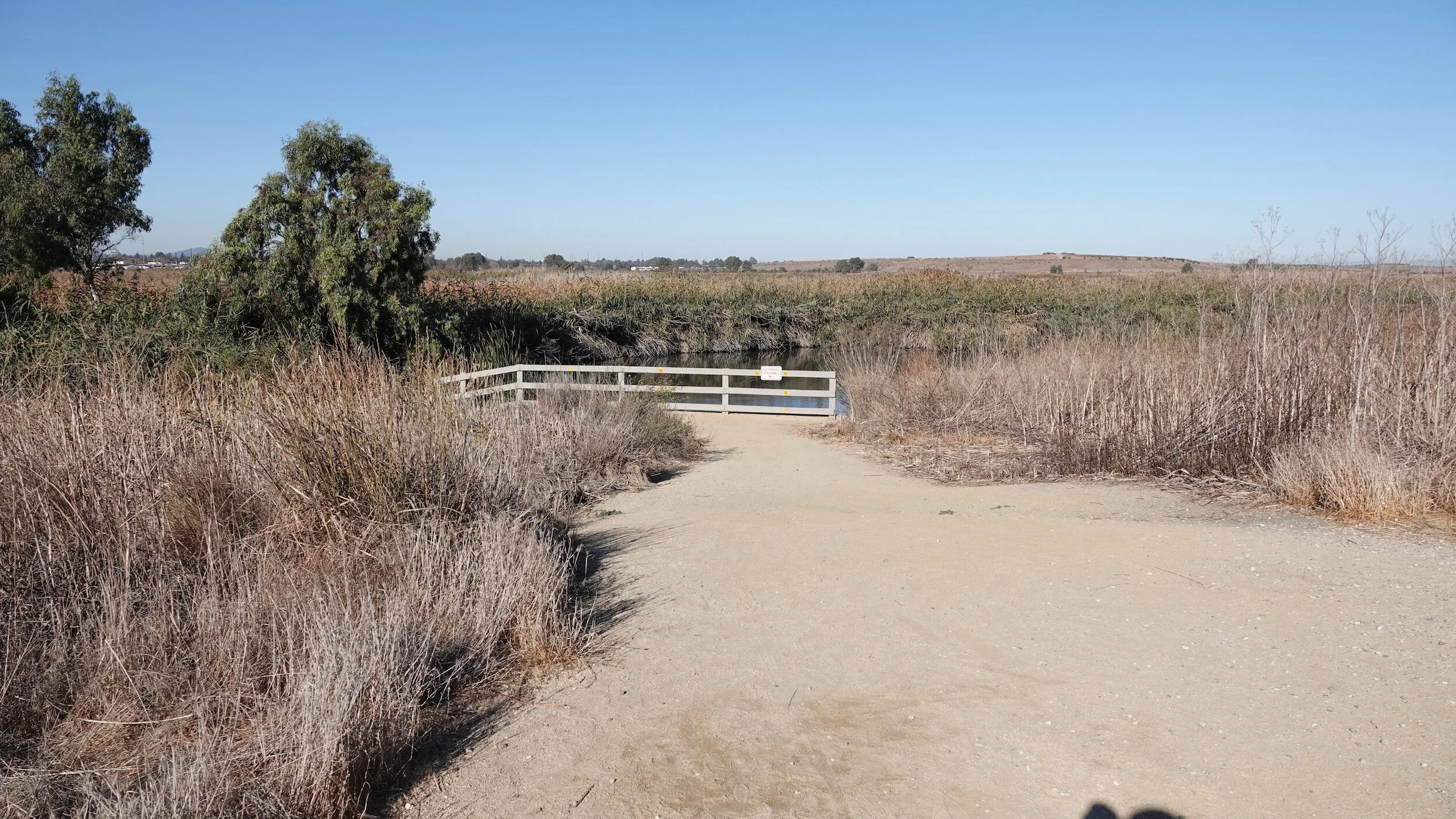
On the way to Stop 1: Trail sloping down to Adobe Creek overlook
Go down the slope to the fence in front of Adobe Creek. This is the Adobe Creek overlook (Stop 1). Here you have a good view of the creek.

Stop 1: Adobe Creek - white spots in reeds are Black-crowned Night-Herons - January
Look across the creek for Black-crowned Night-Herons hidden in the reeds or resting in the eucalyptus trees on the left. You will probably see both the gray, black and white red-eyed adults and the brown pale-streaked or spotted first-year herons with orange eyes. They eat many aquatic creatures and will swallow a fish whole. During the day they rest in the reeds and at night, they hunt.

Black-crowned Night-Herons in reeds - adults and juvenile
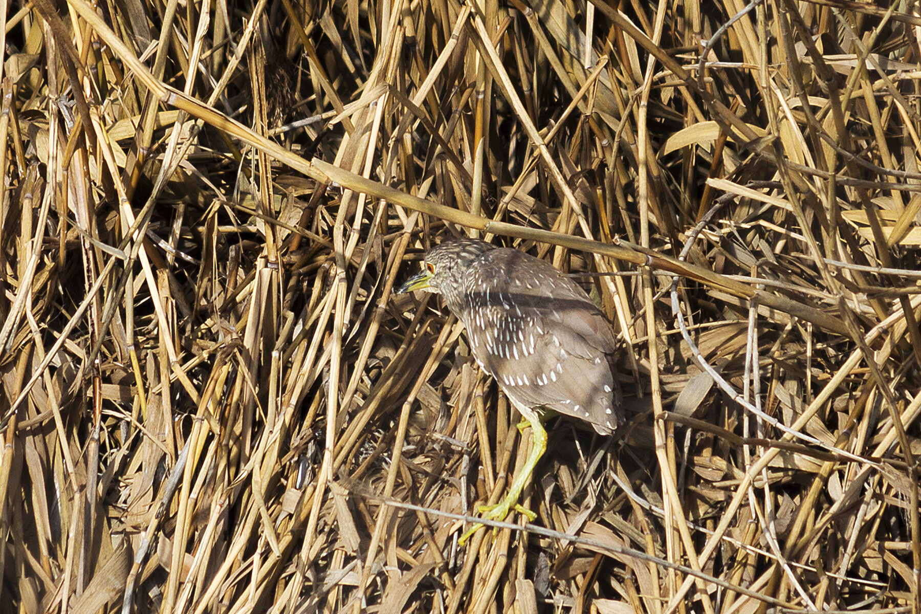
Black-crowned Night-Herons in reeds - juvenile
In the creek you may see Pied-billed Grebes, Mallards, Gadwalls and American Coots. If you are lucky, you may see a circle of American White Pelicans herding fish in the creek.

Stop 2: Charleston Slough viewing platform at medium-low tide
After enjoying the overlook, go back up the slope to the Adobe Creek Loop Trail and go towards the wooden viewing platform. Walk down the path to the platform (Stop 2). (Note that it is often slippery when wet.)
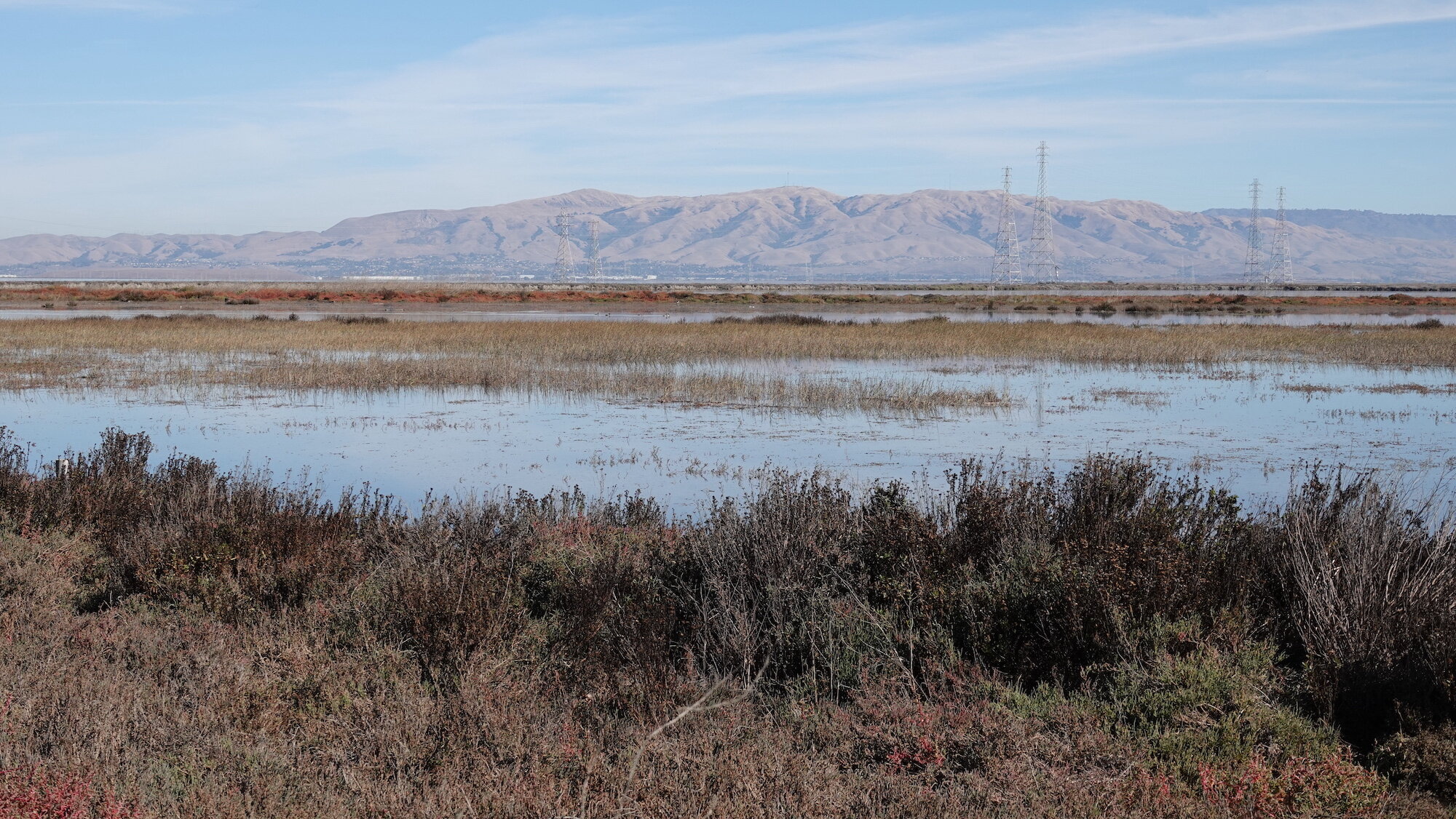
From here you’ll have a good view of Charleston Slough. When the tide is high, it looks like a lake and you will see many ducks. When the tide is low, the shorebirds will be sweeping the mud for biofilms or probing the mud for worms and invertebrates. It’s a good idea to check the level of the tide before you go.

Dowitchers, Black-necked Stilts, Northern Shovelers and Green-winged Teals at Charleston Slough
Take time to watch the behaviors of the birds. Identify the tiny Least Sandpipers on the mud (their legs are yellow when not covered with mud), as well as the American Coots, Marbled Godwits, American Avocets, Black-necked Stilts, Long-billed and Short-billed Dowitchers, Western Sandpipers and many kinds of ducks. Northern Shovelers, Green-winged Teals and Canvasbacks may be on the water-filled channels or on the banks.

View of Avocets in Charleston Slough at high tide from Stop 3.
After watching from the viewing platform, continue eastward on the Bay Trail and turn left onto the dirt levee separating Charleston Slough from Salt Pond A1 (Stop 3). From here you can often see many shorebirds, such as American Avocets, in the mudflats of the slough, such as American Avocets. In January and February the Avocets are developing their rust-colored breeding plumage.
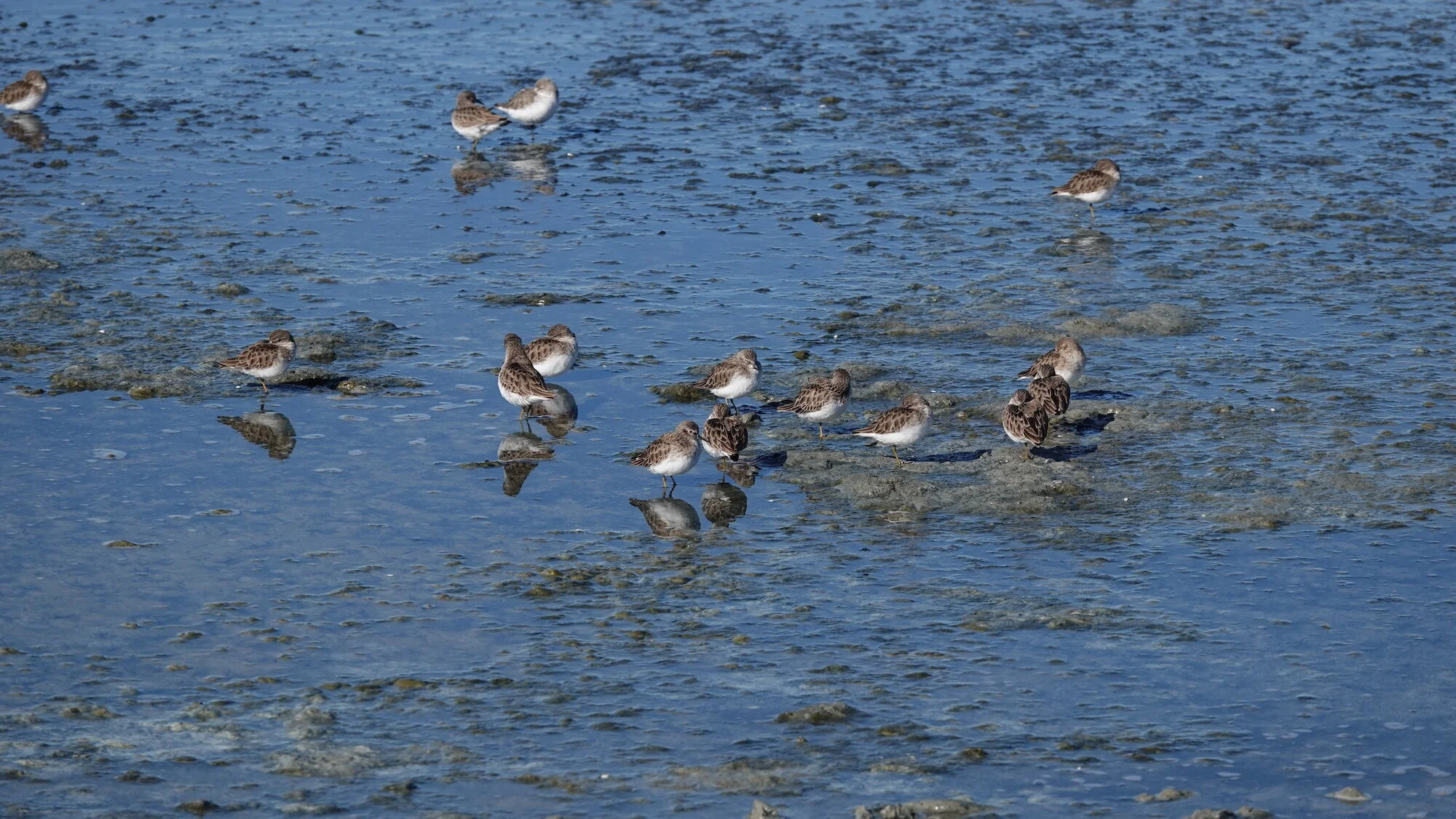
Look carefully for the small Least Sandpipers with yellow legs.
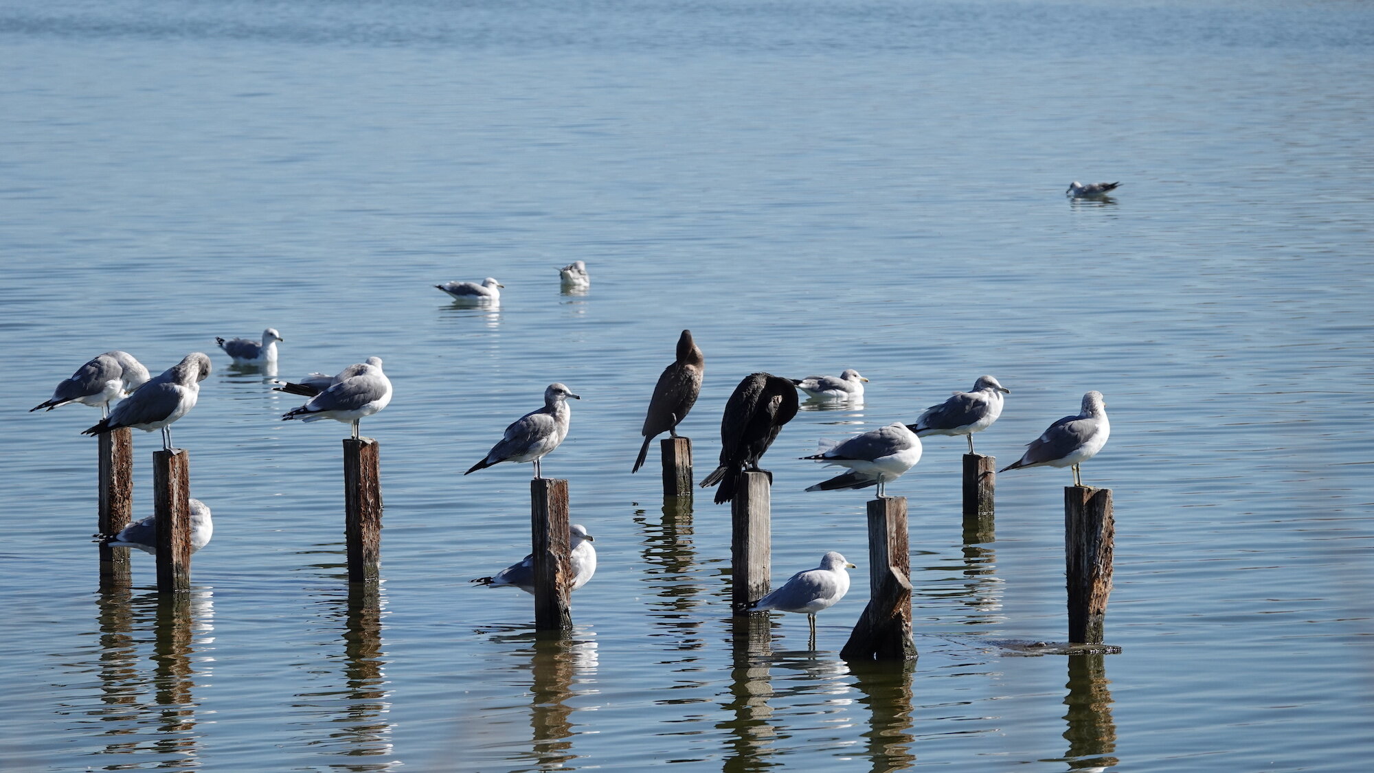
Birds on pilings in Pond A1
And you can sneak a peek at Pond A1 on the right side of the levee to see what birds have perched on the pilings. Note: Pond A1 is not part of Charleston Slough.

Adobe Creek Loop Trail after a rain
When you are finished at the levee, return to the Bay Trail. Go back the way you came, passing the observation deck, then turn right onto the Adobe Creek Loop Trail. Charleston Slough will be on your right and the creek on your left.

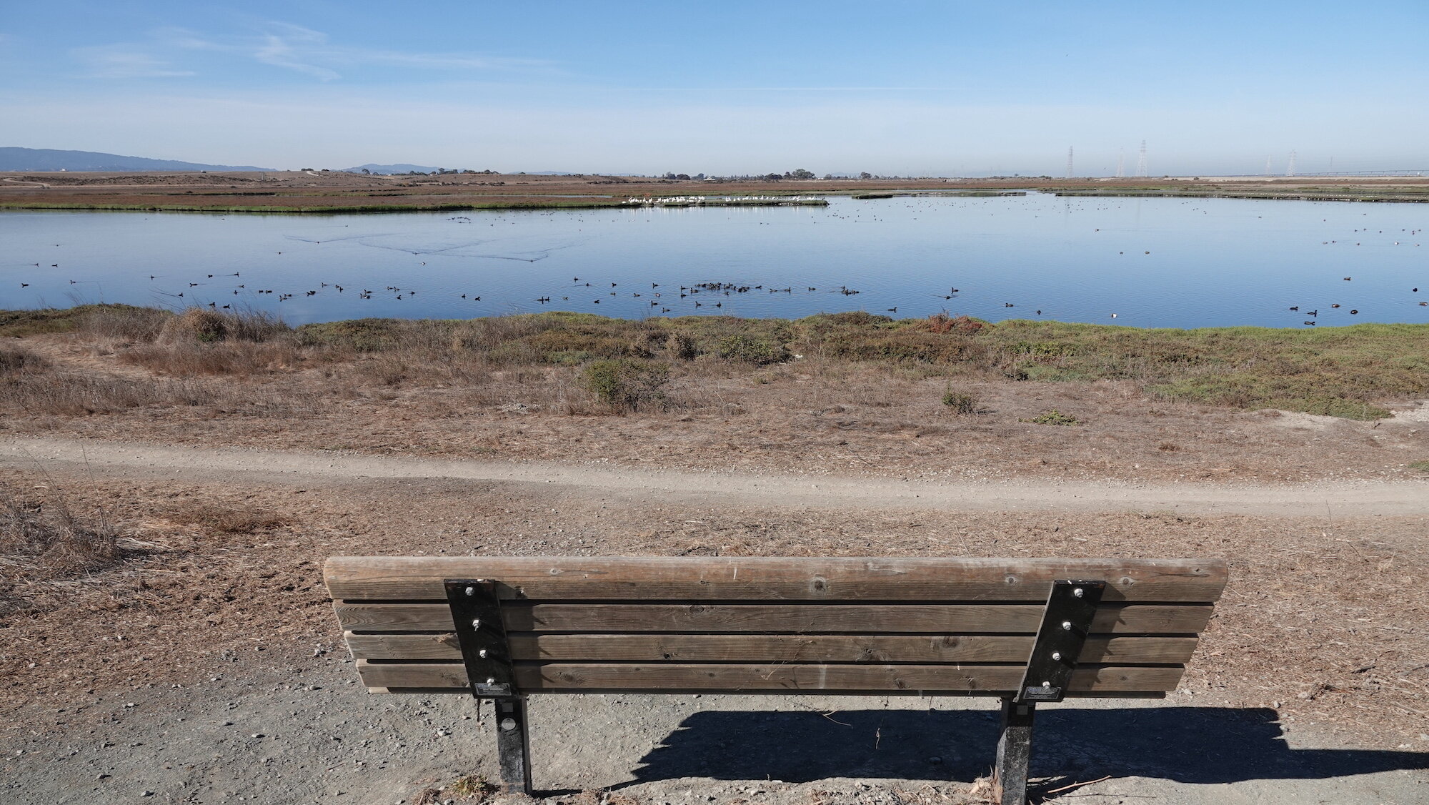
Stop 4: First bench on Adobe Creek Loop Trail, narrow path to the right
Soon you will come to a bench on the left (Stop 4), and a narrow single-file path leading down the slope to the Creek. At this point, American White Pelicans often hunt in the creek or preen on the mud banks. They may also form circles to herd the fish and then dip down to catch them.

Adobe Creek at bottom of narrow path near first bench
If you go down the single-file dirt path, you can view the ducks and birds at creek level if the reeds are not overgrown. A Snowy Egret may show you its hunting techniques. Many ducks and dowitchers have probably tucked their bill under their back feathers to keep warm while they take a snooze. After a heavy rain the creek level may be high, no mud banks will show, and the path to the creek may be flooded. You can still watch the birds from the Adobe Creek Loop Trail if you don’t go down the narrow path.

Canvasbacks and Shovelers with dowitchers in the Slough channel
Look at Charleston Slough across the trail from the Creek. If the tide is out you may see Canvasback ducks along the channel. To finish the short trip, return to the trailhead.
To take the long trip (adding approximately two miles round-trip), instead of returning to the parking lot, continue northward up the Adobe Creek Loop Trail, and look for birds on both sides of the trail. There are five benches that face the slough and four benches that face the creek along this stretch of the trail.

Adobe Creek Loop Trail, the Creek on the left and the Slough on the right

Western Meadowlark

Western Meadowlark blending in
Along the way and on the sides of the trails, you may see Western Meadowlarks walking or running on the ground, scratching in the dirt or making holes with their bills. They feed on seeds and insects. American Pipits, Song Sparrows and Savannah Sparrows can also be seen sometimes.

Adobe Creek “Soap Pond” area according to Google Maps

Charleston Slough with tidegate (white area) between outer and inner Slough
Soon you will come to an area of Adobe Creek Google Maps called the “Soap Pond.” On the other side of the trail in Charleston Slough in the distance you will see a white area which is the tidegate in the levee between the outer and inner Slough.
Stop 5: Bench along Adobe Creek Loop Trail looking at Pelicans on an island
Continuing along the trail, you will come on your left to a bench (Stop 5) from which you can see many American White Pelicans and other birds on the islands in the creek.

Pelicans on island in Adobe Creek

Stop 6: Levee between outer and inner Charleston Slough
On the other side of the trail you will see a levee (Stop 6) separating the outer from the inner Charleston Slough. The levee has a tide gate which allows the bay waters to enter the slough during high tide.
Outer Charleston Slough (open to the bay) at high tide

Northern Harrier hunting over Adobe Creek
Northern Harriers hunt here in the outer Slough and over the creek. At this point you can turn around and head back to the parking lot, watching the creek for interesting birds.
Note that in the Fall of 2021 (depending on permits) construction will begin on a project to replace the 63-year-old tide gate between the Creek and the Bay. The Adobe Creek Loop Trail at the intersection with Bay Trail will be closed from September 1-January 31 each year for four years. Most of it will be open February 1-August 31 during those years.
Ready For More? The Slough is part of Shoreline at Mountain View regional park which includes the Coast Casey Forebay and Shoreline Lake, both good places to bird. Try out our Self-Guided Field Trip for Coast Casey Forebay. Salt Pond A1 to the east of the Slough is part of the “Alviso ponds” of the South Bay Salt Pond Restoration Project and it also has a variety of birds and ducks.
Interactive Map
Directions: From US-101 in Mountain View, exit San Antonio Rd. Continue north to the end of San Antonio Rd then turn right onto Terminal Blvd. Park along Terminal Blvd. Latitude/Longitude: 37.433767, -122.099796
Parking: Paved parking lot, 2 ADA Compliant spots
Fees: None
Public Transportation: Not available
Park Hours: Shoreline at Mountain View: dawn to dusk; Palo Alto Baylands: 8 am to Sunset
Facilities: Wheelchair accessible bathroom and drinking water available at the trailhead.
Trip Mileage: The short walk is about 1 mile round trip. The long walk is about 3 miles.
Trail Conditions: Paved from the trailhead to the intersection of Bay Trail and Adobe Creek Loop Trail and along the south edge of the Slough. The wooden viewing platform may be slippery when wet. The levee between the Slough and Pond A1 is packed dirt. The Adobe Creek Loop Trail is packed dirt with some gravel. There is no elevation change. There are many benches along the route and the locations of 3 are marked on the Interactive Map.
Accessibility: There are two ADA parking spots, and a curb cut and path leading to the trailhead, at the San Antonio Gate. The trails leading to the Bay Trail and along the south edge of Charleston Slough are wide and paved, except for the narrow packed-dirt levee trail that separates the Slough from Pond A1. The trail down the slope to the Adobe Creek overlook is packed dirt and sand. The Adobe Creek Loop Trail between the Creek and the Slough is packed dirt with some gravel. Pedestrians, dog walkers and bicyclists use it. The narrow path going to Adobe Creek next to the First Bench is not wheelchair accessible.
There are six benches facing Charleston Slough, one on the Bay Trail and five on the Adobe Creek Loop Trail. There are benches along the railings of the viewing platform overlooking the Slough. There are four benches facing Adobe Creek on the Loop Trail in the area included in this guide.
Bikes: This is a great trip to do by bike.
Dogs Allowed: Dogs on leashes are allowed on the paved trail from the San Antonio Trailhead to the intersection of the Adobe Creek Loop Trail and the Bay Trail. They are also permitted on the unpaved Adobe Creek Loop Trail but not on the paved Bay Trail along the south edge of Charleston Slough.
Maps and Guides:
Palo Alto Baylands Map. Note that this map calls Pond A1 “Mountain View Slough”
Shoreline at Mountain View Map
Palo Alto Flood Basin Tide Gate Structure Replacement Project | Santa Clara Valley Water
Charleston Slough Tides
eBird Hotspots:
eBird hotspot: Charleston Slough/Coast Casey Forebay - Note that this hotspot combines Charleston Slough and Coast Casey Forebay, so it does not isolate the counts at the Slough.
eBird hotspot: Adobe Creek North of US 101
eBird hotspot: Palo Alto Flood Control Basin
eBird hotspot: Salt Pond A1
Bird ID:
Watch Birding Basics with SCVAS Education & Outreach Specialist Carolyn Knight: Pelicans and Birding Basics: Anatidae (ducks)
Read What to Look for Now Winter 2019-2020 and 2020-2021 by SCVAS Executive Director Matthew Dodder.
Visit All About Birds for more information about the species mentioned in this guide.
More Resources
For more trips like this one, visit Self-Guided Field Trips.
Visit the SCVAS Birding Resources page for more information on where to bird, our birding community, bird identification resources and more.
Read “What to Look for Now” by SCVAS Executive Director Matthew Dodder.
Banner Photo Credit: All photos by Mary Ann Robertson
Last Updated: 3/23/2022
Enjoyed this Trip?
Support the work of Santa Clara Valley Audubon Society and become a member. To contact the trip writer with comments, questions or location updates, please email fieldtrips@scvas.org. You can also post in the comment section below. (If you’d like to post anonymously, type your comment, select “Post Comment”, then simply provide a name, like “Guest”, and select “Comment as Guest”.)