Yuba Pass and Sierra Valley (Summer)
Birding the mid-Sierra
by Matthew Dodder
Trip Covers: June – July (late spring, early summer)
Key Birds
Yuba Pass: Calliope Hummingbird, Mountain Quail, William’s Sapsucker, Black-backed Woodpecker, Hammond’s Flycatcher, Dusky Flycatcher, Clark’s Nutcracker, Townsend’s Solitaire, American Dipper, Green-tailed Towhee, Fox Sparrow (“thick-billed” subspecies), Evening Grosbeak, Pine Grosbeak, Cassin’s Finch, MacGillivray’s Warbler.
Sierra Valley: Bald Eagle, Swainson’s Hawk, White-faced Ibis, Sandhill Crane (Greater, breeding), Willet (breeding), Common Nighthawk, Common Poorwill, Gray Flycatcher, Black-billed Magpie, Sage Thrasher, Vesper Sparrow, Brewer’s Sparrow, Yellow-headed Blackbird.
Introduction
Nearly every summer since we met, Cricket and I have ventured into the Sierra for some montane birding. The sky is an extraordinary blue in the mountains, flowers are everywhere, and the air is absolutely the freshest one can imagine. A colorful assortment of birds breed in the mid-Sierra, and while it’s a relatively short drive, it feels like a world away. The beauty and noiselessness of the woodland is almost impossible to believe—filled with intriguing animal sounds and songs, but so entirely peaceful it feels like you have to whisper to each other so as not to disturb the order of things. Among our favorite destinations is the Yuba Pass and the nearby Sierra Valley, which feature so many spectacular birding spots its hard to know which ones to visit during our usual, too-short long weekend. With so many options, we usually have to skip at least one of our favorite stops before we head home, simply because we run out of time. But the birding is exciting almost everywhere we go so… it’s not a problem.
Because spring arrives later in mountains, and snow can linger along the roads until May, we usually make this trip between June and July. Bird activity is high at that time, and many birds are actively feeding their young. Accommodations are limited so it is essential you make arrangements for lodging several months in advance. We like to stay in Sierra City, but there are other communities to choose from if you prefer. The following account is broken down into day-long excursions from Sierra City. Even if you can only devote two days to your mountain adventure, you can assemble a very nice itinerary with a variety of habitats. But see if you can spend at least three days. Trust me.
The sequence of days mentioned here is completely customizable, of course, and your itinerary will depend on what habitat you feel like exploring—the mountains or the valley… To begin, the mountain areas are cold in the morning, but warm up nicely by late morning and can become quite hot in the afternoon. There are denser woodlands in the mountains, and perhaps a greater assortment of unfamiliar species. At higher elevations, we get tired faster and often need to rest in the afternoon before dinner. The valley on the other hand warms up quite rapidly and involves much more driving to reach birding destinations. The area is wide open with few trees and visibility might bet better. The birds found in Sierra Valley are quite different from those around Yuba Pass, so you will probably want to work both areas into your visit if you are to come away with a full experience of the area.
How to Bird
Be prepared for both frosty mornings and hot afternoons. Hiking poles may be helpful on some hikes. There are very few fuel stations in the area, and only one grocery store so plan ahead. Carry a backpack with water and snacks if you plan to be on the trail for a while. Some roads are rugged, but generally fine for standard passenger cars. Avoid leaving valuables in your vehicle. Mosquitos are occasionally a problem, especially at dusk. Cellphone coverage is spotty. Be aware, this is also Black Bear country.
Excursion 1: First Things First
On the way up…
Lower Carpenter Valley Trailhead
Allow 2-4 hours to explore, RESTROOMS AT TRAILHEAD
Key Birds: Calliope Hummingbird, Williamson’s Sapsucker, Dusky Flycatcher, Hammond’s Flycatcher, Townsend’s Solitaire, Mountain Chickadee, Clark’s Nutcracker, Evening Grosbeak
eBird Hotspot: https://ebird.org/hotspot/L4708466
Location: 39.385923, -120.256350 (#1 on interactive map)
Trail Map: https://www.truckeedonnerlandtrust.org/lower-carpenter-valley
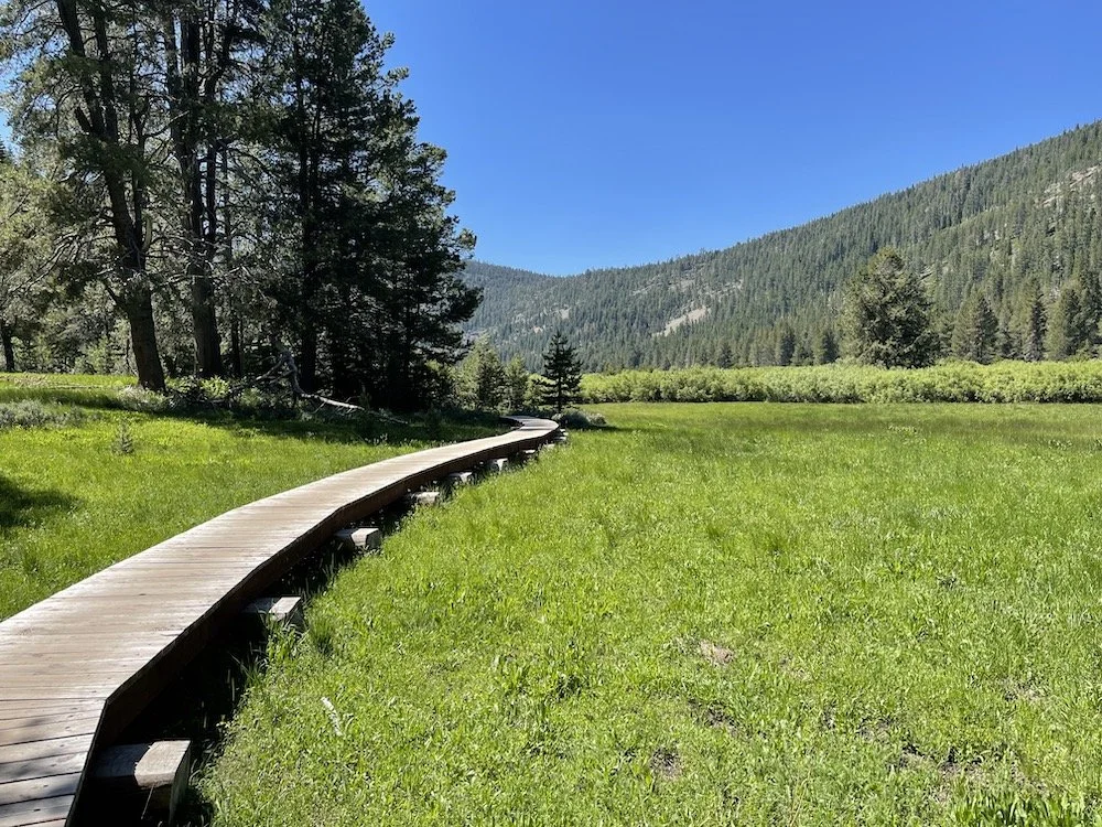
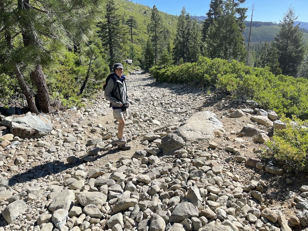
If you are not in a rush to reach your lodge, be sure to stop by this beautiful valley. This is a newly opened area just outside of Truckee. It was privately owned for almost a century and remains one of the few, mostly unchanged subalpine meadows in the region. The trailhead is located at the end of a long rutted dirt road, and for that reason, few people visit it. But if you do go you will likely get some of your first montane species for the trip. Williamson’s Sapsucker, Calliope Hummingbird, Dusky and Hammond’s Flycatchers, Mountain Chickadee, Clark’s Nutcracker, Townsend’s Solitaire, Evening Grosbeak, and Cassin’s Finch. The area is a lush emerald green in early summer and features a 5-mile walk along the edge of the meadow. The trail leads you over a boardwalk which brings you close to the preferred habitat of the rare Black Pettaltail (Dragonfly).

White-headed Woodpecker by Tom Grey

Lower Carpenter Valley
Sierraville Cemetery on Henry Dota Rd
Allow at least 1 hour to explore, NO FACILITIES
Key Birds: Great Horned Owl, Mountain Bluebird, Mountain Chickadee, Green-tailed Towhee, Brewer’s Sparrow, Vesper Sparrow, Chipping Sparrow
eBird Hotspot: https://ebird.org/hotspot/L580462
Location: 39.584028, -120.379686 (#2 on interactive map)
This is a good stop on your way to your lodging. It’s an easy stroll, but remember, you’ve been in the car for several hours and you are now at a higher elevation… you might get more tired than you think. The cemetery is small and pretty with thick conifers for Great Horned Owls and good scrubby habitat around the edges for Green-tailed Towhee, Brewer’s and Vesper Sparrows. Most often we find Chipping Sparrows here along with Mountain Chickadee. In the large fields adjacent to the road, there are often Mountain Bluebirds, and in recent years, we have found Black-billed Magpies quite easily. In years past we had to drive many miles to the far end of the valley to find them… Be sure to fill up your tank at the small gas station before you head up the hill to you lodge.
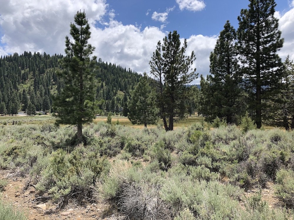
Sierraville Cemetery

Mountain Bluebird by Fred Lim
Excursion 2: easy hikes
“Breathing easier”
Frazier Falls Trail
Allow at 1-2 hours to explore, RESTROOMS AT TRAILHEAD
Key Birds: Mountain Quail, Calliope Hummingbird, Dusky Flycatcher, Hammond’s Flycatcher, Olive-sided Flycatcher, Nashville Warbler, MacGillivray's Warbler
eBird Hotspot: https://ebird.org/hotspot/L3053941
Location: 39.709000, -120.646000 (#3 on interactive map)
Frazier Falls Trail Map: https://www.fs.usda.gov/recarea/plumas/recreation/recarea/?recid=82706&actid=50
This area was new to us on our last visit and provided a fantastic view of Frazier Falls and good looks at some of our target species. A main trail features a moderate walk on a mostly paved walkway leads to a dramatic overlook where we found a very cooperative Nashville Warbler just a few feet from us. There are a variety of montane trees, shrubs and flowers here that characterize the habitat and many vocal Fox Sparrows and a few Green-tailed Towhees. You will likely hear Olive-sided Flycatcher as soon as you leave your car. Before you leave the area, stroll up the road to search for additional species in the dense woodland like White-headed Woodpecker, Golden-crowned Kinglet, Mountain Chickadee, and Hermit Warbler.

Nashville Warbler by Tom Grey
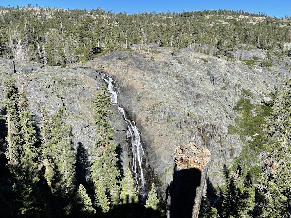
Fraizer Falls
Church Meadow
Allow 1-2 hours to explore, NO FACILITIES
Key Birds: Williamson’s Sapsucker, Calliope Hummingbird, Hammond’s Flycatcher, Dusky Flycatcher, White-crowned Sparrow
eBird Hotspot: https://ebird.org/hotspot/L2222722
Location: 39.674586,-120.6204972 (#4 on interactive map)
This is a small meadow along an unpaved road. The road leading into the area is interesting enough with a mixture of flowery patches of sunlight open woodland and denser conifer stands. We had wonderful encounters with Calliope Hummingbird and Nashville Warbler in the willows just off the road. Fox Sparrows were abundant here as were White-crowned Sparrows (oriantha subspecies). The lodgepole pines tend to fill in alpine meadows like this, so the forest service has ringed the pines around the periphery. With luck, this will help maintain the meadow as it is for a while, keeping it a good haven for some of the edge-species we found. The thicker woodland beyond the meadow’s edge was good for both Woodpeckers and Flycatchers.

Church Meadow

Calliope Hummingbird by Tom Grey
Yuba Pass Campground
Allow 2-3 hours to explore, RESTROOMS
Key Birds: White-headed Woodpecker, Williamson’s Sapsucker, Calliope Hummingbird, Pine Grosbeak, Evening Grosbeak, Cassin’s Finch, Dusky Flycatcher, Hammond’s Flycatcher, Golden-crowned Kinglet, Hermit Warbler, Nashville Warbler, MacGillivray's Warbler
eBird Hotspot: https://ebird.org/hotspot/L8101122
Location: 39.617040, -120.489825 (#5 on interactive map)
At about 7,000 feet above sea level, this one area supports most of our target species. Even as we enter the ample parking lot in the morning, we can hear Hermit Warbler, Cassin’s Finch, and White-headed Woodpecker around the edges of the lot. If one watches the gravel shoulders along the main road, Cassin’s Finches and often Evening Grosbeaks are gathering grit to help them digest their seed diets. The meadow immediately visible from the lot and restrooms has on several occasions supported Calliope Hummingbird, Lazuli Bunting, nesting Lincoln’s Sparrow, and Western Tanagers would be hard to miss anywhere on this trip. The edges of the campground, which has been closed for several years but is still walkable, has hosted nesting Williamson’s Sapsucker, and even Pine Grosbeak. One should definitely keep an eye and ear open for Black-backed Woodpecker which tends to nest in older, fire-damaged trees. Both sides of the main road are worth exploring and an early morning start may produce Mountain Quail and even Sooty Grouse.
When you’re done with the walkable areas, consider driving south from the lot along the gravel road which will take you higher into the mountains and provide you with possible Clark’s Nutcracker (usually heard before seen), and if you are exceptionally lucky, possibly Northern Goshawk! There are a couple of pullouts which are worth exploring but do not have hotspots assigned. Be prepared for nothing also… but when you think you’re getting too far away and might get lost on those twisty roads, turn around and head back to the lot.

Yuba Pass Campground
Excursion 3: Alpine Lakes
“Touching the sky”
Lakes Basin, Round Lake Trailhead
Allow 4-5 hours to explore fully, RESTROOMS AT TRAILHEAD
Key Birds: Green-tailed Towhee, Fox Sparrow, Dusky Flycatcher, Hammond’s Flycatcher, Olive-sided Flycatcher
eBird Hotspot: https://ebird.org/hotspot/L2959354
Location: 39.692980, -120.656310 (#6 on interactive map)
Round Lake Trail Website: https://www.fs.usda.gov/recarea/tahoe/recreation/recarea/?actid=104&recid=56028
Some of the most stunning scenery in the mountain portion of this itinerary can be found in the Lakes Basin, specifically the Round Lake Trailhead. This can be a short 1-2 mile hike or a very long 10 mile hike depending on your level of commitment. Most likely, the target birds here will be found without needing to cover a great distance, but the more you hike, the more beauty you will find. From the deep old growth woodland where last year we had a family of Black-backed Woodpeckers, to the shaded willow brakes where Nashville Warbler feeds, the shadowy underbrush beside the trail where MacGillivray’s Warbler can be found, or the mountain scree where Green-tailed Towhees abide, these are everything you seek in a mountain hike! Stunning views, brilliant cobalt blue sky and ancient snow-white trees that clutch huge granite borders in their afterlife… This is where one touches the sky, I think. When you visit, wander and wonder at this marvelous place.

Black-backed Woodpecker by Tom Grey
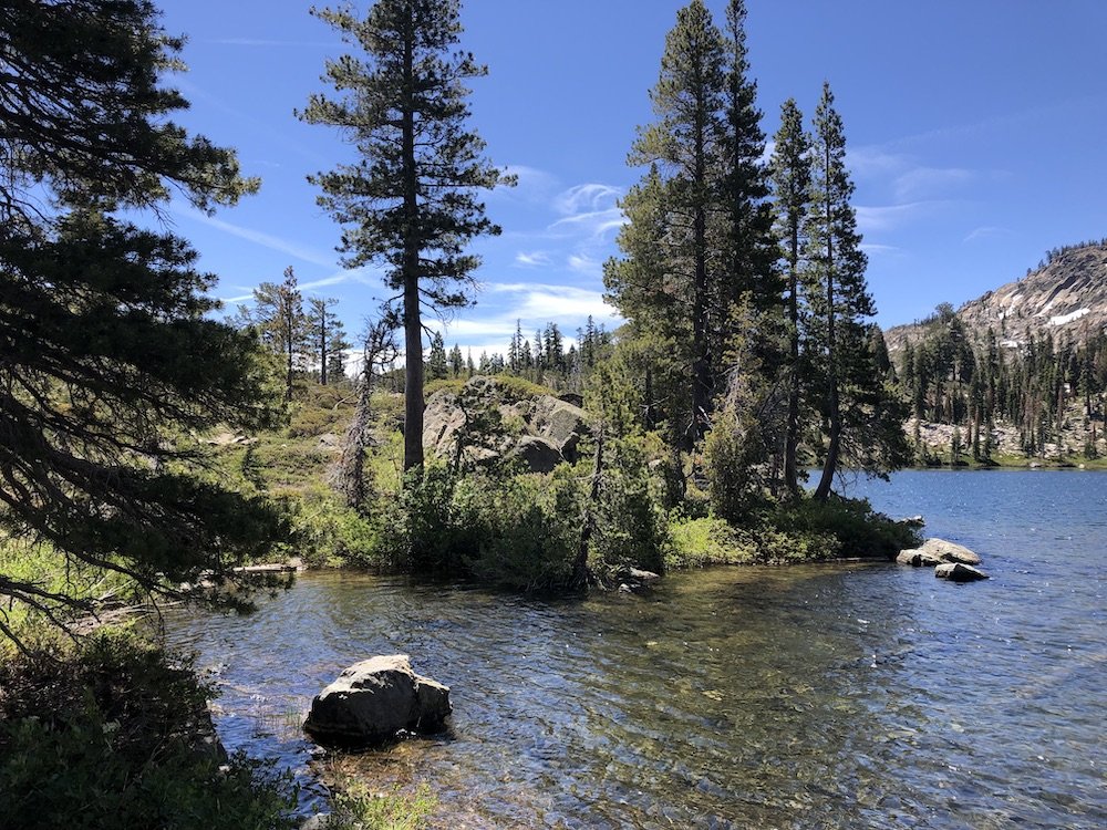
Round Lake

Evening Grosbeak by Chris Johnson
Sardine Lake (inc. Sand Pond, Lower Sardine, Upper Sardine)
Allow 3 hours to explore, RESTROOMS AT TRAILHEAD
Key Birds: White-headed Woodpecker, Red-breasted Sapsucker, MacGillivray's Warbler, Green-tailed Towhee, Fox Sparrow
eBird Hotspot: https://ebird.org/hotspot/L391547
Location: 39.617161, -120.623789 (#7 on interactive map)
If you still want the spectacular views and are willing to share that beauty with more people, the hike up to Upper Sardine Lake will give you many of the same birding opportunities. You might even come away with an Osprey or Caspian Tern too!
Trail to Upper Sardine Lake
Park near the Sand Pond Trail, which was partially closed of our last visit but was still very productive, and walk up the well marked, but very craggy trail past Lower Sardine Lake to Upper Sardine Lake. The trio of lakes is mostly uniform in its complement of birds, ranging from White-headed Woodpecker, Olive-sided Flycatcher and Western Wood-Pewee, Fox Sparrow, Lincoln’s Sparrow, Green-tailed Towhee, Nashville and Yellow Warbler. You should hear numerous MacGillivray’s Warblers in the alpine scrub above and below you, as well as Hammond’s and Dusky Flycatcher. Watch the lake below you for Common Merganser and other Waterfowl. Pine Grosbeak is occasionally seen here and Cassin’s Finch should be hard to miss. Keep your eyes and ears open for Clark’s Nutcracker high on the ridge. You may find some abandoned cars along this impossible road leading to Upper Sardine Lake. Who knows what sorcery possessed the driver to attempt that trip… the thin air, I suppose.
Along the emergent vegetation on the banks of Sand Pond you may find Chalk-fronted Corporal, Four-spotted Skimmer, and along the creek that connects the lakes we once found Grappletail (Dragonflies)

Upper Sardine Lake

Green-tailed Towhee by Tom Grey
Excursion 4: Sierra Valley driving day
"A change of scenery”
Calpine Road in Sierra Valley
Allow at least 30 minutes to explore, NO FACILITIES
Key Birds: Brewer’s Sparrow, Vesper Sparrow, Black-billed Magpie
eBird Hotspot: https://ebird.org/hotspot/L391656
Location: 39.665175, -120.414514 (#8 on interactive map)
This quick stop is a good place to begin your day in the valley. There is very little traffic and a wide shoulder that allows you to walk safely along the edges of the scrubby vegetation. If it is a sunny morning, you should soon begin to hear a variety of birds, most significantly Brewer’s Sparrow, Vesper Sparrow and Sage Thrasher. All three species can be found vocalizing from the tops of the sagebrush or fence posts. Both Sparrows are nondescript and streaked, but notice their different structures. The Vesper is a bulky Sparrow with a heavy head and a rather short tail. It’s song is quite beautiful and its practice of singing at night accounts for its common name—vespers are evening church services that feature music and candlelight… Close observation might reveal the chestnut-colored shoulder patch and white outer tail feathers. The Brewer’s is even plainer-looking but is typical for Spizellas in being dainty in proportions and long-tailed. It’s song is much like a Canary’s with endlessly varying trills an buzzes that seem to go on without the bird pausing for breath.

Brewer’s Sparrow by Tom Grey
Calpine Road
Sierra Valley (Marble Hot Springs Road, Steel Bridge)
Allow 2 hours to explore, NO FACILITIES
Key Birds: Yellow-headed Blackbird, Sage Thrasher, Vesper Sparrow, Brewer’s Sparrow, Black-billed Magpie, Swainson's Hawk, Bald Eagle, White-faced Ibis, Pronghorn
eBird Hotspot: https://ebird.org/hotspot/L1219737
Location: 39.7555406,-120.3542966 (#9 on interactive map)
As you turn onto this dirt road, pull off and listen to the birds around you. The sagebrush and flooded grass are filled with Vesper and Brewer’s Sparrow, Lark Sparrow, Horned Lark, Sage Thrasher, and Western Meadowlark. It’s a beautiful area and from the moment you begin the tour and the dramatic effects of water that runs through the valley should be obvious. Pause every few hundred feet to survey the channels and sagebrush for various Waterfowl, White-faced Ibis, Yellow-headed Blackbirds, Wilson’s Snipe and Green Heron. In the distance you may see “Greater” Sandhill Cranes and their cinnamon-colored young may be visible as they move through the tall grass. Willet also breeds here and you have the rare opportunity to see them in their dramatic alternate plumage. Bald Eagle often patrols the area, as does Swainson’s Hawk. Our only native Antelope, the Pronghorn, makes this valley its home and they can be see grazing here. The famous steel bridge is worth a long pause as the nesting Yellow-headed Blackbirds and Cliff Swallows center their colonies in the marsh beside the bridge. Continue along the road until it rejoins the pavement, but keep an eye out as you drive past flooded areas or structures that might provide perches for Raptors. Black Tern is quite rare here, but worth watching for.

Along Marble Hot Springs Road

Yellow-headed Blackbird by Tom Grey
Sierra Valley Preserve
Allow 30 minutes to 1 hour to explore, NO FACILITIES
Key Birds: Sage Thrasher, Vesper Sparrow, Brewer’s Sparrow, Black-billed Magpie
eBird Hotspot: https://ebird.org/hotspot/L1325268
Location: 39.784468, -120.380115 (#10 on interactive map)
Sierra Valley Preserve web page: https://www.frlt.org/outdoor-adventures-lost-sierra/sierra-valley-preserve/
After leaving Marble Hot Springs Road, consider stopping at the Sierra Valley Preserve to stretch your legs and explore the plant life up close. This is a newly acquired nature preserve that provides an opportunity to walk among the sagebrush habitat. A kiosk offers information about the acquisition and importance of this area as well as an informative brochure with watercolor illustrations by John Muir Laws.

Sierra Valley Preserve

Black-billed Magpie by Tom Grey
Antelope Valley Road (Smithneck Creek Wildlife Area)
Allow 2 hours to explore, NO FACILITIES
Key Birds: Gray Flycatcher, Townsend’s Solitaire, Nashville Warbler, Lewis’s Woodpecker
eBird Hotspot: https://ebird.org/hotspot/L339970
Location: 39.635475,-120.2980111 (#11 on interactive map)
Smithneck Creek Wildlife Area webpage: https://wildlife.ca.gov/Lands/Places-to-Visit/Smithneck-Creek-WA
Just east of Loyalton, find Smithneck Road and take it south to Antelope Valley Road (855). Continue on a rugged dirt road for 1 miles through a combination of second-growth pine woodland, sagebrush and ranch land habitat until you rejoin Hwy 45 toward Sierraville. The terrain is quite dry and very different from other areas you may explore in the valley or this trip as a whole. We have found a small number of target birds along this stretch including Lewis’s Woodpecker, White-headed Woodpecker, Mountain Quail, Townsend’s Solitaire and Gray Flycatcher. It is easy to get disoriented on this mostly sign-free trail, but you are not likely to get lost. The map included for the area is quite good. The road is good, but a 4-wheel drive vehicle is recommended.

Antelope Valley Road

Gray Flycatcher by Tom Grey
Excursion 5: forest roads, relaxed birding
“Before you go…”
Chapman’s Saddle Road (Forest Road 9)
Allow 5 hours to explore
Key Birds: Mountain Quail, Spotted Owl, Williamson’s Sapsucker, MacGillivray's Warbler
eBird Hotspot: https://ebird.org/hotspot/L952772
Location: 39.6177225,-120.5076599 (#12 on interactive map)
One mile west of the Yuba Pass Campground you will find Chapman’s Saddle Road (also called Forest Road 9). This beautiful, well-maintained unpaved road leads roughly 16 miles through old growth forest and active logging areas. The road is wide and manageable with a Prius. It is best in the morning before the road has seen much traffic, but it is never busy along this route. It’s just that Sooty Grouse and Mountain Quail are best seen before “rush hour”. Stop frequently, walk up and down the road and listen. You may hear several species of Woodpecker, Olive-sided and Hammond’s Flycatchers, Golden-crowned Kinglet, Red Crossbill, or Evening Grosbeak… But being an old-growth woodland, you may not always be able to see the birds. Still, patience is often rewarded, such as the time a Mountain Quail paused on a sunlit stump just 20 feet from where we stood and seemed not to care we were staring at it. As always, it is recommended you familiarize yourself with the songs you may here on this trail.
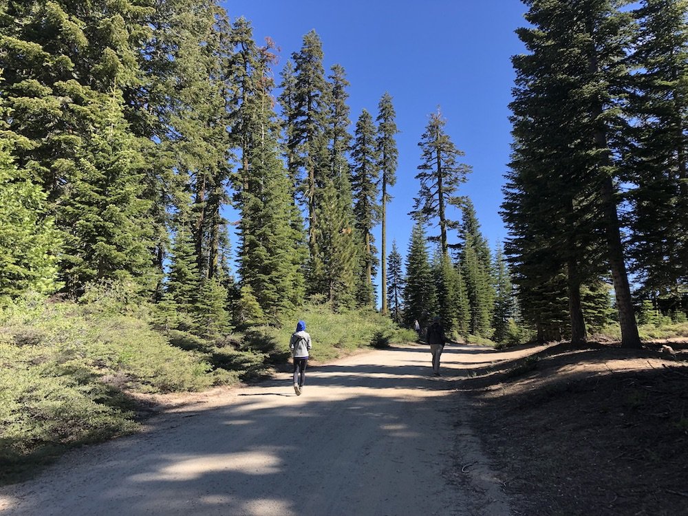
Chapman’s Saddle Road (Forest Road 9)

Mountain Quail by Chris Johnson
Big Springs & Vicinity (South of Bassett’s)
Allow 30 minutes to 1 hour to explore
Key Birds: American Dipper
eBird Hotspot: https://ebird.org/hotspot/L1183618
Location: 39.596595, -120.610464 (#13 on interactive map)
If you have not managed to find American Dipper, one of the signature Sierra birds, there are several nice areas to search. As expected, Dippers enjoy the rushing water of cold mountain rivers and streams. North Yuba River, Salmon Creek and others are all suitable, and any place you can get a good view of the river rocks is worth checking. Most years we have had luck at Big Springs (39.596595, -120.610464). A wide turnout beside a natural spring is one of the best places to search. Visibility is not easy, and one must be cognizant of fast-moving traffic as you walk across Hwy 49, but a last minute search of the rocks and froth may reward you with views of this enigmatic bird. Watch for a small slate-gray birds bobbing up and down and diving into the water, or zipping past with fast wingbeats. Interesting to note is the song of the Dipper is among the loudest one will find in North America—evolved to be heard above the white noise of the river. If this location doesn’t provide looks at the bird, a short drive north to the Jankowski & Stafford Family Homestead (39.611053, -120.601848) may offer another chance. Pull off into the cul-de-sac and walk toward the water. This area is safe from traffic but the footing is awkward, so exercise caution.

American Dipper by Chris Johnson
Finally, the grocery store at Bassett’s Station has maintained Hummingbird feeders for years on their second floor balcony. If you park in the lot and looks up at the feeders, you might see several Calliope Hummingbirds. They dash in for a quick sip of nectar and then buzz up into the trees beside the building. The meadow across the street is right beside the river, so short exploration of this area on foot might also be worthwhile. Don’t forget to stop into the Bassett’s grocery store. Maps and snacks are available and they always appreciate your support.

Big Springs
Interactive Map
PARKING: Parking is generally not an issue except at Sardine Lake or Salmon Lake which can get crowded by late morning.
FEES: There are no fees in any of the areas mentioned in this guide.
PARK HOURS: Not applicable. There are no parks in this area.
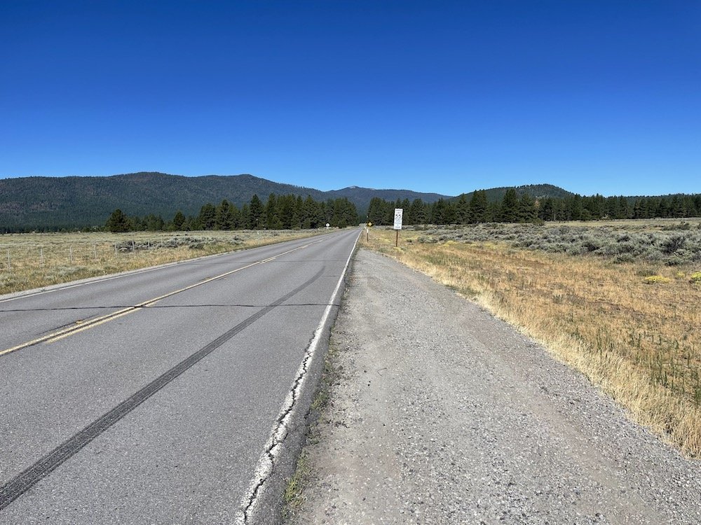
TRIP MILEAGE: It is 250-275 miles from the South Bay to the Yuba Pass Campground. The drive can take 5 1/2 hours. It is best to exit the Bay Area as early as possible to avoid the worst traffic. The same advice applies to the drive home.
ACCESSIBILITY: Few if any of the trails mentioned in this guide are accessible by wheelchair.
BIKES: Not recommended for the birding trails, but allowed in some locations.
DOGS: Not recommended for the birding trails, but allowed in some locations.
More Resources
For more trips like this one, visit Self-Guided Field Trips.
Visit the SCVAS Birding Resources page for more information on where to bird, our birding community, bird identification resources and more.
Read “What to Look for Now” by SCVAS Executive Director Matthew Dodder.
Banner photo: Carpenter Valley by Matthew Dodder; all other landscape photos by Matthew Dodder
Last Reviewed: 2/17/2023
Enjoyed this Trip?
Support the work of Santa Clara Valley Audubon Society and become a member. To contact the trip writer with comments, questions or location updates, please email fieldtrips@scvas.org. You can also post in the comment section below. (If you’d like to post anonymously, type your comment, select “Post Comment”, then simply provide a name, like “Guest”, and select “Comment as Guest”.)