
Stevens Creek County Park (Spring/Summer):
A Morning Drive-and-Bird
by Mary Ann Allan
Just a short hop off Highway 280 in Cupertino brings you to this, our very first Santa Clara County park. Drive through lower Stevens Creek Canyon, stopping to bird at parking spots and picnic areas. Shady creeksides, a reservoir to scan, and oak and chaparral hillsides are alive with resident and migrant birds. The secret to finding them is to come early to beat the heat and crowds. And don’t forget your picnic lunch!
Trip Covers: April - August
Key Birds: Acorn Woodpecker, Ash-throated Flycatcher, Warbling Vireo, Steller's Jay, Northern Rough-winged Swallow, Wrentit, California Thrasher, Orange-crowned Warbler, Wilson's Warbler, Black-headed Grosbeak
How to Bird
As the name implies, Stevens Creek County Park is dominated by Stevens Creek, which winds out of the Santa Cruz Mountains on its way to San Francisco Bay in Mountain View. Centered in the park is 82-acre Stevens Creek Reservoir, with developed park areas both upstream and downstream.
Stevens Creek. Photo: Mary Ann Allan
One of the things I like best about this park is how quickly it can be reached from urban areas of west county. The park is nestled along Stevens Canyon Road in the lower foothills between Saratoga and Cupertino. It’s a big park---1,077 acres---yet some of the best birding and prettiest areas are right along the road. If mobility is an issue or you don’t have much time to spare, this park is worth checking out.
The five birding spots on this tour fall into two groups:
Above the dam Stops 1, 2, and 3 are spread out over 1.5 miles along Stevens Canyon Road. These stops hit upstream Stevens Creek and the reservoir.
Below the dam inside the main entrance gate The main entrance gate opens at 8:00 am, so Stops 4 and 5 cannot be reached until then. Located in the busiest area of the park, these stops offer some of the best birding opportunities.
To maximize birding over a two- to four-hour outing, I like to arrive as early as possible, start at the furthest upstream location, and then work my way back down the canyon to arrive at the main gate by opening time. This way all the parking locations above the dam will be right turns and you can survey the tour locations as you drive past them on your way to Stop 1.
Parking lots can fill up especially on weekends, so an early morning arrival is a must. Or come on a weekday morning, when usage is lighter.
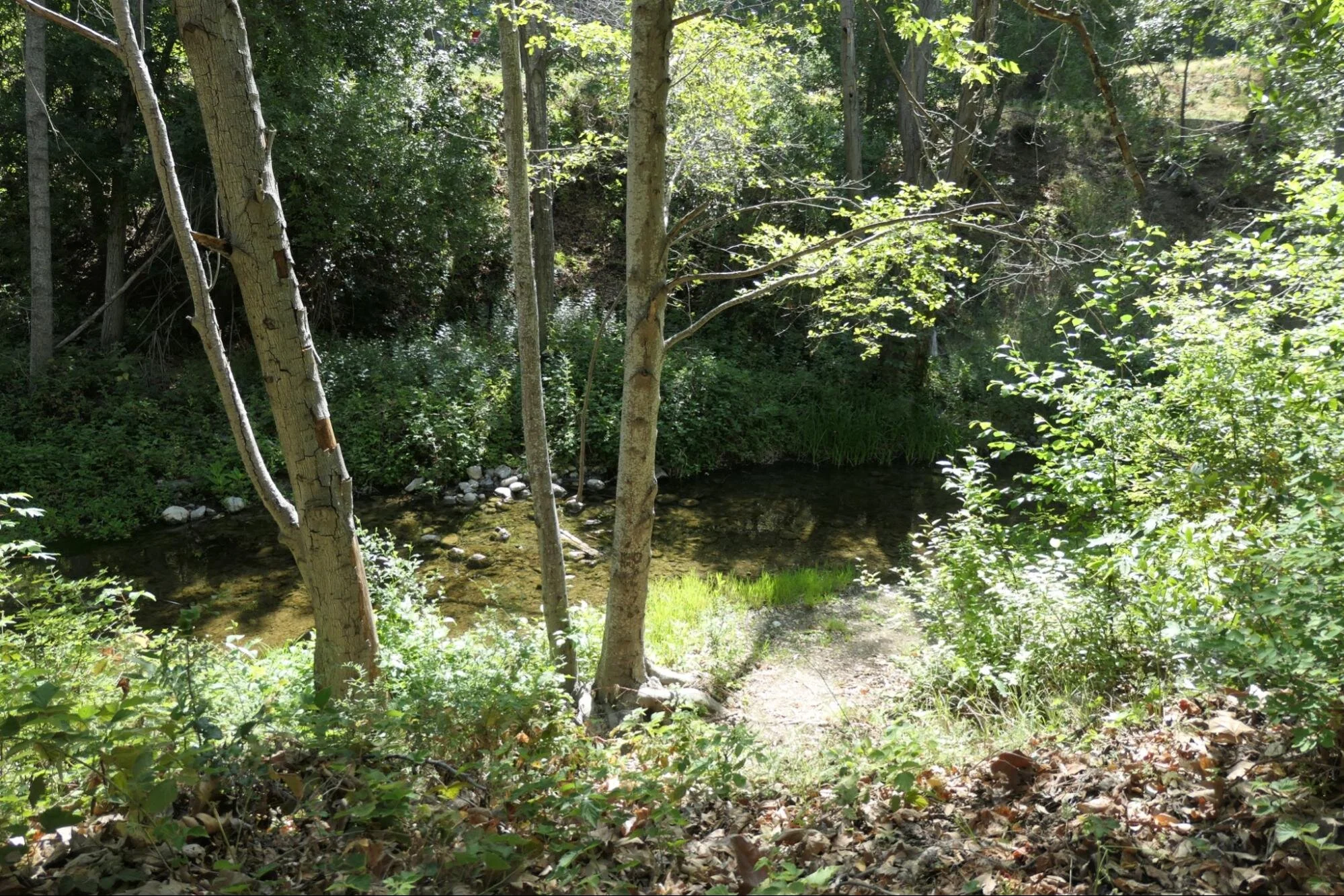
Stop 1. Cooley Picnic Area
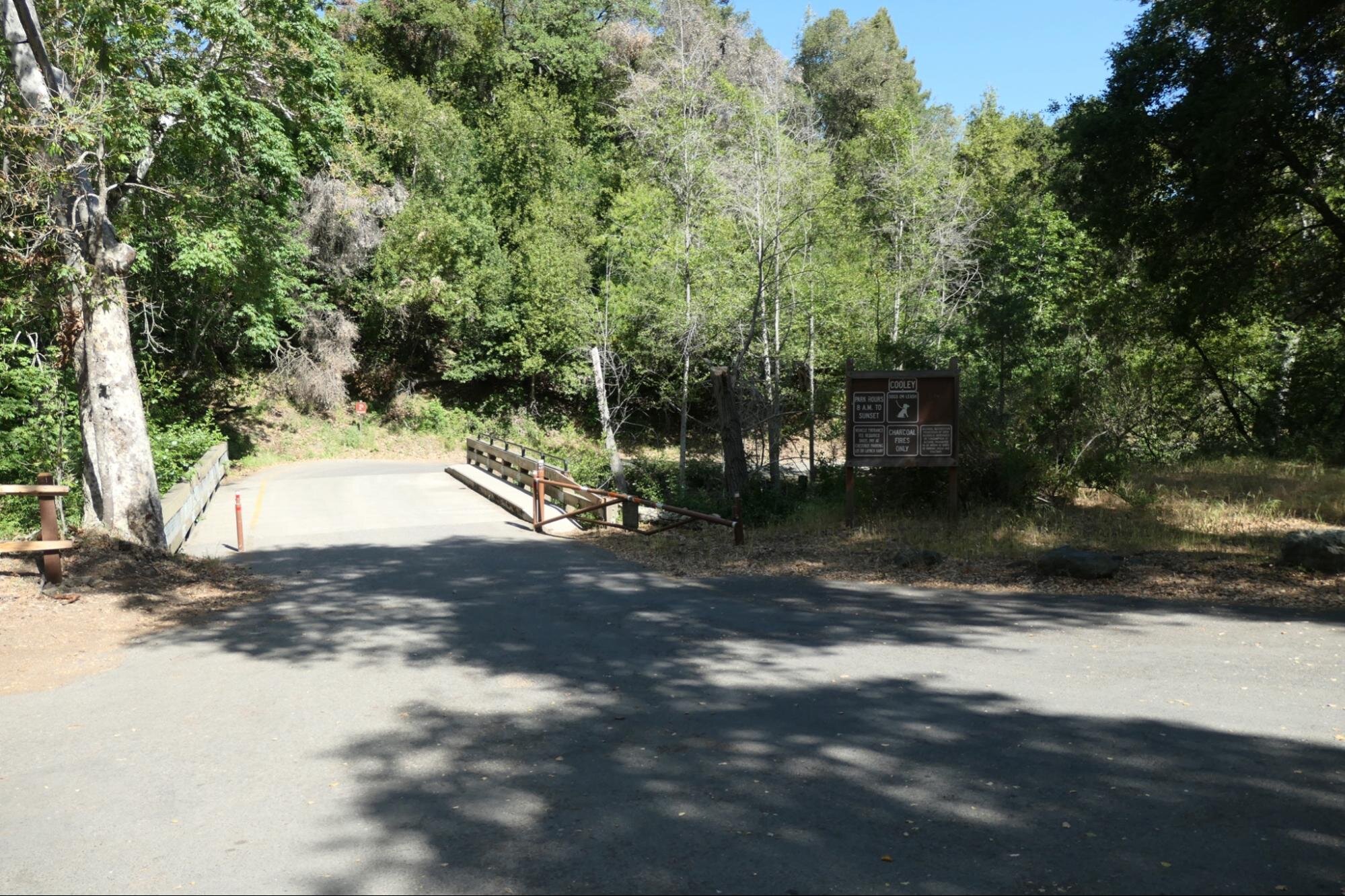
Cooley Picnic Area Entrance. Photo: Mary Ann Allan

Cooley Picnic Area. Photo: Mary Ann Allan
About 5 miles up Stevens Canyon Road from Highway 280, you will come to a stop sign at a Y intersection. Veer right and then make the first possible right turn into your first stop, shady little Cooley Picnic Area. If the gate across the creek is locked, park along the road and walk in, birding as you go. A confusing chorus of woodland birdsong greets you. Check the low trees along Stevens Creek for Black Phoebe, Western Wood-Pewee, and Pacific-slope Flycatcher and walk the perimeter of the picnic grounds for ground-loving birds like Dark-eyed Junco, Spotted Towhee, and California Towhee. Scan the tree canopies for Warbling Vireo, Black-headed Grosbeak, American Robin, and Orange-crowned Warbler. These arboreal singers are especially hard to see in the leafy trees of spring and summer, so don’t despair. Noisy Acorn Woodpecker, Nuttall’s Woodpecker, Chestnut-backed Chickadee, American Crow and Steller’s Jay are better at making themselves seen. A careful look at the large tree trunks and limbs may reveal White-breasted Nuthatch (listen for its nasally call) or the well-camouflaged little Brown Creeper. From the drier slopes across the road you may hear the gobbling of Wild Turkey, the “cuidado” call of California Quail, and the ping-pong bouncing call of Wrentit. It can be chilly here first thing in the morning so have a jacket handy.

Dark-eyed Junco Adult and Juvenile. This begging youngster is already growing its white outer tail feathers, a good field mark for this bird. But its streaky breast and lack of an adult’s black head have fooled even seasoned birders. By winter it will look like its parent. Photo: Caroline Lambert

Steller’s Jay by Caroline Lambert
Stop 2. Stevens Creek Road Crossing

Stevens Creek Road Crossing. Photo: Mary Ann Allan

Trail Entrance at Stop 2. Photo: Mary Ann Allan
Retracing your drive in, you will come to a spot with low metal railings and sidewalks on both sides of the road (see photo). This is where Stevens Creek flows under the road on its way to the reservoir. Drive across this bridge and pull into the wide gravel pullout on the right. This unimproved intimate birding spot can be full of surprises. Walk down the short narrow weedy path to the gravely edge of Stevens Creek.

Stevens Creek View at Stop 2. Photo: Mary Ann Allan

Wilson’s Warbler by Caroline Lambert

Song Sparrow by Sonny Mencher
Listen for Wilson’s Warbler and Spotted Towhee scolding from the willow/berry thickets, and for the 3-part call of Song Sparrow. Hutton’s Vireo and rarer Cassin’s Vireo have been found here. Bullock’s Oriole may stop by from their haunts in the big eucalyptus trees across the road (a preferred nesting tree for them). Anna’s Hummingbird, Black-headed Grosbeak, and Hairy and Downy Woodpecker also like this spot. Approach the creek bed quietly and scan for shorebirds, ducks, and other wildlife. It can be a little buggy here...a great place for warblers, flycatchers and other insectivores. But you may want some bug spray.
Stop 3. Lakeshore Picnic Area

Lakeshore Picnic Area Parking. Photo: Mary Ann Allan

Lakeshore Picnic Area. Photo: Mary Ann Allan
Continuing past the fire station and driving a bit further, look for a split rail fence on the right and park there along the road. California Scrub-Jay, Wrentit, and Bewick’s Wren may greet you at the roadside. Walk through the Lakeshore Picnic Area down toward the reservoir. This spot provides the best views of upper and lower Stevens Creek Reservoir. Listen for Oak Titmouse in their namesake trees over the picnic tables.

Stevens Creek Reservoir. Photo: Mary Ann Allan

Stevens Creek Reservoir. Photo: Mary Ann Allan
Even with low water conditions, the reservoir is certain to add to the day’s bird list. Double-crested Cormorant, Canada Goose, Killdeer, and Mallard are regulars here. Scanning the unobstructed sky above the reservoir can reveal Red-tailed Hawk, Red-shouldered Hawk, Common Raven, or possibly a Bald Eagle among the Turkey Vultures. Views are often distant (a spotting scope is helpful here), but thanks to the drought the far shoreline is now much closer and the exposed silty reservoir bottom is forming a whole new grassy habitat for birds and beasts.

Killdeer by Sonny Mencher
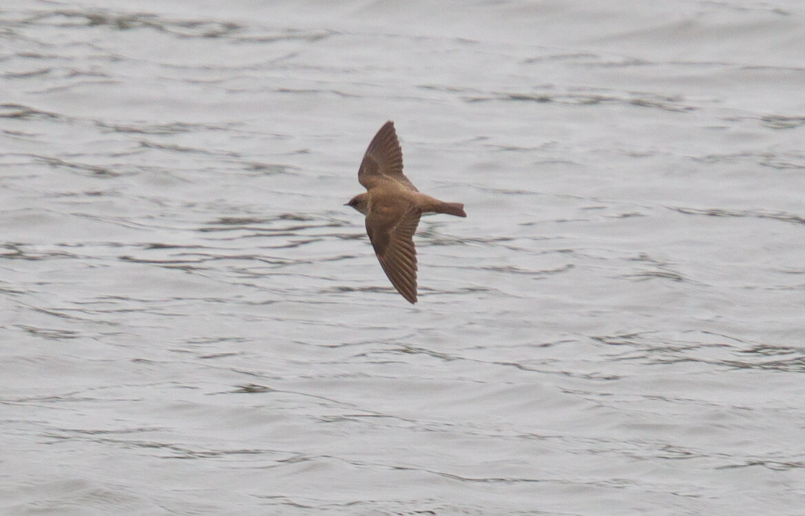
Northern Rough-winged Swallow. Look for this little dull-brown mouse of a swallow flying low over the reservoir as it hunts for insects. It gets its name from tiny serrations along the leading edge of its outermost wing feathers. The purpose of this rough edge is still debated. Photo: Caroline Lambert
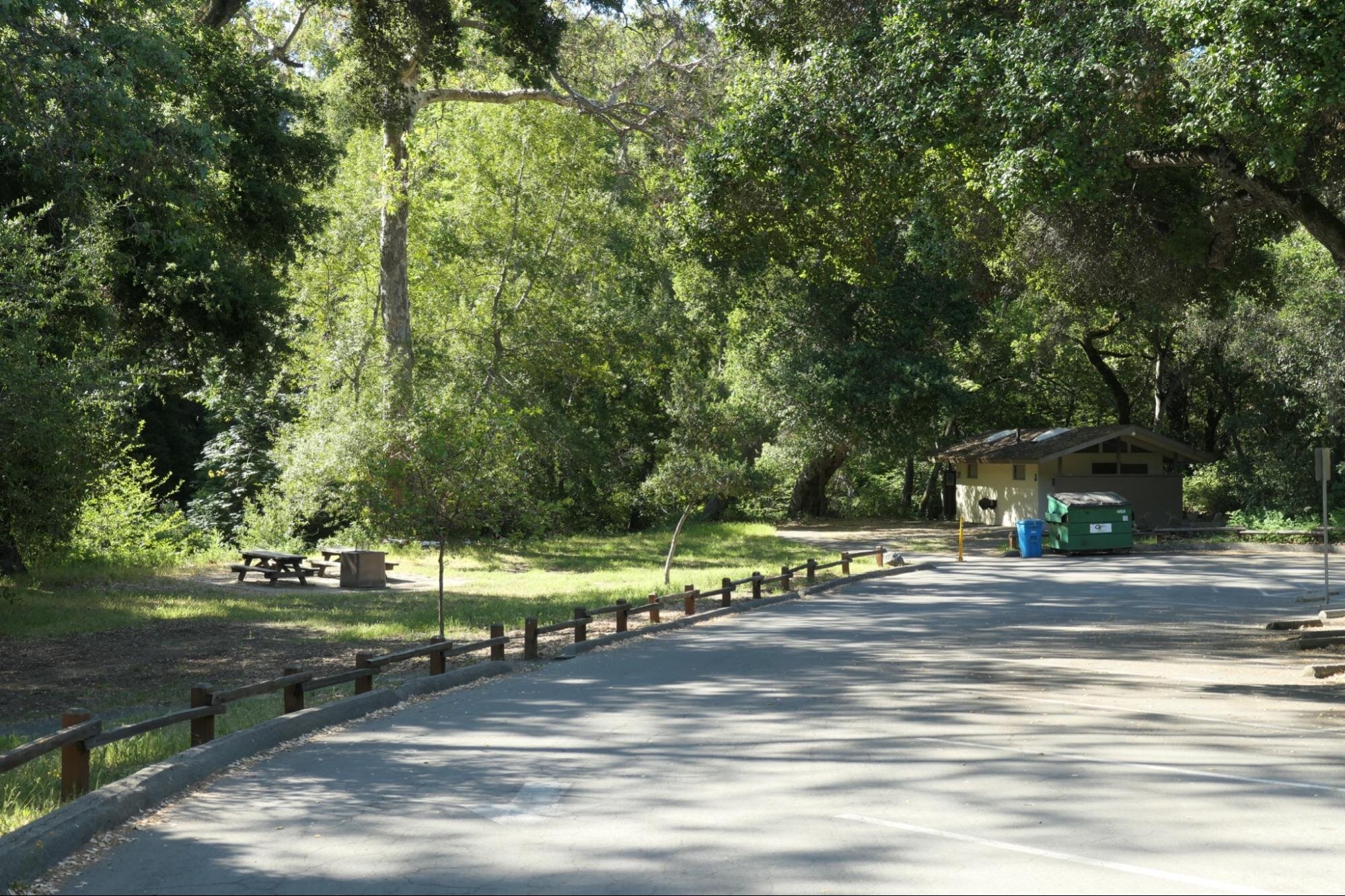
Stop 4. Chestnut Parking Lot
Main Park Entrance Sign. Photo: Mary Ann Allan
View of Main Park Entrance from the South. Photo: Mary Ann Allan
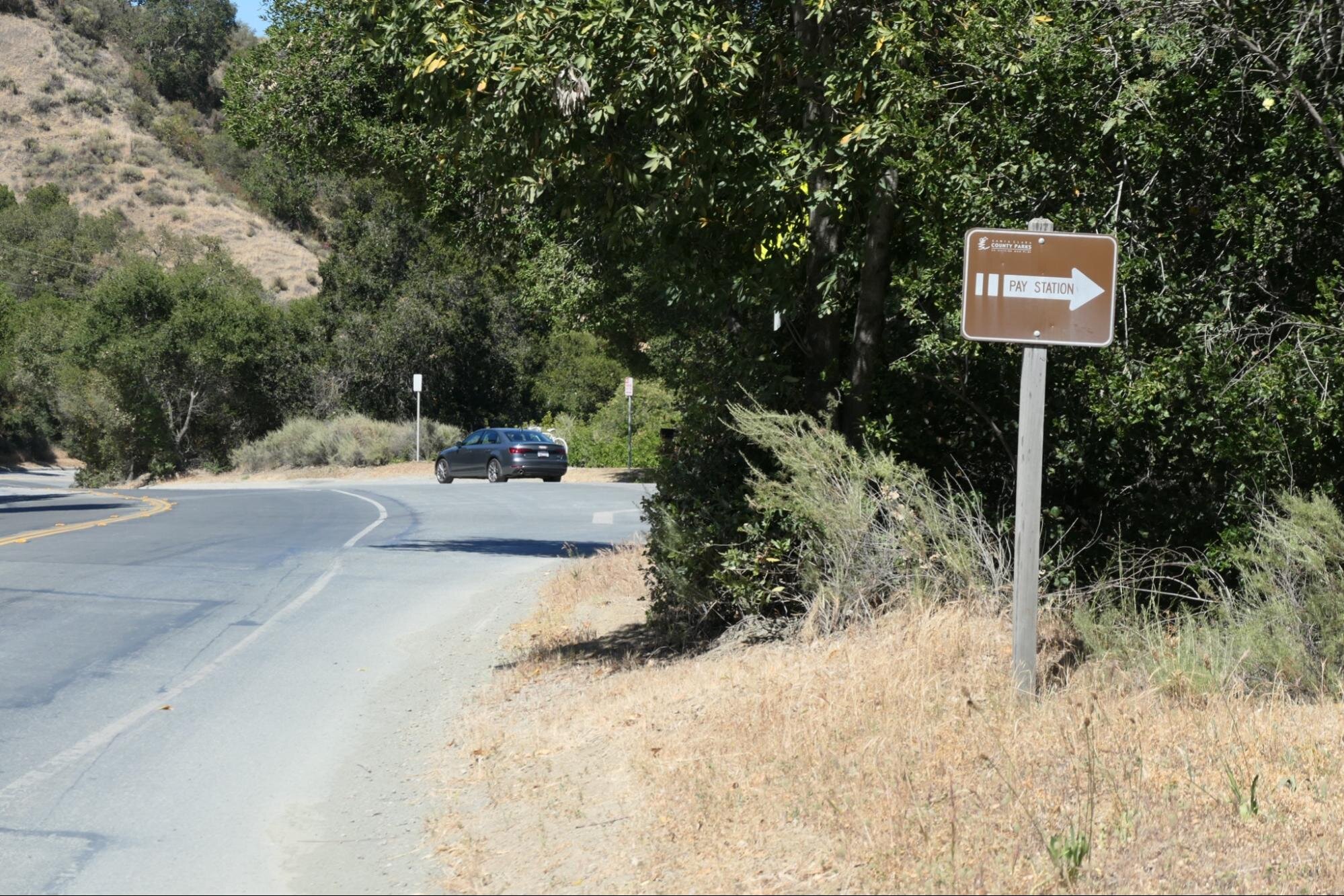
You may have noticed the park entrance sign on your drive past it earlier. Coming back toward the entrance now, this sign doesn’t face you. Be alert for a small brown sign with an arrow pointing you to a right turn ahead, where you curl down the entrance road to Chestnut Parking Lot (first lot on the left). Here you will need to pay a vehicle entry fee using a machine in the front of the lot ($6, credit card only).
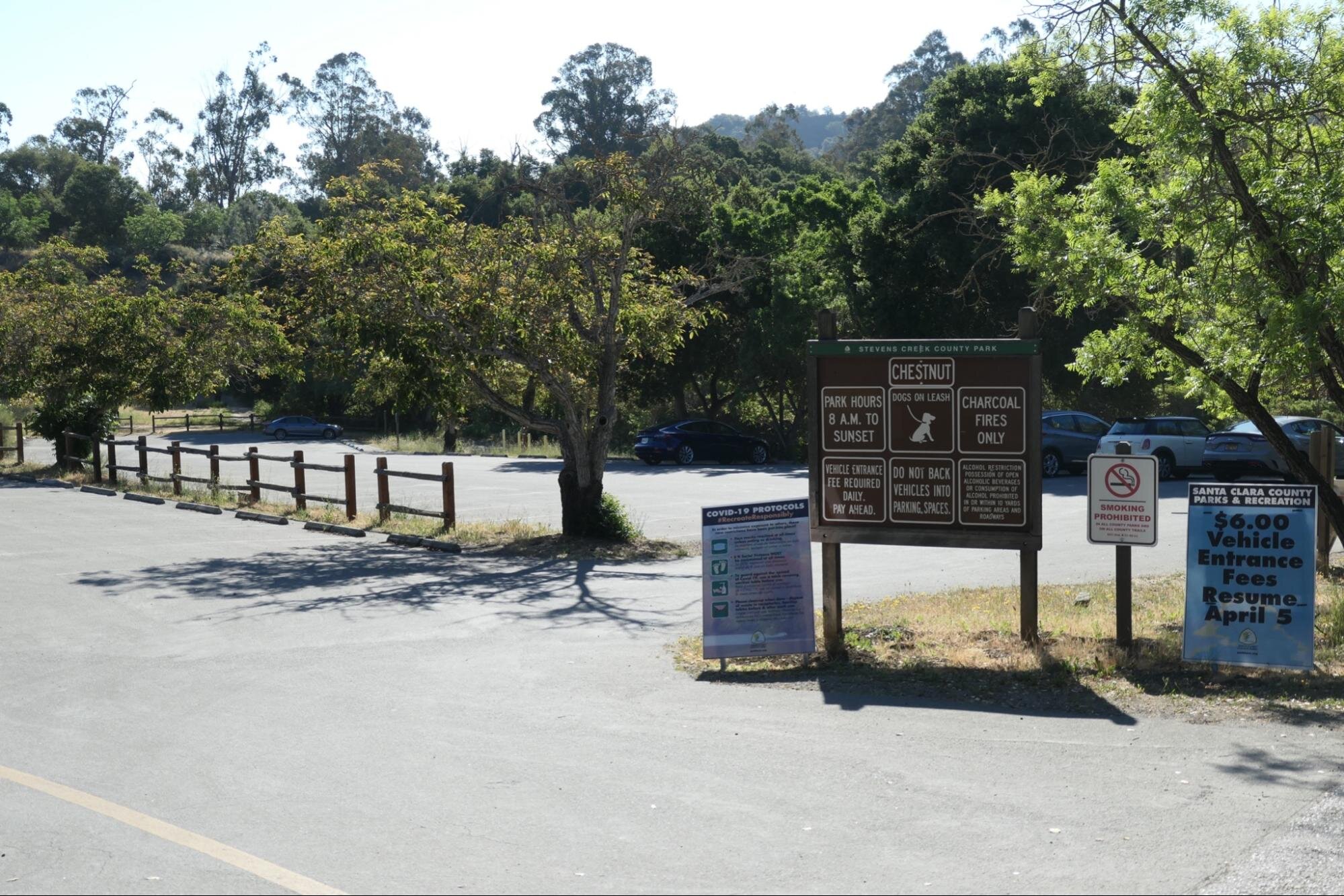
Chestnut Picnic Area Parking Lot. Photo: Mary Ann Allan
This “below-the-dam” portion of the park has the most amenities including several picnic areas, a park office, creekside walks, mountain bike-hiking-horse trails, old orchards, and a disc golf course.
Drive to the far end of the parking lot to begin birding.You will be greeted by the loud “waka-waka-waka” of Acorn Woodpecker, and if you are lucky, by the soft burry “kaBRICK” or “Kibrr-kibrr” of Ash-throated Flycatcher. Look for this cresty-headed, rusty-tailed flycatcher perched mid-tree near the parking lot. It is one of the few flycatchers to nest in tree cavities, using holes made by others. The sycamore, willow, and cottonwood trees in this mature riparian area are perfect for them. This is also a reliable spot for Steller’s Jay, California Thrasher, Spotted Towhee, and Song Sparrow. Look skyward for groups of grey Band-tailed Pigeons, our native pigeon of western North America. They are longer and larger than the feral pigeons found in our cities.
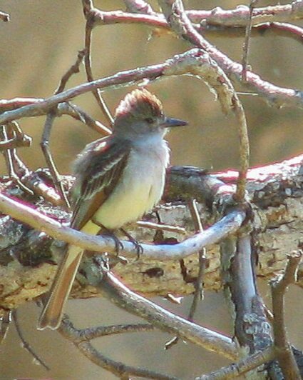
Ash-throated Flycatcher by Sonny Mencher
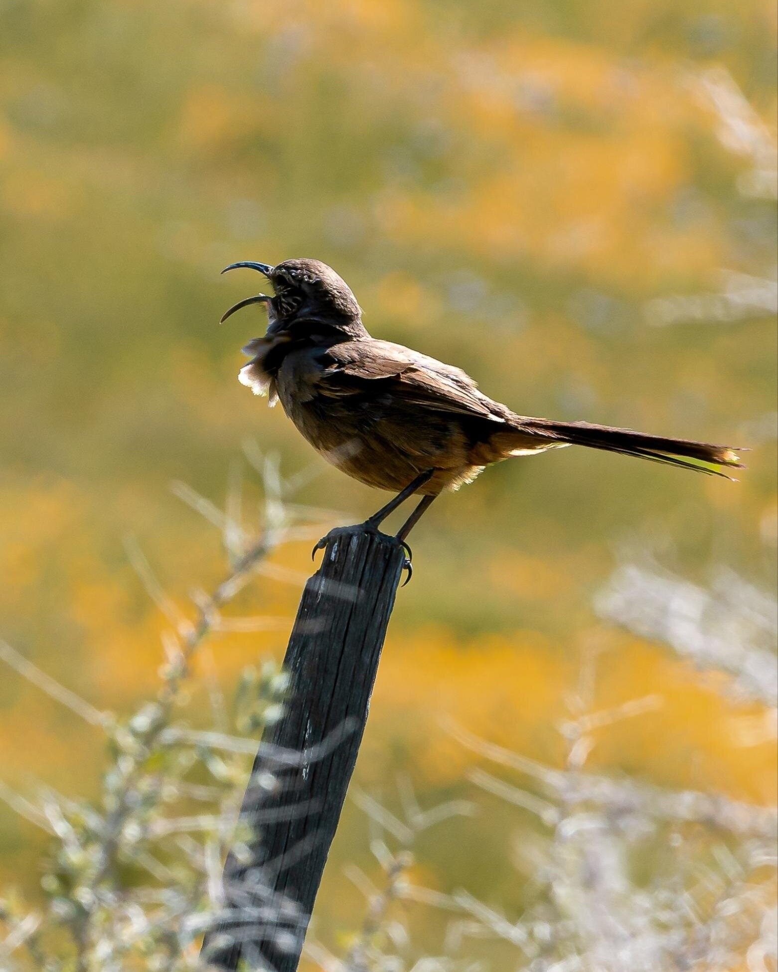
California Thrasher by Sonny Mercher

Foot Bridge over Stevens Creek. Listen and look for Wilson’s and Orange-crowned Warblers here. Photo: Mary Ann Allen

Picnic Area Near Creek. Picnic tables are first-come-first-served. So sit a spell and let the birds find you. Photo: Mary Ann Allan
There are many short trails around Chestnut Parking Lot for you to explore. You could walk them all and only cover a mile. A small bridge with metal handrails (photo) crosses Stevens Creek and leads to picnic tables and restrooms. An often birdy short loop trail at the far end of the lot goes up a small hill and returns near the creek. Check the park map for exact trail locations. Let the birdsong dictate your route. The default option is to bird the perimeter of the parking lot before relocating to the last spot on this tour.
Stop 5. Bay Tree Picnic Area
Bay Tree Picnic Area and Parking Lot. Photo: Mary Ann Allan
Only 0.2 miles down the park road (keep right at the Y and go past the park office) you will reach Bay Tree Picnic Area. There are convenient restrooms here and once again Stevens Creek is a stone’s throw away. You can bird the parking lot and small picnic grounds, then stroll down the road back toward the park office. These environs are great for Western Wood-Pewee, Pacific-slope Flycatcher, Western Bluebird, Warbling Vireo, and Bewick’s Wren. At the entrance to the picnic area, a wide trail leads up toward drier slopes, where you might find Blue-gray Gnatcatcher, Northern Flicker, California Thrasher, and California Quail.

A good birding spot on the road near Bay Tree Picnic Area. Photo: Mary Ann Allan
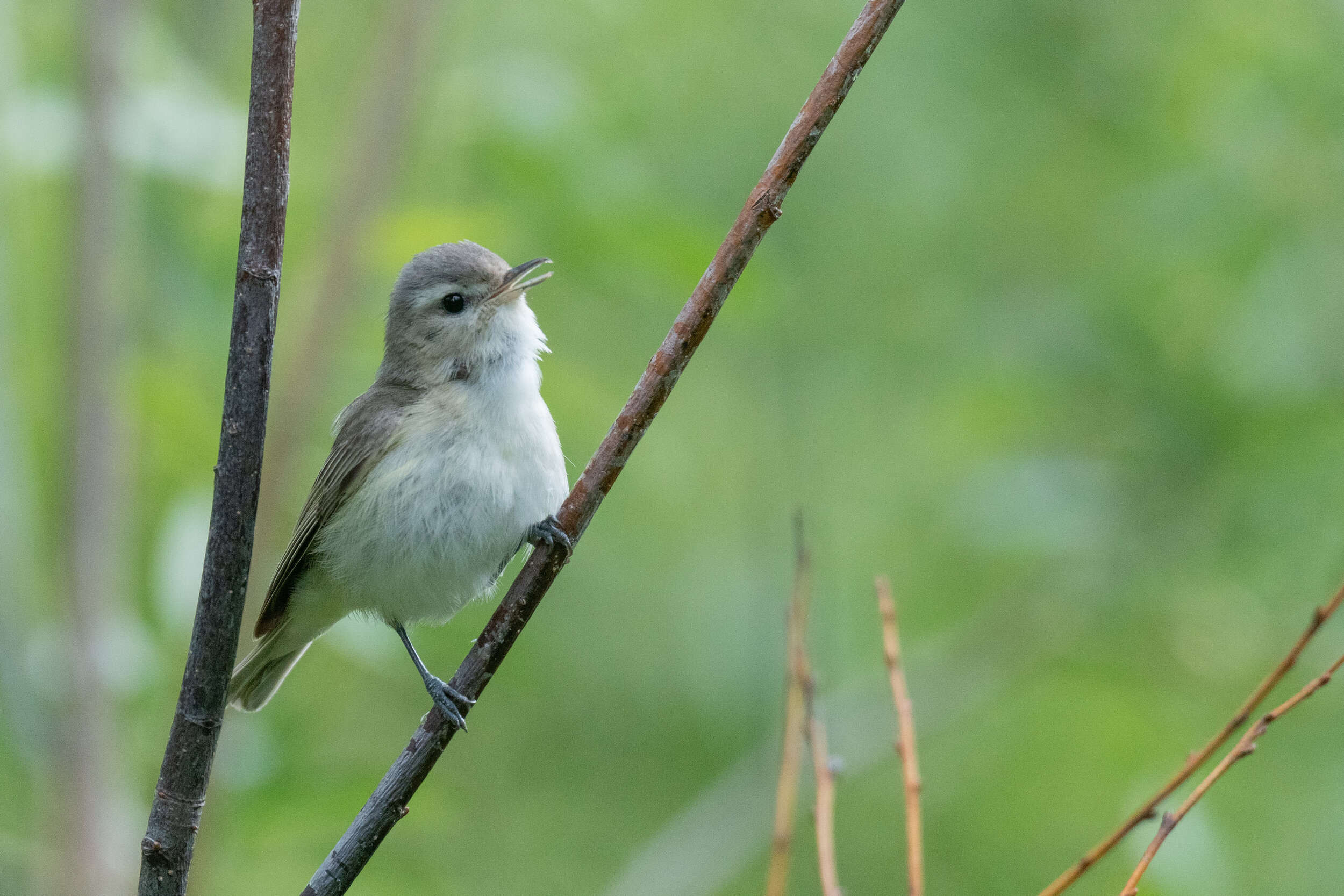
Warbling Vireo by Vivek Khanzodé

Western Wood-Pewee by Vivek Khanzodé
Ready for More? If this car-based approach has you itching to see more of Stevens Creek Park, there are over 9 miles of trails to consider. The 1.5 mile Zinfandel Trail connects Cooley Picnic Area to Picchetti Ranch Open Space Preserve, another great birding location. The Tony Look/Stevens Creek Trail is longer and traverses the drier slopes above the eastern side of the reservoir, away from the road noise of Stevens Canyon Road. These are just two possibilities. Check out the Stevens Creek/Upper Stevens Creek County Park Guide Map to get a better sense of trail lengths and options.
Interactive Map
Route Summary
Stop 1: Cooley Picnic Area: 37.280522, -122.073391
Stop 2: Stevens Creek Road Crossing: 37.284794, -122.077636
Stop 3: Lakeshore Picnic Area: 37.294382, -122.081768
Stop 4: Chestnut Parking Lot: 37.307021, -122.073215
Stop 5: Bay Tree Picnic Area: 37.303742, -122.074756
Directions: Take Highway 280 to Foothill Expressway. Follow Foothill Blvd. west 2.5 miles to the Main Park Entrance Latitude/Longitude: 37.306339, -122.074811 or 5.2 miles to Cooley Picnic Area. Stop 1 of this tour Latitude/Longitude: 37.280522, -122.073391
Note: Foothill Blvd. becomes Stevens Canyon Road after it crosses McClellan Road.
Stevens Canyon Road is a popular bicycling road. In some places, the roadway is quite narrow. Over the first 3 miles from Highway 280, the route is shared with large trucks traveling to/from the rock quarry near the reservoir dam area (no big trucks go beyond the quarry). Farther up the canyon, the road is windy and the shoulder non-existent. Please drive slowly and be ready to share the road with cyclists.
Parking: On street parking (Stop 3 and possibly Stop 1), gravel parking pullout (Stop 2), and paved parking lot (Stops 4 and 5).
Fees: Day-use parking fees (purchase at Stop 4, Chestnut Parking Lot). Credit card only. See the park website for more information.
Park Hours: 8:00 am to sunset. Stops 1, 2, 3 can be visited earlier.
Facilities: Wheelchair accessible bathrooms in main park entrance areas (Stops 4 and 5), wheelchair accessible pit toilet at Cooley Picnic Area (Stop 1), wheelchair accessible porta-potty at Lakeshore Picnic Area (Stop 3). No facilities at Stevens Creek Road Crossing (Stop 2). Cell phone service is poor to none beyond the reservoir.
Drinking fountains in the Main Park Entrance areas.
Heads-up! The area has limited to no cell phone service. To print or download this guide before you go, select the text you want (don’t include the banner photo), then print to PDF, or use a free service such as printfriendly.com, which lets you shrink or remove photos.
Accessibility: Stops on this tour are wheelchair accessible except for Stop 2, Steven Creek Road Crossing. Some of the trails around the parking lots, (trails are optional for this tour) are not wheelchair accessible.
Bikes: This is a good trip to do by bike only if you are an experienced cyclist. Due to the narrow roads with no separated bike paths, we do not recommend this tour to cycling families.
Dogs: Dogs are allowed on 6-ft leash
More Information
EBird Hotspots
More Resources
For more trips like this one, visit Self-Guided Field Trips.
Visit the SCVAS Birding Resources page for more information on where to bird, our birding community, bird identification resources and more.
Read “What to Look for Now” by SCVAS Executive Director Matthew Dodder.
Banner Photo Credit: Warbling Vireo by Vivek Khanzodé
Last Updated: 5/20/2022
Enjoyed this Trip?
Support the work of Santa Clara Valley Audubon Society and become a member. To contact the trip writer with comments, questions or location updates, please email fieldtrips@scvas.org. You can also post in the comment section below. (If you’d like to post anonymously, type your comment, select “Post Comment”, then simply provide a name, like “Guest”, and select “Comment as Guest”.)