
San Tomás Aquino Creek Trail (Winter):
Birds, 49ers, and Great America
by Ann Hepenstal
While I used to take "lunch break bird walks" along part of the San Tomás Aquino Creek Trail, now I walk the trail to see the wintering Wilson’s Snipes and a nice variety of birds. This unglamorous trail offers flat walking, glimpses of nature, and some fun birds amid the office parks and neighborhoods. It often yields over 30 species in a 1-mile outing.
Trip Covers: November - January
Key Birds: Common Merganser, Wilson’s Snipe, White-crowned Sparrow, Golden-crowned Sparrow, Western Meadowlark, Common Yellowthroat
Important Trail Notes: Before birding this trail, always check the Levi's Stadium event schedule and check on the street closures and parking limitations! On 49ers Game Day, the trail is closed to the public from Agnew Road to Tasman Drive. Also, Valley Water periodically clears vegetation and debris out of the creek to minimize flood risk which can result in significant changes to the bird habitat--and thus, the birds you'll see. See our links under “More Information”.
How to Bird
The San Tomás Aquino Creek Trail runs south from the San Francisco Bay Trail to Pruneridge Avenue in Santa Clara and is easily accessed from a variety of locations. Maybe you have an access point near your home or workplace! See the public transportation and parking tips towards the bottom of this guide for more information.
For the purposes of this guide, we’ll park on Agnew Road and join the paved trail where the creek crosses Agnew Road [#1 on Interactive Map]. We’ll walk about south to 101 to look for Wilson's Snipe, and then return north the way we came, passing our starting point. After this we will continue north for about another ½ mile to explore the trail as far north as Levi’s Stadium. The total trip as written is slightly over 2 miles but it’s easy to shorten as needed.

View along the trail. Careful of bicyclists and runners! Photo by Ann Hepenstal.
Starting at Agnew Road, walk south on the San Tomás Aquino Creek Trail towards US-101. (The creek will be to your left.) Here on the main trail, you MUST remain vigilant and aware of other traffic on the trail! It’s heavily used by walkers, runners, skateboarders, scooter-riders, skates, and bicyclists. Don’t get hit, don’t step out into someone’s path, and don’t whack anyone with your scope tripod! The trail is paved and easy to walk or roll on, but it makes an underpass at the streets, so you need to be able to manage an incline down and up.
Just to the south of Agnew Road, the creek widens into a little pool [# 2 on Interactive Map] where you will likely see your first Mallards of your walk. Check for Belted Kingfishers or Hooded Mergansers who sometimes make an appearance here.

Belted Kingfisher by Brooke Miller.
As you approach Mission College Boulevard, look in the eucalyptus trees by Fire Station 8 for Yellow-rumped Warblers and Anna’s Hummingbirds. Then check for Western Bluebirds in the Chinese Pistache trees in the Great America employee parking lot entrance.
As you continue south towards US-101, listen for Marsh Wrens in the reeds, and watch for Black Phoebes (and if you’re lucky, Common Yellowthroat). Often you’ll see Snowy and Great Egrets working the creek channel.

Snowy Egret by Carter Gasiorowski
Continuing south, check the field to the west of the creek [# 3 on Interactive Map] for Western Meadowlarks and Golden-crowned and White-crowned Sparrows. Check posts for Say’s Phoebe and the trees and fences for Western Bluebirds. The utility wires are reliable for European Starling, and once in a while an American Kestrel turns up. Check the nearby office buildings Peregrine Falcon has perched there, and look for a Red-Tailed Hawk atop the redwood trees at the office park opposite the field.
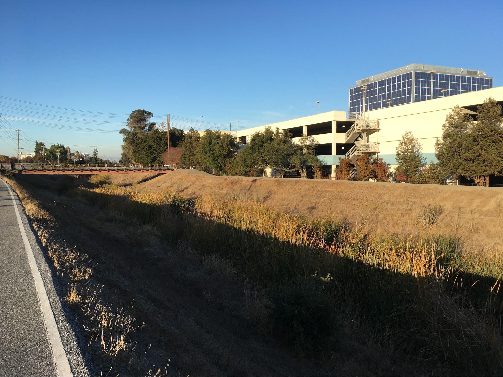
View of Freedom Bridge and the parking garage for the Intel SC-12 building. Photo by Ann Hepenstal.
Continue walking south towards US-101. In the fall and winter, we often find multiple Wilson's Snipe along the water’s edge, in groups of 2 to 10. (I’ve counted 40 some snipes in this location.) Scan carefully amidst the debris and reeds as the birds’ camouflage hides them well! Check the bushes and trees next to the Intel parking lot as the Coast Live Oak, Toyon, and others give food and habitat to sparrows, Lesser Goldfinches, Bushtits, Bewick’s Wrens, Cedar Waxwings, etc.

Look along the water’s edge and the bottom of the reeds for Wilson’s Snipes. Photo by Ann Hepenstal.
Once you get to the 101 overpass, I like to turn around (although you can continue walking to Pruneridge Avenue if you wish!). Return back to Agnew Road, passing your starting point, and continue north on the trail towards CA-237. Check the small tree between the trail and the creek [#7 on Interactive Map] for sparrows and other small birds that may perch there.
The ponds at the Great America “Flight Deck” roller coaster [# 8 on Interactive Map] typically offer coots, Pied-billed Grebes, and ducks including Bufflehead, Common Goldeneye and Ruddy Duck. Approaching the stadium, check the building for Peregrine Falcon or American Kestrel. Check the persimmon trees across the creek [#9 on Interactive Map] to see if birds are feasting on the fruit.

Checking the creek near the stadium. Be sure to check the persimmon trees across the creek from this point! Photo by Ann Hepenstal.
At Levi’s Stadium [#10 on Interactive Map], check high spots for Peregrine Falcons, and then turn around to retrace your path back to Agnew Road and your car.
Ready for More? Visit throughout the year to watch bird species leave and arrive; nesting behaviors; and the changes of the seasons
Interactive Map
Parking: Since the surrounding area is either inaccessible (e.g. Great America amusement park) or office parks, most of the nearby parking lots are private property. Here are three suggestions for free and legal parking locations. As always, check for special events at Levi’s Stadium and read all signs for special parking restrictions!
Street parking is available on the East side of Agnew Road where it crosses the Creek near Mission College Boulevard. The trail access is only yards away and there are ramps from the street to the sidewalk. The trip as written starts from this parking location [#13 on Interactive Map] Latitude/Longitude: 37.3910946, -121.9678106
There are a few street parking spaces along Octavius Drive (between Augustine Drive and Scott Boulevard). [#14 on Interactive Map] Walk over to Scott Boulevard and proceed to the creek trail entrance from Scott. [#15 on Interactive Map] Parking Latitude/Longitude: 37.3803827, -121.9702933
The City of Santa Clara’s Tasman Parking Garage, 2525 Tasman Drive, provides free parking, has a Chargepoint EV charging station and good trail access. You should verify hours before parking here. [#16 on interactive map] Latitude/Longitude: 37.4046257, -121.9718970
Fees: none (be sure to park legally so you don’t get towed or ticketed)
Public Transportation: The VTA 59 bus stops at Mission College Boulevard at Agnew Road, with easy access to the creek trail. The VTA light rail Great America Station (service by the Orange and Green Lines) is located adjacent to another Creek trail entrance from Tasman Drive. [#11 and #12 on Interactive Map]
Park Hours: daylight hours unless there’s a special event or game at 49ers stadium
Facilities: no water, first aid or bathroom facilities on the trail. Strong cell phone signal.
Trip Mileage: you can select the distance you want to walk. (I’ve spent about 2 hours counting Snipe on the trail and only walked a half mile!)
Trail Conditions: paved trail. Mostly flat, but with downslope/upslope where the trail goes under a roadway. Highly trafficked trail with bicyclists, walkers, joggers, scooters--stay alert and be cautious in order to avoid collisions. Ramp access to the trail from the street entry points.
Accessibility: No seating along the trail. Where the trail goes under a road, the trail makes inclines which may be difficult to traverse. Low points on the trail may be muddy after high water events. Ramp access at trail entry points at roads. No restrooms.
Bike: This is a great trip to do by bike.
Dogs Allowed: Dogs are allowed on 6-ft leash
More Information:
eBird hotspot: San Tomas Aquino Creek Trail
Info on Levi’s Stadium and the events schedule
49ers game schedule
City of Santa Clara website: check for special parking restrictions and street closures.
For information on closures of the trail for maintenance or weather, call (408) 615-3080 (Trail under crossings may be closed during the rainy seasons when they are inundated by the water levels in the creek.)
Creek Trail Information
Map of the Creek Trail
More Resources
For more trips like this one, visit Self-Guided Field Trips.
Visit the SCVAS Birding Resources page for more information on where to bird, our birding community, bird identification resources and more.
Read “What to Look for Now” by SCVAS Executive Director Matthew Dodder.
Banner Photo Credit: Wilson’s Snipe by Tom Grey
Last Updated: 01/05/2024
Enjoyed this Trip?
Support the work of Santa Clara Valley Audubon Society and become a member. To contact the trip writer with comments, questions or location updates, please email fieldtrips@scvas.org. You can also post in the comment section below. (If you’d like to post anonymously, type your comment, select “Post Comment”, then simply provide a name, like “Guest”, and select “Comment as Guest”.)