
Parkway Lakes and the Coyote Creek Trail in South San Jose (Spring/Summer)
by Dani Christensen
Lined with tule, cattails, willows, and cottonwoods, Parkway Lakes is a part of the Coyote Creek Parkway located in South County. You will travel south along the Coyote Creek riparian corridor looking and listening for breeding songbirds, water birds, and raptors.
Trip Covers: March - August
Key Birds: Common Gallinule, Cliff Swallow, Marsh Wren
How to Bird
This trip is 1 mile one-way along the Coyote Creek Trail, with the option to add another 1.5 miles, bringing it to anywhere from 2-5 miles long. There is infrequent shade, so best to start early as the days get warmer. Start out at the gravel lot on Monterey Road (shown on interactive map), checking the surrounding trees for the ever-present California Scrub-Jays, House Finches, and Black Phoebes. Black birds like Brewer’s Blackbird, Brown-headed Cowbird, Red-winged Blackbird, Tricolored Blackbird (occasional, winter) and Great-tailed Grackle can also be seen.
Walk up the path out of the parking lot across the paved trail to look out on the water from a dirt path [1]. Scan the water for waterfowl and waterbirds, such as Double-Crested Cormorant, Canada Goose, American Coot, Pied-billed Grebe, Gadwall, and Mallard. You may get the occasional Eared Grebe, Common Merganser, Caspian Tern, or lingering wintering waterfowl in late winter/early spring. Belted Kingfisher can often be seen and heard here on the open water as well as further down the creek. Check the large trees across the water for perched raptors like Red-tailed Hawk, or possibly Osprey or Bald Eagle.
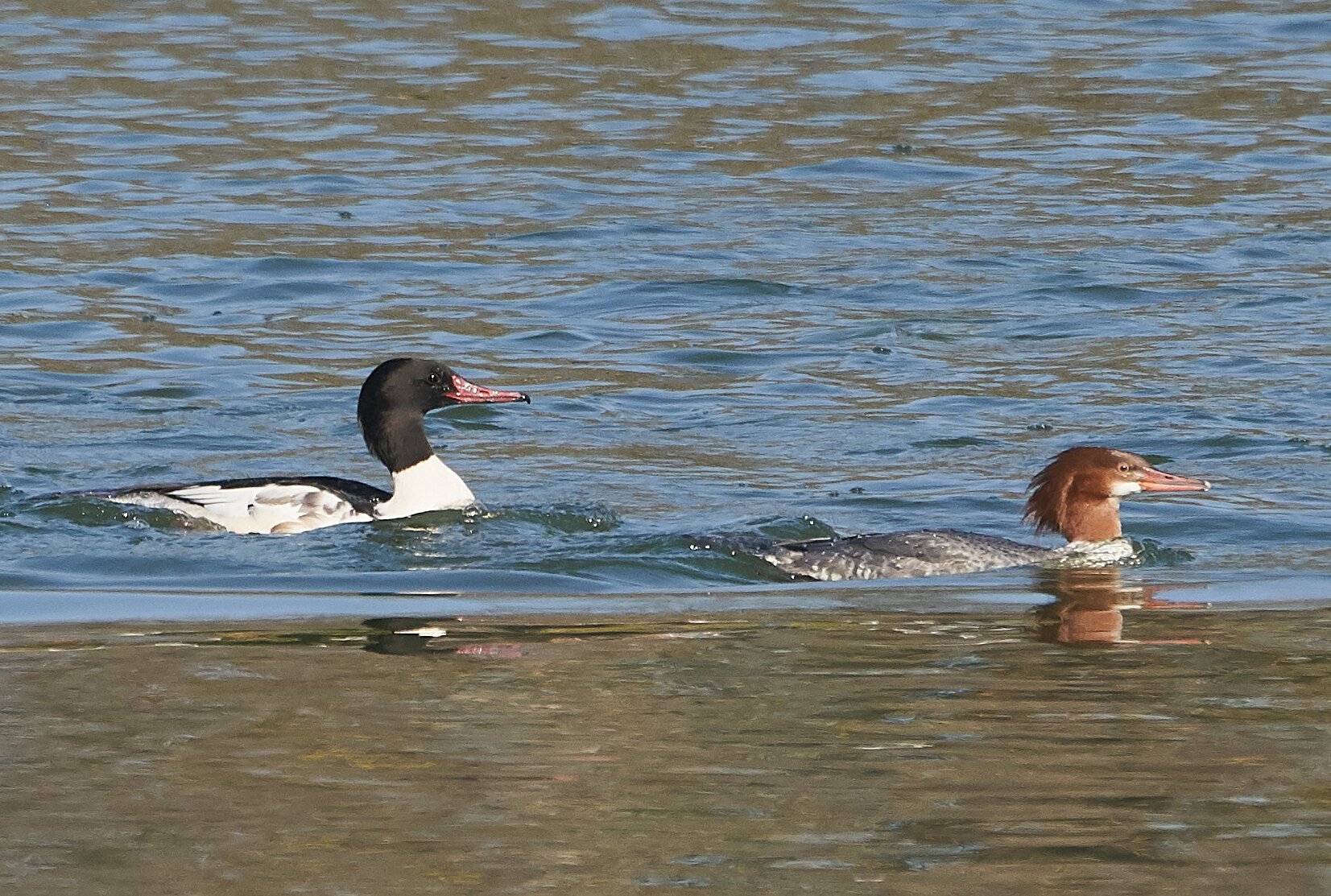
Common Mergansers can be found on the Coyote Creek, either on the open water or the quieter reaches of the creek. Photo by Brooke Miller
Once you’ve observed the open water, be sure to check the reeds for songbirds. The creek is bordered by water-loving plants such as tule, cattail, and mulefat, providing ample shelter and nesting places for breeding birds. There is a gravelly path that parallels the water, away from the hustle and bustle of the paved trail. I like to walk south (to the right from the gravel lot) along this dirt path to look for lurking Common Yellowthroat, Song Sparrow, and Marsh Wren along the water’s edge. As spring advances, listen for their territorial songs to clue you in on their location.

Listen for the song of the Common Yellowthroat, which goes, “Witchety-witchety-witchety-witch!” Photo by Carter Gasiorowski
Continue south on the path to Metcalf Road, checking the bases of coyote brush for sparrows like late wintering White-crowned and Golden-crowned, as well as resident Spotted and California Towhee. The typical woodland species can be found here in the live oaks, such as Oak Titmouse, White-breasted Nuthatch, Chestnut-backed Chickadee, Bewick’s Wren, Hutton’s Vireo, and Bushtit. Possible woodpeckers include Northern Flicker and Nuttall’s, Hairy, Downy, and Acorn Woodpecker (the last three more common once you cross Metcalf and get into the Cottonwoods). California Thrashers can often be heard singing from the thickets. Compare their infrequent ramblings to the regular mimicking song of the Northern Mockingbird, also found here.

Common Gallinule with young by Tom Grey
Cross the Metcalf bridge [2], checking the water for the shy and less numerous cousin of the coot, the Common Gallinule. After crossing the bridge, you’ll start to notice a buzzing in the air. That’s the swallows, who have returned to the county in late winter/spring, and many kinds are possible: Tree, Violet-Green, Cliff, Northern Rough-winged, and Barn Swallow. Learning to differentiate their vocalizations can help you ID these quick birds on the wing. What draws me here is the colony of Cliff Swallows that nest under the Metcalf Road overpass [3]; be sure to check this out! Cross Metcalf Road and walk down to the water to peer up under the overpass. By March they should have arrived and by April begun to refurbish the existing mud nests above the water.

Cliff Swallows are colonial nesters that build globular mud nests with a funnel-like entrance hole. Cliff Swallows use natural features like cliff faces and cave entrances for nesting spots, but with the expansion of human-made structures like bridges, culverts, and buildings, they too have expanded their range. Photo by Sushanta Bhandarkar
By now you’ve gone about a half-mile, and have the option to turn around at any point. Sometimes the creek beyond this point floods with heavy rainfall, and when this happens this section of trail may be closed. But if not, and you have the ability to continue on, I recommend it. At this point you will be joining the paved trail, so be aware of other trail users such as cyclists. Continue birding the creek, which is now on your left. Red-shouldered Hawks often nest on this more forested side, and American Kestrels nest nearby too. Ash-throated and Pacific-slope Flycatchers arrive for the breeding season, and can be seen on this quieter stretch of the trail. Warbling Vireo are also here. Golden Eagles can often be seen soaring overhead, and scanning the Diablo Range in the distance (to the east, or left) can often reveal a small herd of Tule Elk.
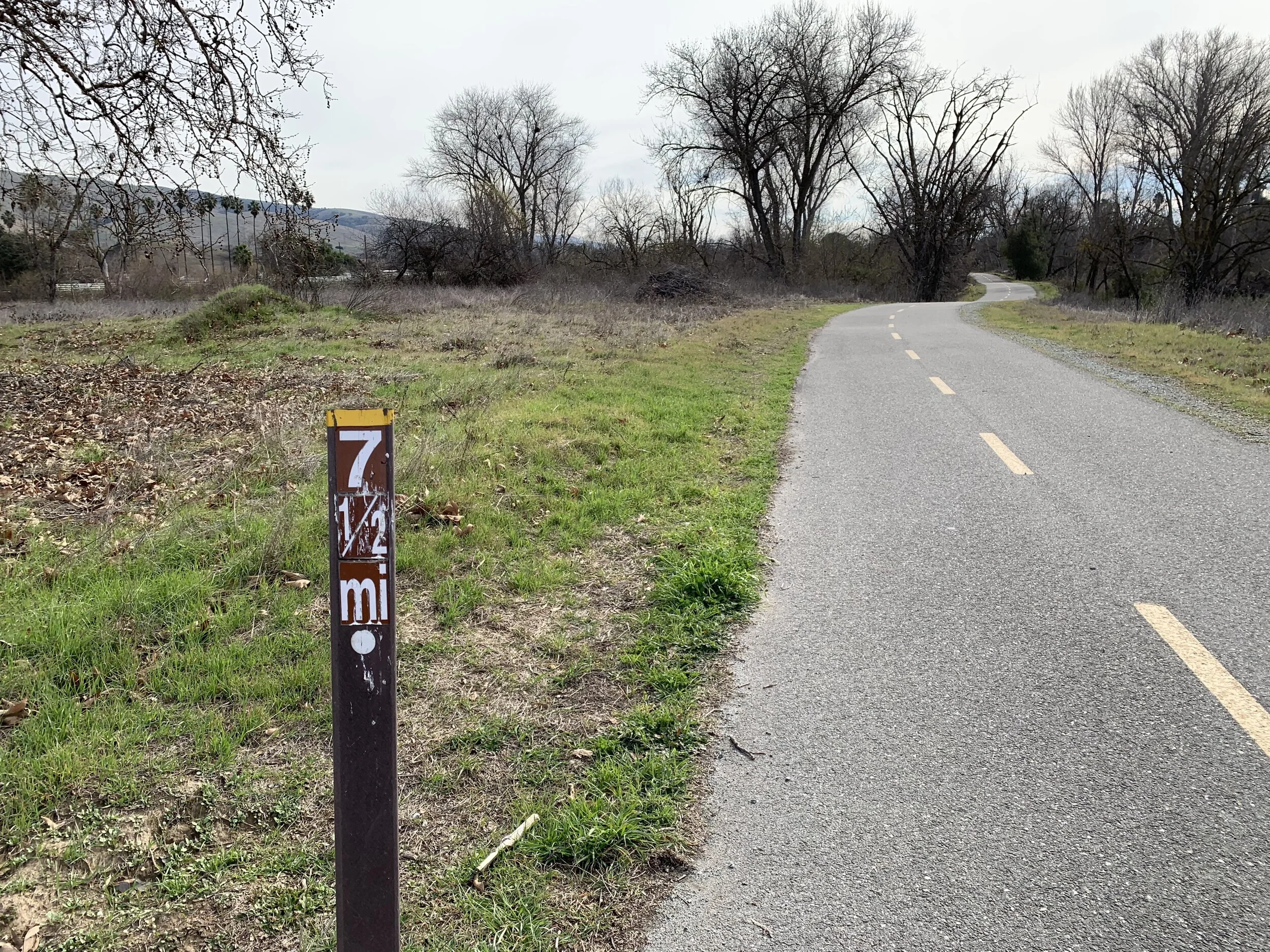
Shortly after seeing this mile marker, look for a footpath leading you around to the edge of the pond. Photo by Dani Christensen
Continue south on the trail, eventually reaching a 7 ½ mile marker (photo). Shortly after this marker you’ll find a footpath taking you to the edge of a small marshy pond [4], which may be drying up as spring turns to summer. You’ll probably hear the Red-winged Blackbird chorus as you approach. Check here for Black-crowned Night-Heron and more ducks like Mallard and Gadwall. After checking the pond, re-join the paved trail and traverse through more cottonwoods. You’ll reach a dog-leg in the trail where it meets Coyote Ranch Rd. The road has been badly damaged by the major flooding of February 2017. Go left, then right, to stay on the trail.
At the Ranch, you’ll likely find some new species such as Western Bluebirds and Hooded Orioles. The orioles like the palm trees lining the entrance to the Ranch [5], so don’t forget to look there. Check for a pair of White-tailed Kites in this open area. Continue south along a field until the trail dips down and crosses the creek [6]. This low area of the trail can sometimes have water, but usually not enough to soak your shoes. Look for Sora sneaking around here.

This quiet area sometimes offers close looks at birds like Common Yellowthroat and Sora, who don’t see you coming around the bend. Photo by Dani Christensen
The draw for me to walk this far is to check for nesting Great Blue Heron (possibly Great and Snowy Egrets too). You may have spotted these birds already on your trip, but at about 2 miles away from the parking lot you may find these colonial birds’ nests high up in a group of Sycamores across the creek (which is now to your left) [7]. Please practice good birding ethics, and if you happen to find any nests, give the birds plenty of space and avoid causing any distress.

Caption: Great-blue herons often reuse their big stick nests from previous years, refurbishing with new sticks. The male will gather the material and female will decide where to place it. Photo by Dani Christensen
At this point you can make your way back and save the rest of the trail for another day. Once you are back at the Ranch, you can return either by the paved trail you came in on, or take Coyote Ranch Road back for a change of scenery. Both will bring you back to the Metcalf Bridge, just watch for the occasional vehicle if you take the road.
Ready for More?
From the gravel lot, you could go left (north) instead of right! This will take you down to Metcalf Park and beyond. Explore other parts of the Coyote Creek trail with our other Self-Guided Trips.
Interactive Map
Directions: From US-101 or CA-85 S in San Jose, exit Bernal Rd. Turn right to continue on Bernal Rd , take the next right for the Monterey Rd ramp, then turn left (south) onto Monterey Rd. After approximately 1.5 miles, make a U-turn at Metcalf Rd. Pass the first small gravel lot near the corner of Metcalf Rd and Monterey Rd and continue for less than 0.5 miles to reach the second gravel lot which will be on your right. Drive slowly to find the lot entrance, it’s easy to miss! Latitude/Longitude: 37.229643, -121.756636
Parking: Gravel parking lot
Fees: None
Public Transportation: None
Trail Hours: Trail use is sunrise to sunset, parking lot open 8 a.m. to sunset.
Facilities: Porta-potty (not ADA), picnic tables, and cell phone service.
Trip Mileage: 2 miles with an option to extend to 5 miles.
Trail Conditions: flat paved bike trail
Accessibility: Stay on the flat, paved trail for easier accessibility.
Bikes: This is a great trip to do by bike
Dogs: Dogs allowed on 6’ leash
More Information:
Coyote Creek Parkway Map
Coyote Creek Parkway Website
eBird hotspot: Parkway Lakes and Coyote Creek Trail – Coyote Ranch Vicinity
All About Birds: Cliff Swallow
Birding Basics with SCVAS Education & Outreach Specialist Carolyn Knight: Hirundinidae (swallows)
More Resources
For more trips like this one, visit Self-Guided Field Trips.
Visit the SCVAS Birding Resources page for more information on where to bird, our birding community, bird identification resources and more.
Read “What to Look for Now” by SCVAS Executive Director Matthew Dodder.
Banner Photo Credit: Dani Christensen
Last Updated: 04/19/2022
Enjoyed this Trip?
Support the work of Santa Clara Valley Audubon Society and become a member. To contact the trip writer with comments, questions or location updates, please email fieldtrips@scvas.org. You can also post in the comment section below. (If you’d like to post anonymously, type your comment, select “Post Comment”, then simply provide a name, like “Guest”, and select “Comment as Guest”.)