
Los Alamitos Creek Trail (Spring/Summer)
Ann Verdi
Enjoy this easy, partially shaded walk alongside the Los Alamitos Creek in Almaden Valley. Bird life is plentiful and varied, especially in the spring! Or visit in the summer to take advantage of the shady trails.
Trip Covers: April - August
Key Birds: Common Merganser, California Quail, Black-chinned Hummingbird, Red-shouldered Hawk, Acorn Woodpecker, Northern Flicker, Downy Woodpecker, White-breasted Nuthatch, Pacific-slope Flycatcher, Ash-throated Flycatcher, Warbling Vireo, Tree Swallow, Violet-green Swallow, Blue-gray Gnatcatcher, Yellow Warbler, Wilson’s Warbler, Hooded Oriole, Black-headed Grosbeak
How to Bird
The riparian corridor of the Los Alamitos Creek Trail is a popular and well-used 5-mile, paved trail that winds its way through residential suburban Almaden Valley beginning at Almaden Lake over to its terminus at McKean Road. Because this trail is fairly long, I have divided it into two segments, so instead of trying to cover the whole length of this trail and back, you can choose areas where you would like to bird and decide how much time you want to bird. I have also included a few additional options of possible interest.

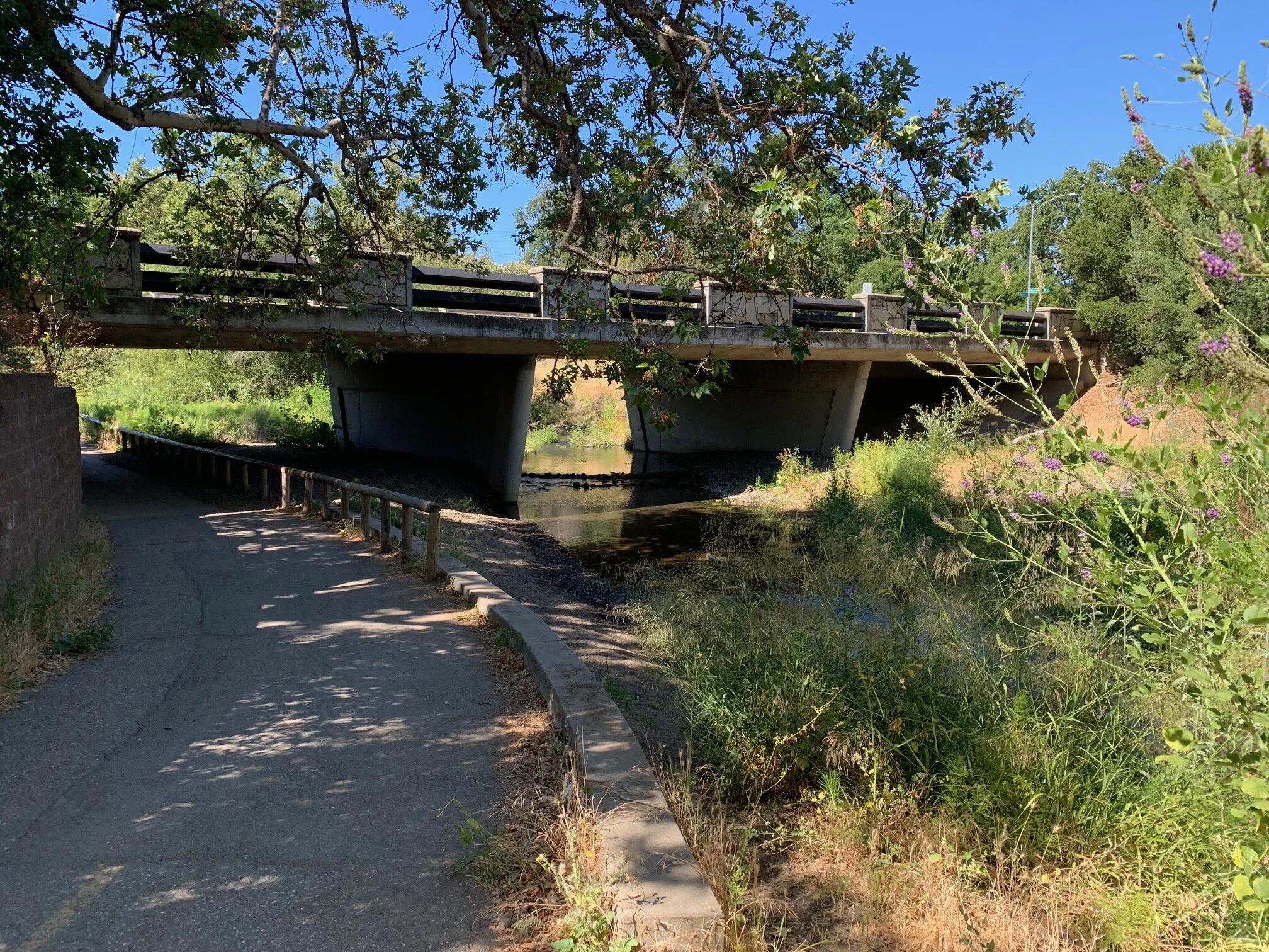
Los Alamitos Creek viewed from the Graystone Ln Bridge.
Los Alamitos Creek from Almaden Lake to Camden pedestrian bridge (1.5 miles one way): This is the most popular and most heavily trafficked part of the trail. You’ll want to get an early start as you will encounter not only walkers, but also bicyclists, runners, moms with baby strollers, young kids with scooters. Starting from the south end of Almaden Lake (#1 on the interactive map), the trail follows closely by the creek, so right away you will begin to hear and see birds such as Lesser Goldfinch, Oak Titmouse, Chestnut-backed Chickadee, Bewick’s Wren, White-breasted Nuthatch. Also listen and look for Blue-gray Gnatcatchers which may be present here.

Trail entrance from Winfield Blvd at Almaden Lake

Los Alamitos Creek Trail just south of Almaden Lake
Here are some other places of interest along this part of the trail:
Mazzone Bridge (#2 on map) – The trail goes under the bridge so you will be really close to the creek – An extra option here could be to also check the opposite side of the creek where there is a small footpath of only a few yards leading to the confluence of a feeder creek and which also goes along the base of a lone hill which is fenced off on top because of an indigenous burial site and because it is protected is now something of a sanctuary for birds for the Acorn Woodpeckers, Northern Flickers, Western Bluebirds, and Violet-green Swallows who nest there. Wilson’s Warbler, Downy Woodpecker, Warbling Vireo and Song Sparrow have all been seen and heard in the creek at this location.
Mazzone Dr Bridge
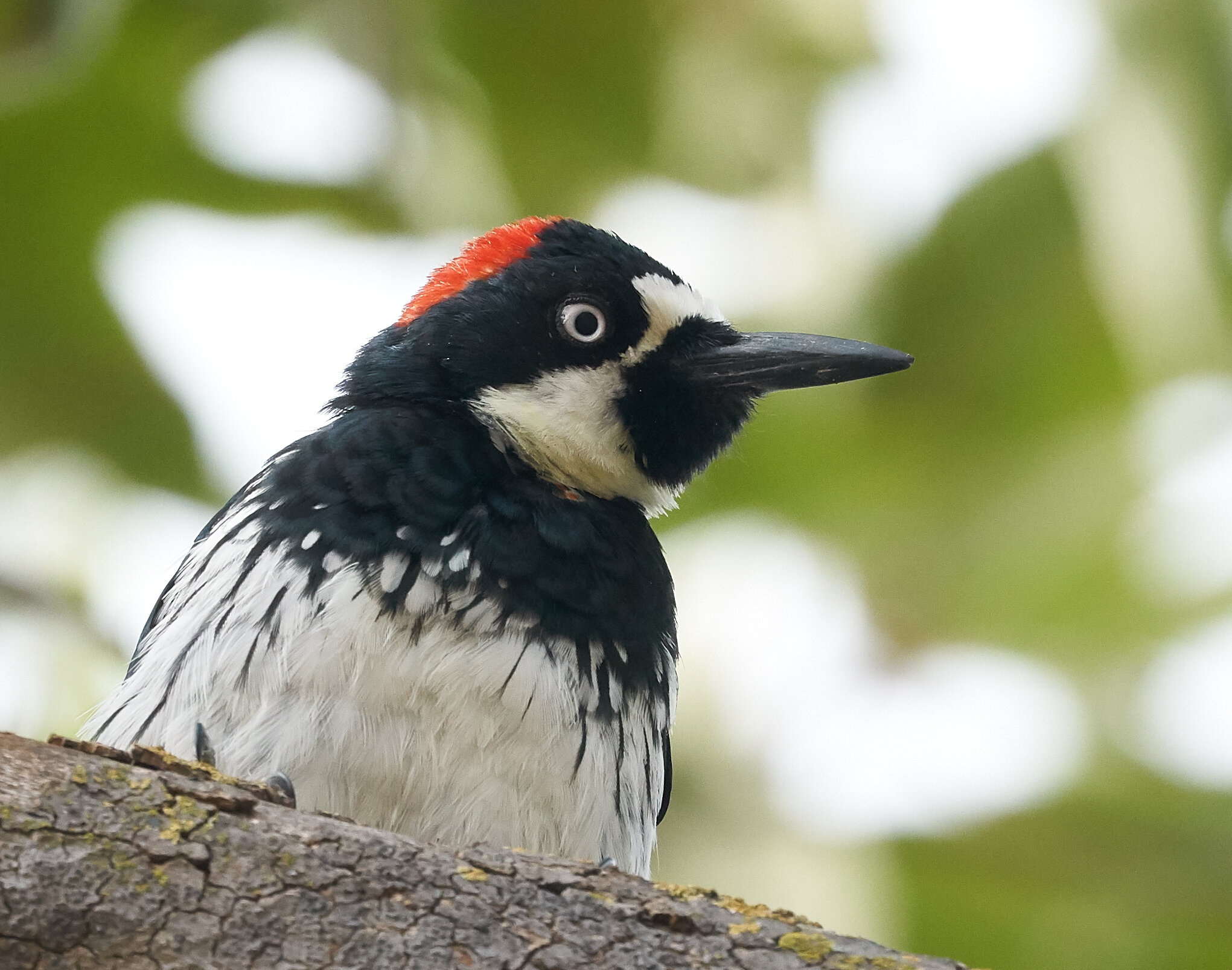
Acorn Woodpecker by Brooke Miller
The main paved trail continues through a grassy area where Tree Swallows as well as Violet-green Swallows are seen with Lesser Goldfinch and House Finch in the bushes. The paved trail then enters an area of oak woodlands while at all times following the creek on the west.
Here there is a split in the trail (#3) to your left where a separate dirt trail continues parallel to the main trail but the focus is more on the grassy hillside and chaparral along the Boulder Ridge Golf Course. Originally this dirt trail was meant for equestrian riders, but now it’s more of an interesting and quieter trail for walkers. This is a good place to look and listen for birds of these habitats. California Thrasher and California Quail are resident here. Wrentits are also here, but are easier heard than seen. Springtime birds can include Ash-throated Flycatcher, Lazuli Bunting, Rufous Hummingbird, while Western Kingbirds have been known to nest in the transmission towers along the ridgetop. Other birds seen occasionally here include Olive-sided Flycatcher, Band-tailed Pigeon, Vaux’s Swift, and Golden Eagle on the ridgetop. Rufous-crowned Sparrow has also been seen here, but is much more apt to be found farther south at Stile Ranch Trail at Santa Teresa County Park. This dirt trail then merges with the main trail again near Pfeiffer Ranch Park.

California Quail by Chuq Von Rospach

The trail splits here. Follow the left fork for better views of the chaparral hillside or follow the right fork to stay close to the creek.

California Thrasher by Erica Fleniken
Pfeiffer Ranch Park (#4) is a good rest stop with picnic tables in the middle of the mature oak woodland. A variety of spring migrants and resident birds can be seen and heard here – Black-headed Grosbeak, Warbling Vireo, and Hooded Orioles in the palm trees in the residential housing, plus our more familiar resident birds – Oak Titmouse, Chestnut-backed Chickadee, White-breasted Nuthatch and Western Bluebird all nest here. Red-shouldered Hawk is the most common raptor to show up here. I recently saw a Common Raven nest high in a tall pine. And once in a while, a rarity can show up here, like a Yellow-breasted Chat in 2020 and 2021.
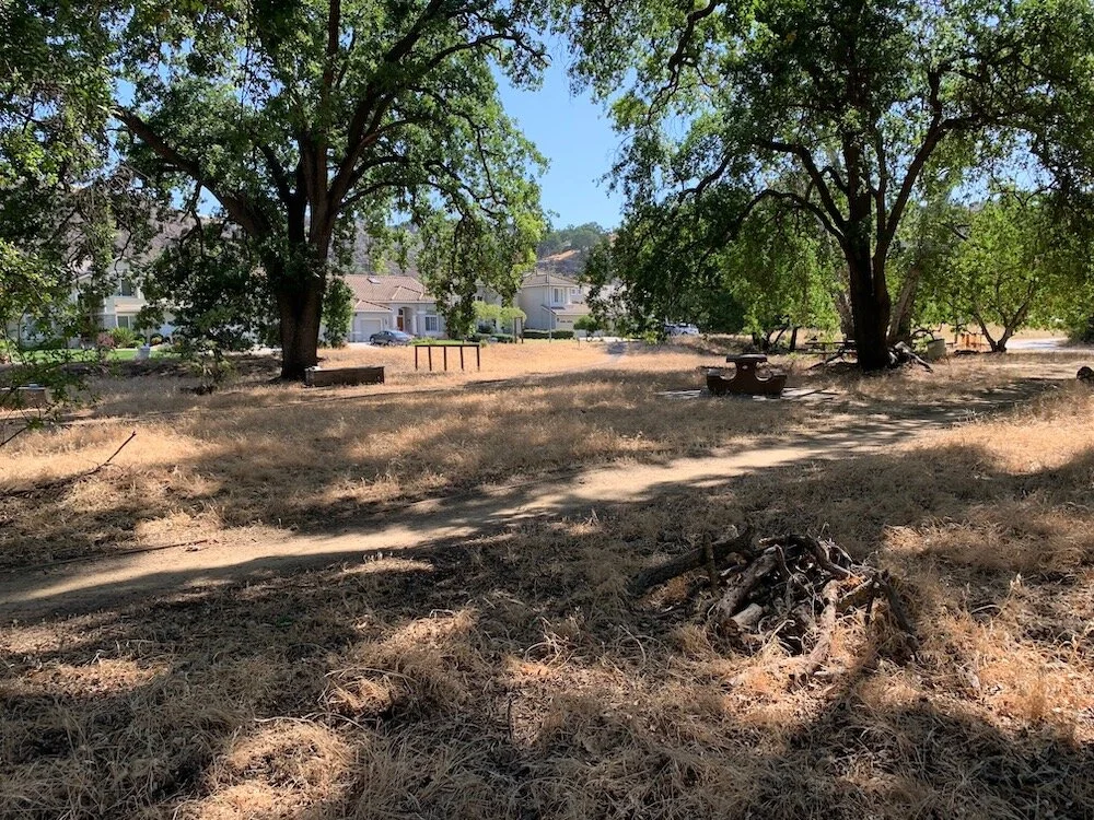
Pfeiffer Ranch Park with picnic tables in the shade of the mature oaks.
The Pfeiffer Ranch Park honors the Pfeiffer family and their early contributions to this area in the planting of orchards, and in the quarrying of brown (golden) sandstone – a unique form of sandstone found in the Santa Teresa Hills. The sandstone from here is found in the original buildings of Stanford University, Lick Observatory, and the old post office in downtown San Jose which is now part of the San Jose Museum of Art. Boulder outcroppings of this sandstone can be seen from this park above the residential houses just to the north. Just to the south of Pfeiffer Ranch Park at the corner of Graystone Lane just above the creek is a relic of this bygone era – the “Pfeiffer Stone House”, an old rounded storage chamber for tools and food. It is now remembered with a plaque as an historical marker (unnumbered pin on map).
After leaving Pfeiffer Ranch Park, the trail proceeds to the Camden pedestrian bridge (#5) where Yellow Warblers and Pacific-slope Flycatchers are heard and seen. A no-fee parking lot is here. This is the turn-around spot for most people on their outings – a round trip from Almaden Lake to this bridge is three miles.

Camden Ave pedestrian bridge

Pacific-slope Flycatcher by Brooke Miller
If you choose this route on the return, Almaden Lake is another good place for more birding, but for this route there is still one more optional stop to make before moving on to the rest of the trail. A small narrow dirt footpath leads down from the pedestrian bridge and follows the willow-lined creek through woodlands and goes under the Graystone Lane Bridge (# 6) opening out to a glade of mature coast and valley oaks and sycamores plus a large kumquat tree (#7) which attracts many birds. This small footpath is notable as an area where Black-chinned Hummingbirds are known to nest. Besides our more common birds, Swainson’s Thrush have been found along this quiet trail, and recently a Western Wood-Pewee was seen here as well.

Black-chinned Hummingbird by Brooke Miller

Glade of mature coast and valley oaks and sycamores plus a large kumquat tree
This reaches the end of the first segment, but before continuing on, I wanted to add a few words about Greystone Park (#8) dominated by tall evergreens which is right across the street from Graystone Lane and is a good place for a rest stop – and it is the only other place on the route besides Almaden Lake where there is an available restroom. During the spring and summer seasons most birds seen here will be American Robin, Dark-eyed Junco, Lesser Goldfinch, and California Scrub-Jay. While not in the “spring/summer” time frame, I just want to mention some other notable birds that have been found here among the evergreens in other seasons – Townsend’s Warbler, Hermit Warbler, Nashville Warbler, Golden-crowned Kinglet, Red-breasted Nuthatch – so this park is definitely worth a visit at any time of year.

Shady Greystone Park - a restroom stop.
Los Alamitos Creek from Graystone Lane to McKean Road (approx. 3.5 miles): This is the second segment where the paved asphalt trail continues to follow the creek southward, this time on the west side of the creek. This is pretty much a straight-shot along this part of our route where pedestrian and biking numbers are considerably less. As part of a flood control plan the paved trail is now on top of an embankment, so you will be at a higher level and can look down on the creek and its environs. One thing you may notice along here is that there seem to be several footpaths meandering throughout the understory. I’m not sure where they all go, so I tend to discourage getting down there and then wanting to get back up by having to scale the steep embankments. Besides, the other day when I was checking it, I saw deer using one of those footpaths, so I’m inclined to let the deer and other wildlife have priority in this maze.

Chestnut-backed Chickadee by Tom Grey
Birding along this part of the route may seem quieter; however, once in a very great while you may find something surprising, as I remember seeing Yellow-billed Magpie near Leland High School here years ago which are no longer seen here. The trail passes by Leland High School where there is a bench with a map of Los Alamitos Creek. Then the trail heads toward “Singer Park” (#9) and the rest of the southern part of the route. If you choose to eliminate this part of the trail, that’s OK as it can seem to be a lot of walking without seeing much more than what you’ve already seen.

Singer Park
“Singer Park” – This piece of land is noted on maps as “Singer Park”, but there is no signage when you reach this so-called “park” which is a wide undeveloped area of prickly weeds and poison oak. There is a dirt trail leading there, but I would suggest doing any birding from the paved trail which now dips down to eye-level again at this juncture. The reason for including this area on this route is that this is where the Calero Arroyo coming in from the Calero Reservoir meets Los Alamitos Creek which now veers sharply west to go under Camden Ave.

Warbling Vireo by Vivek Khanzodé
The trail splits here (#10). If you continue over the creek, keeping Camden Ave on your right, you will be following the Calero Creek Trail to Harry Road. For the purposes of this guide, continue across Camden Ave to remain on the final section of the Los Alamitos Creek Trail. There are pedestrian warning signs to motorists here at the bridge so you can cross safely to get to the other side of Camden. Take a moment to view into the “Singer Park” area at the bridge where Los Alamitos Creek turns west, and see and hear woodland birds in the trees and undergrowth. This is also where Common Merganser can be found as well as Mallards.
If you have decided to drive down to this area, your parking will need to be on a side street. One side street I recommend is Villagewood Dr which is next to Carrabelle Park (#11), a small oak-wooded park which can have some interesting birds. The street that you will want to follow for the Los Alamitos Creek Trail is Queenswood – the next street south if you can find parking there. Los Alamitos Creek can be birded on the other side of the creek on Royalwood, but Queenswood is the “official” route. This is a delightful stretch and a pleasure to bird at any season. Like any other birding site, there are times when it can be very birdy, other times when things seem too quiet. Birds seen here include Rufous Hummingbird, Black-headed Grosbeak, Pacific-slope Flycatcher, Warbling Vireo, Song Sparrow, Wilson’s Warbler, and others. This can be a very pleasant walk as the trail heads west under Almaden Expressway over to McKean Road where the official trail ends. You can retrace your steps along Queenswood on your way back, or you can go back on Royalwood on the other side of the creek (#12).

The section of Los Alamitos Creek Trail that runs alongside Queenswood Way
Meanwhile Los Alamitos Creek continues west through New Almaden and beyond to the Almaden Reservoir area where it reaches to its origin in the Santa Cruz Mountains.
Hope you enjoy your choice of birding locales with this report – and just know that birding can be good at any time of year on Los Alamitos Creek
Ready for More?
If you have some extra time, Almaden Lake can be an excellent location to bird. Heads up - the lake will be undergoing some changes over the next several years. The Los Alamitos Creek will no longer flow into the lake but bypass it on the west side. The original island will be expanded (Egrets and Herons nest here) and a second island will be added. To learn more about the upcoming improvements to Almaden Lake, watch Almaden Lake: Evolution of the Environmentand How Birds Adapt by Larry Manning, SFBBO volunteer.
Interactive Map
Directions
Almaden Lake Park: From CA-85 in San Jose, exit Almaden Expwy. Continue south on Almaden Expy for 0.8 miles. Turn left onto Coleman Rd, continue for 0.3 miles driving over the Coleman Bridge. Turn right onto Winfield Blvd. Park along Winfield Blvd or park in the Almaden Lake parking lot for a fee. Almaden Lake Park opens at 8:00 am and restrooms are available. Latitude/Longitude: 37.238892, -121.869842
Camden Ave parking area: From CA-85 in San Jose, exit Almaden Expwy. Continue south on Almaden Expy for 2.5 miles. Turn left on Camden Ave and proceed for 0.5 miles passing the Westgate Church, South Campus. Turn left into the Camden parking lot. Latitude/Longitude: 37.222636, -121.853922
Parking: ADA compliant spots available at Almaden Lake Park lot and Camden Ave lot. Street parking on Winfield Blvd and near Greystone Park and Carabelle Park.
Fees: If you park in the parking lots of Almaden Lake Park, day-use parking fees apply. See the park website for more information.
Public Transportation: VTA bus stop is at Winfield Blvd and Coleman Ave.
Trail Hours: One hour before sunrise to one hour after sunset.
Facilities: Restrooms available at Almaden Lake Park off Winfield Blvd and at Greystone Park at Camden Ave & Mt. Carmel Drive.
Trip Mileage: Variable
Trail Conditions: The entire length of the trail is flat asphalt paving spaced six feet across. Some optional side trails in this report are dirt and these are noted. This trail can be busy with walkers, joggers, strollers and bicyclists.
Accessibility: The entire length of the trail is flat asphalt paving spaced six feet across, so is wheelchair accessible. There are benches along the entire route. The trail is about 50% shade.
Bikes: Bikes are allowed but not recommended for this trip.
Dogs: Dogs are allowed on 6-ft leash.
More Information
More Resources
For more trips like this one, visit Self-Guided Field Trips.
Visit the SCVAS Birding Resources page for more information on where to bird, our birding community, bird identification resources and more.
Read “What to Look for Now” by SCVAS Executive Director Matthew Dodder.
Photo Credits: Banner photo and all location photos by Eve Meier
Last Updated: 5/10/2022
Enjoyed this Trip?
Support the work of Santa Clara Valley Audubon Society and become a member. To contact the trip writer with comments, questions or location updates, please email fieldtrips@scvas.org. You can also post in the comment section below. (If you’d like to post anonymously, type your comment, select “Post Comment”, then simply provide a name, like “Guest”, and select “Comment as Guest”.)