
Coyote Lake (Winter):
A Winter Stop for Waterfowl and Much More
by Edward Rooks
Whether you want a relaxing lakeside drive with easy bird watching, or a vigorous hike through the rolling hills, Coyote Lake in Gilroy is a prime attraction for birdwatchers. Beautiful scenery is the backdrop to lots of overwintering waterfowl and wild animals like deer, wild boar, Wild Turkey and California Quail that are habituated to people. Come for the Bald Eagles and courting Western and Clark’s Grebes and you will find so much more.
Trip Covers: November - March
Key Birds: Ring-necked Duck, Common Merganser, Western Grebe, Clark’s Grebe, Black-necked Stilt, Wilson’s Snipe, Spotted Sandpiper, American White Pelican, Great Blue Heron, Great Egret, Bald Eagle, Red-tailed Hawk, Rock Wren, Canyon Wren, and Phainopepla (uncommon).
How to Bird
Coyote Lake Harvey-Bear County Park, nestled in the Diablo foothills east of Gilroy, encompasses Coyote Lake and 33 miles of trails. This park has 3 entrances: the main entrance (#1 on map) which provides access to the lake, the Mendoza Entrance (# 2 on map), and the Harvey-Bear Entrance (#3 on map). This guide covers the main entrance only.
During winter months, the greatest bird diversity is found on and around the shores of Coyote Lake. This lake is a 3-mile long, narrow fault-valley reservoir that sits on the Calaveras Fault and is hemmed in behind the 1000-1400 foot high Coyote Ridge, which rises along the eastern flank of Gilroy and Morgan Hill. The park road, Coyote Reservoir Road, runs through the park and parallels the west side of Coyote Lake offering many wonderful birding opportunities at numerous parking lots and picnic areas.

Walking north on Coyote Ridge Trail with views of Coyote Valley to the west and Coyote Lake to the east.
Additional birding opportunities can be found along the hilly trails that traverse a diversity of habitats including open ranch land, mixed woodland, riparian woodland and chaparral. These trails are mostly on the flanks of Coyote Ridge. Coyote Ridge Trail runs along the top of the ridge where you will find rocks that are dark volcanic basalt, full of holes created by gas bubbles. The west facing grassy slopes of the Coyote Ridge are open ranch land with great views of Gilroy, Morgan Hill and beyond. The eastern facing slopes of Coyote Ridge are covered with oak woodland that offers wonderful views of Coyote Lake and the slopes of the 2000-2400 foot high “Timber Ridge”, east of the lake.

The view from Mummy Mountain Trail of Coyote Creek, which flows from right to left into the south end of Coyote Lake. The steep slopes of the 2000 ‘ high Palassou Ridge Preserve stand over the eastern shores of the lake.
Besides the birds, other wildlife to enjoy includes the western pond turtle, California tiger salamander and bay checkerspot butterfly. During your visit you’re likely to see Columbian black-tailed deer. Wild boar can often be seen in all areas of this park, including the campgrounds, and they are quite tame.

Wild boar frequently forage along the shores of Coyote Lake and banks of Coyote Creek.

Acorn Woodpeckers on a telephone pole along Coyote Reservoir Road.
For the purposes of this guide, I have chosen just three stops along the lake: Lake View Campground, Sandy Beach, and the dam. These make a nice auto tour if you are not up to hiking. This road is very narrow, so take care to drive at or below the speed limit. You will share this road with other vehicles, including trucks and RVs. You will also share it with wild boar, deer, Wild Turkey, California Quail and possibly gray fox and bobcat. Bring a spotting scope if you have one.
I’ve also chosen two of my favorite hikes: the 3.5 mile loop using the Ed Wilson Trail which can be accessed from the dam and a 4.8 mile loop using the Gaviota and Valley Oak Trails which you can access from the campground.
Auto Tour Stop 1: Lake View Campground (#4 on map)
Target birds: Eagles, Hawks, Acorn Woodpecker, Western Bluebird
Starting from the park entry kiosk, drive 0.2 miles to the Lake View Campground. There is a small parking lot and bathrooms for day-users. Wander around the campground to find Acorn Woodpeckers, Western Bluebirds and European Starlings competing for nest cavities in large old oaks. Be sure to check the trunks and larger branches of the pepper trees for Red-breasted Sapsuckers. Turkey, Crow and White-crowned Sparrow flock to forage in the campgrounds and around, as do California Scrub-Jay, Steller’s Jay and California Towhee. You can find raptors overhead, including both Golden and Bald Eagle, and Song Sparrow and Common Yellowthroat in the marsh and riparian vegetation at the back of the lake. There is an unmarked trail across the dry lake bed to the creek. It is worth birding, but only if it’s not flooded or muddy. You can walk down to the edge of the lake to see waterfowl. If the lake has been drained it could be a quarter mile away. If it has been raining, the lake’s edge is beside the campgrounds. It is not uncommon to see wild boar and a herd of deer in the campground. Gray fox and bobcat are more wary, but have habituated to people and can be seen on occasion, if you are quiet and vigilant.
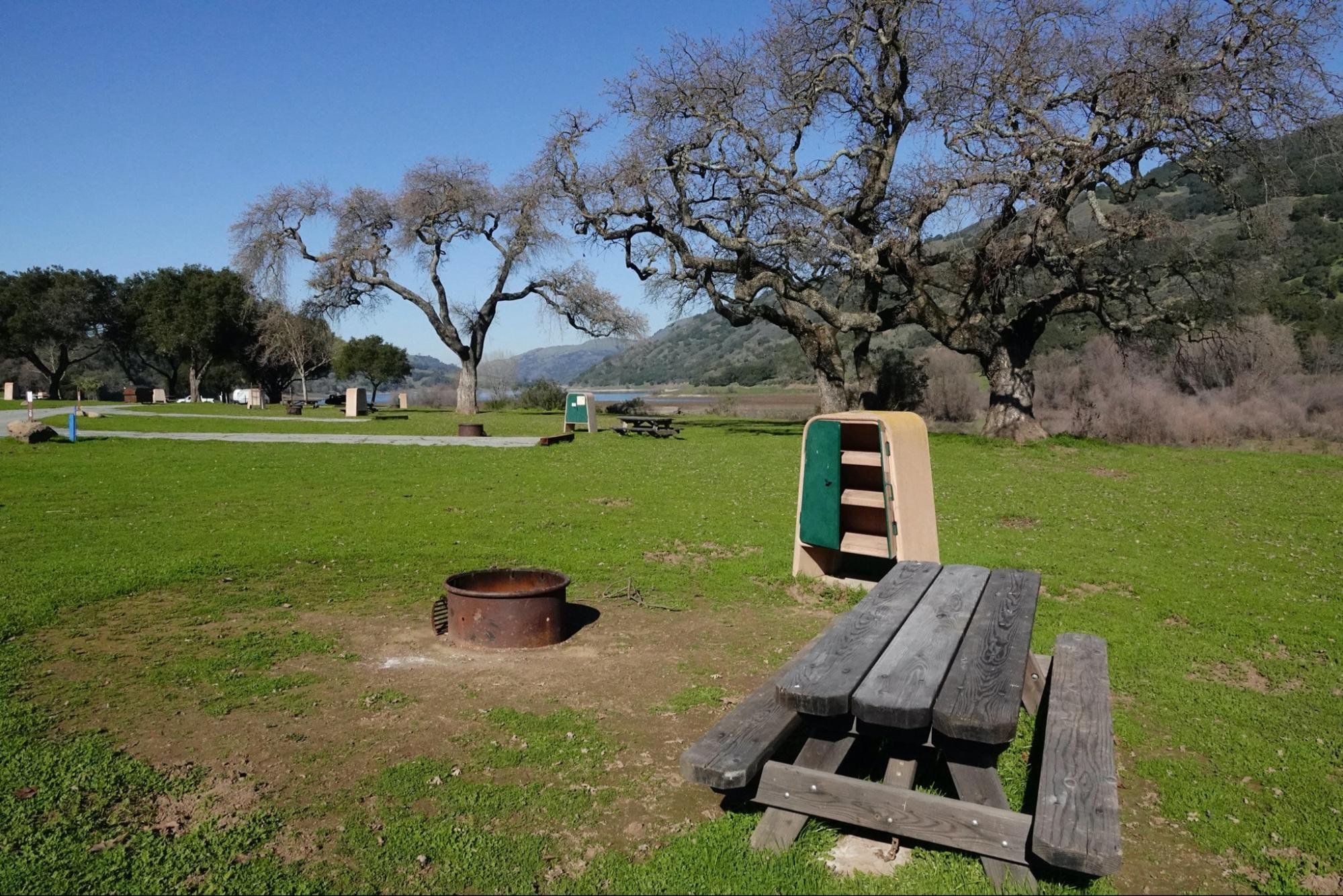
Lake View Campground on the south-eastern shore of Coyote Lake.

Wild Turkey are regular visitors to Lake View Campground.

Golden Eagle circling over Lake View Campground

Clark’s Grebe at Sandy Beach.
Auto Tour Stop 2: Sandy Beach (#5 on map)
Target birds: Western Grebe, Clark’s Grebe, waders and waterfowl
The second stop is 0.8 miles further along Coyote Lake Rd. Turn right into Sandy Beach Picnic Area where you can park and have access to the bathrooms and then scope the diverse waterfowl overwintering on the lake. Large numbers of Canada Goose, Mallard, Canvasback, Ring-necked Duck, Gadwall, Wigeon, and Ruddy Duck swim in the lake and rest on the far bank alongside American White Pelican, Canada Geese, Eared Grebe, and Pied-billed Grebe. The black and white pattern and long necks of Western Grebe and Clark’s Grebe stand out, as does their loud reedy call and spectacular synchronous courtship display, often described as a dance. To learn more about this behavior, see our More Resources links below.

View from Sandy Beach Picnic Area of Western Grebes and Clark’s Grebes on Coyote Lake.

View north of Coyote Lake from Sandy Beach Picnic Area.

Western Grebes synchronized “rush” display.

Bald Eagle flying over the lake scanning for fish.
Auto Tour Stop 3: Coyote Dam (#6 on map)
Target birds: Bald Eagle, Rock Wren and Canyon Wren
Drive 2.3 miles further north from Sandy Beach Picnic Area to the end of Coyote Lake Rd and park at Coyote Dam parking lot. Scan the large boulders for Rock Wren and Canyon Wren. Patience will pay off. While waiting for the wrens to show themselves, you can cautiously walk down to the lakeshore; there are trails down on both sides of the dam. Walk a short distance slowly and stop every now and then to scan the shrubs and dam boulders. Birds hidden in the rocks and shrubs will show themselves if you are slow and quiet, or will flush if you move too quickly. Target birds at the dam include Bald Eagle, often seen here as a pair nest nearby. You can also regularly find Common Merganser, Clark’s Grebe, Western Grebe, Ring-necked Duck, Spotted Sandpiper, Wilson’s Snipe, and Lincoln’s Sparrow. There is a small spillway catchment pond to the north of the dam, where it is possible to scope Wood Duck, Hooded Merganser and other waterfowl. White-throated Swifts often feed near the dam.

Coyote Dam is a 140-foot high, 980-foot long earth and rock dam built in 1936. Canyon Wren and Rock Wren can be found among the rocks.

Be sure to scan the catchment pond below Coyote Dam and its spillway.

Wilson’s Snipe among the boulders on the Coyote Dam.
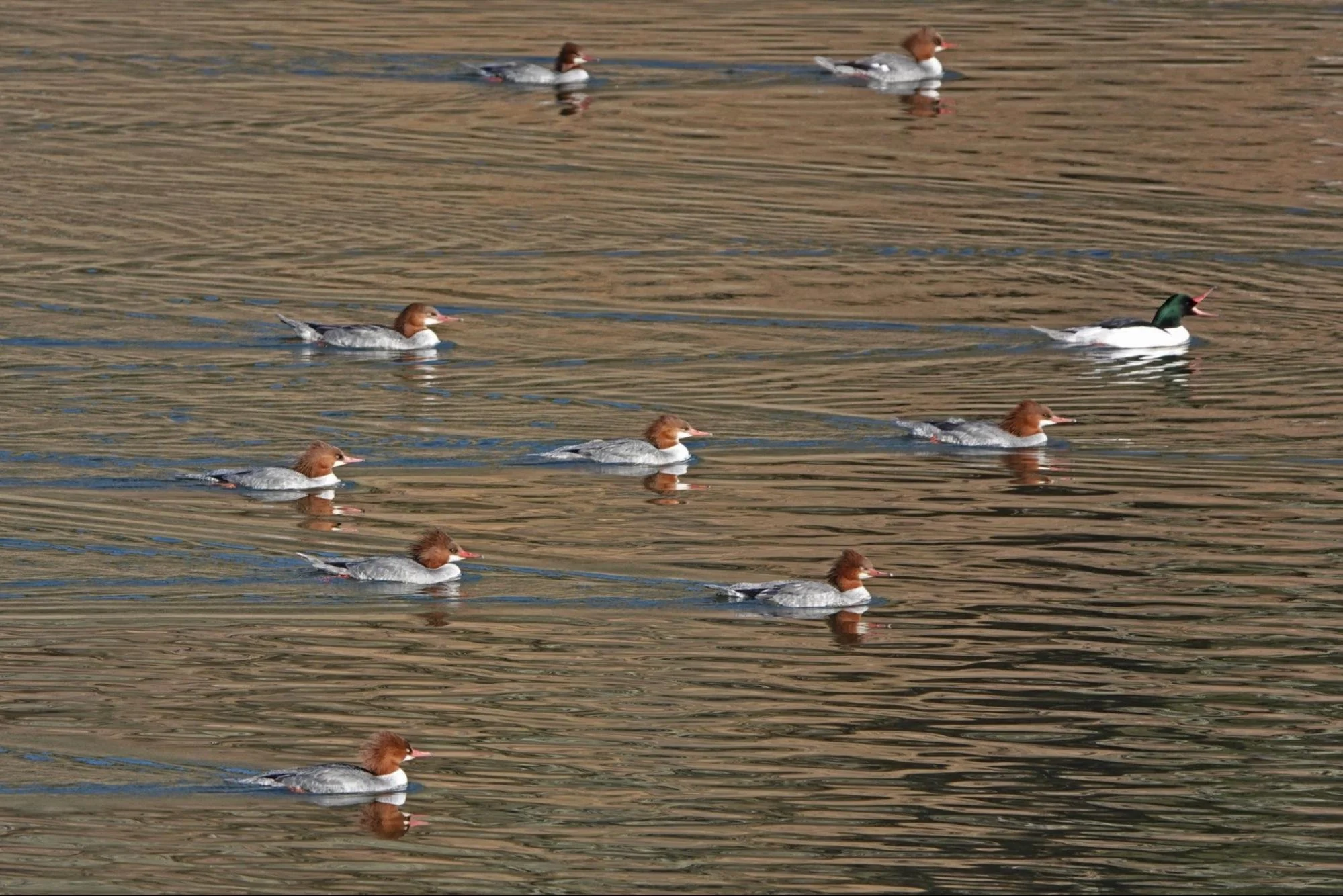
Common Mergansers at Coyote Dam.

Canyon Wren at the dam.
Canyon Wren singing at the dam — video by Steve Zamek
Hike 1: Ed Wilson Trail (loop trail, 3.5 miles, 500 ft elevation gain)
Target birds: Phainopepla and Golden Eagle
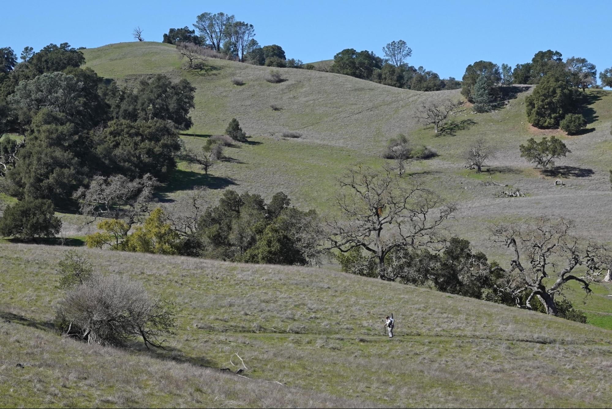
Ed Wilson Trail is a moderate and relaxing trail that takes you up to some of the best panoramic views in this park. It’s a short adventure that always surprises with an unexpected sighting of maybe an eagle, a falcon, deer, a coyote, or a family of wild boar. Start at the north-west corner of the dam parking lot (#7 on interactive map), and walk up the wide, wooded trail to the Harvey Bear Trail. Be sure to listen and look for Nuttall’s Woodpecker, White-breasted Nuthatch and Yellow-rumped Warblers in the oaks and for California Scrub-Jay, Hermit Thrush and Purple Finch among the shrubs. Turn right at the intersection (#8 on map) and walk 0.2 miles to the intersection of Ed Wilson Trail (#9 on map). This trail traverses picturesque cattle ranch land. Raptors like White-tailed Kite and Red-tailed Hawk and occasionally Golden Eagle can be found here. Acorn Woodpeckers and American Crows seem to own the place. When you spot a mistletoe laden oak tree, take some time to watch for Phainopepla as these birds love to eat the mistletoe berries. The peak of Ed Wilson Trail stands ahead of you. Turn right and walk up the wooded east facing slope of the ridge through about a mile of oak woodland. The ridge and peak of the trail is studded with Gray Pine and you will have sweeping scenic vistas of both Coyote Valley and Coyote Lake. With luck you might see other raptors like American Kestrel, Red-shouldered Hawk, White-tailed Kite and Merlin. Take your time while birding the ridge and west slope. It is easy to overlook small birds flitting among the rocks and grasses. Look for Savannah Sparrow, Grasshopper Sparrow (spring/summer), and Western Meadowlark before descending to the Harvey Bear Trail (#10 on map) for the return leg of the hike.
See the highlighted routes on the county park map in the resources section below.
Ed Wilson trail and peak.

White-tailed Kite circling about Ed Wilson Trail.

Northern Harrier on the Ed Wilson Trail
Hike 2: Gaviota Trail (loop trail, 4.8 miles, 500 foot elevation gain)
Target Birds: White-tailed Kite, California Quail, Hairy Woodpecker, Northern Flicker, Western Bluebird, Bushtit, Wrentit, Townsend’s Warbler, Spotted Towhee
The habitat along this loop is similar to the Ed Wilson Trail with grasslands and woodlands but it also passes through some chaparral shrubland on the Gaviota Trail, attracting Wrentit, Bewick’s Wren, and maybe California Thrasher, Lesser Goldfinch, wintering Sparrows and Spotted Towhee. There is a spring and water trough along Church Creek on the Rancho San Ysidro Trail that attracts birds all year long, even when the weather has been dry. Hikers, horseback riders and off-road bicyclists can share these trails.

Picnic table with a view on the Gaviota Trail at the Blue Oak Trail junction.

Gaviota Trail winds through grassland, chaparral and woodland.
Park at the Lakeview Campground parking lot to start this 4.8 mile loop hike using the Gaviota (#11 on map), Rancho San Ysidro (#12 on map) and Valley Oak trails (#13 on map). Cross Coyote Reservoir Rd to the trailhead and hike uphill for 0.3 miles. Here you will find woodland birds like Hairy Woodpecker and if you listen carefully, maybe even a Brown Creeper. There is a cattle pond on your left as you exit the woods. Sometimes there are ducks, sometimes wild boar and sometimes cattle drinking. Keep left at the Valley Oak trail junction and walk uphill for 0.1 miles to the Coyote Ridge Trail. Turn right on Coyote Ridge Trail for 0.1 miles and then turn left onto the Gaviota Trail that will take you around the west facing slope of the ridge for 2.2 miles. Turn right at Rancho San Ysidro Trail and walk uphill for 0.7 miles. Spend some time at the spring as Jays, Juncos, Woodpeckers, Towhees and other birds come here to bathe and drink. Turn right, before the green gate, onto Coyote Ridge Trail for 0.1 miles. Turn left onto the narrow footpath that is not well marked. This trail will split and one segment will take you down to the Boat Ramp and San Ysidro Picnic Area. Take the trail on your right into the woods, along the Valley Oak Trail which is shaded and is the best chance you will have of finding a mixed flock of leaf gleaning birds like Chestnut-backed Chickadee, White-breasted Nuthatch, Oak Titmouse, Yellow-rumped Warbler, Townsend Warbler and Dark-eyed Junco. This segment of trail is 1.1 miles long and will return you to the campground trail to finish the remaining 0.3 miles back to the Lake View Campground.
You can also make this same loop starting from the San Ysidro Picnic Area or you can create a shorter 3.5 mile loop trail using the Blue Oak and Coyote Ridge Trails rather than the Valley Oak Trail. Consult the park map for details.

Gaviota loop trail highlighted on the County Park Map, showing 2 optional routes.

Townsend’s Warbler in a Coast Live Oak tree on the Gaviota Trail.

Sharp-shinned Hawk over the Gaviota Trail.
Ready for More? There is so much to see at Coyote Lake. This guide already covers more than what you can do in one day, but if you need a little bit more, try the Mendoza Entrance for species such as Yellow-billed Magpie and Lark Sparrow. You can consult our self-guided field trip for that area.
If you enjoyed the grebes’ courtships and displays and would like to see more, try visiting Calero Reservoir in San Jose.
Interactive Map
Directions: These directions are for the main entrance to Coyote Lake - Harvey Bear County Park (not for the Mendoza or Harvey-Bear entrances.) From US-101 in Gilroy, take the Leavesley Road exit. Proceed east on Leavesley Road 2 miles to New Avenue. Proceed north on New Avenue 0.5 miles to Roop Road. Proceed 3.5 miles east on Roop Road into the foothills past the Mendoza Ranch entrance. Turn left into the park and proceed 1 mile north to the park entrance, pay station and visitor center with exhibits. Latitude/Longitude: 37.078408, -121.528361
Parking: Paved parking lots all along Coyote Lake. The parking lot at the dam is dirt.
Fees: Day-use parking fees. See the park website for more information.
Public Transportation: None available
Park Hours: The park is open year-round for general day use from 8 a.m. to sunset.
Facilities: Wheelchair accessible bathrooms/porta-potties at all 3 auto-tour stops. Good cell phone service.
Trip Mileage: Variable. This guide covers an auto tour with 3 stops and 2 hikes.
Trail Conditions: Many of the trails are well maintained wide dirt roads. You will share these multiple use trails (including the Coyote Ridge Trail) with people on horseback and on bicycles. You will also share these trails with cattle and where these trails are wetter and shaded, the cattle can stir up the mud and create tripping hazards. Narrower footpaths like Mummy Mountain Trail and Ed Wilson Trail, are single use hiking trails that allow you to escape the potential stress of faster traffic so you can bird watch in peace. Trails on the eastern slope of Coyote Ridge are shaded by woodland, but trails along the ridge and on the western slope above Gilroy and San Martin are in open ranch land. You will be exposed to the sun for long stretches, so wear long sleeves and a hat and bring ample water.
Accessibility: For those that need an accessible trip, I’ve chosen 3 stops along the main park road. Each of these stops have ADA-compliant parking and a wheelchair accessible bathroom/porta-potty. In addition to birding from the parking lots, the campground (stop 1) has paved roads which can be birded. The gravel access road at the dam (stop 3) is flat. Unfortunately, there is a narrow gate opening that a wheelchair user will not be able to go through. The paved boat launch parking lot is also a great spot to bird.
Bikes: Bikes are allowed but not recommended for this trip.
Dogs: Dogs are allowed on 6-ft leash.
More Information
Coyote Lake Harvey-Bear Ranch County Park Trail Map
Coyote Lake Harvey-Bear Ranch County Park Website
eBird hotspot: Coyote Lake County Park
eBird hotspot: Coyote Lake CP -- Dam Area
Read North American Nature Photography Association’s Grebes Walk on Water to find a Mate.
For more information on the rushing behavior or grebes, read All About Birds Grebe Life History.
More Resources
For more trips like this one, visit Self-Guided Field Trips.
Visit the SCVAS Birding Resources page for more information on where to bird, our birding community, bird identification resources and more.
Read “What to Look for Now” by SCVAS Executive Director Matthew Dodder.
Photo Credits: All photos by Edward Rooks
Last Updated: 3/23/2022
Enjoyed this Trip?
Support the work of Santa Clara Valley Audubon Society and become a member. To contact the trip writer with comments, questions or location updates, please email fieldtrips@scvas.org. You can also post in the comment section below. (If you’d like to post anonymously, type your comment, select “Post Comment”, then simply provide a name, like “Guest”, and select “Comment as Guest”.)