
Stanford University (Spring):
Spring Songbirds on the Stanford Dish Trail
by Adam Burnett
Springtime at the Stanford Dish Trail, part of the Stanford University campus, offers a mix of wintering grassland birds, hunting raptors, and singing spring migrants. Though often rather busy, this 3.6-mile loop is popular for good reason: sweeping views, rolling hills, a pleasant patchwork of woodland and pastureland, and—of course—a multitude of birds!
Trip Covers: March - June
Key Birds: White-tailed Kite, American Kestrel, House Wren, Western Bluebird, Grasshopper Sparrow
How to Bird
This self-guided trip takes you on a 3.6-mile loop beginning and ending at the parking area on Stanford Avenue. The counterclockwise loop takes you up and down over rolling hills, through grassland and open oak woodlands, and past a variety of antenna installations, including the Stanford Dish itself. Along the way, you’ll enjoy sweeping views of Silicon Valley and San Francisco Bay, with hopefully more than a few birds in the foreground.
This trail is quite popular, so expect parking to be busy at all times, particularly in the evenings and on weekends. The main parking area is along Stanford Avenue, immediately northeast of the intersection with Junípero Serra Boulevard. Additional parking for this trailhead is available elsewhere (see “Parking”), but any of these alternate parking areas will extend your walk by a mile or more. For a less-traveled approach to the Dish Trail, park at the smaller Alpine Road parking area, which tends to be a bit less busy, and hike up to the dish and back. This approach is described a bit more in the “Ready for More?” section, along with other alternate suggestions in case the Stanford Avenue parking area is full.
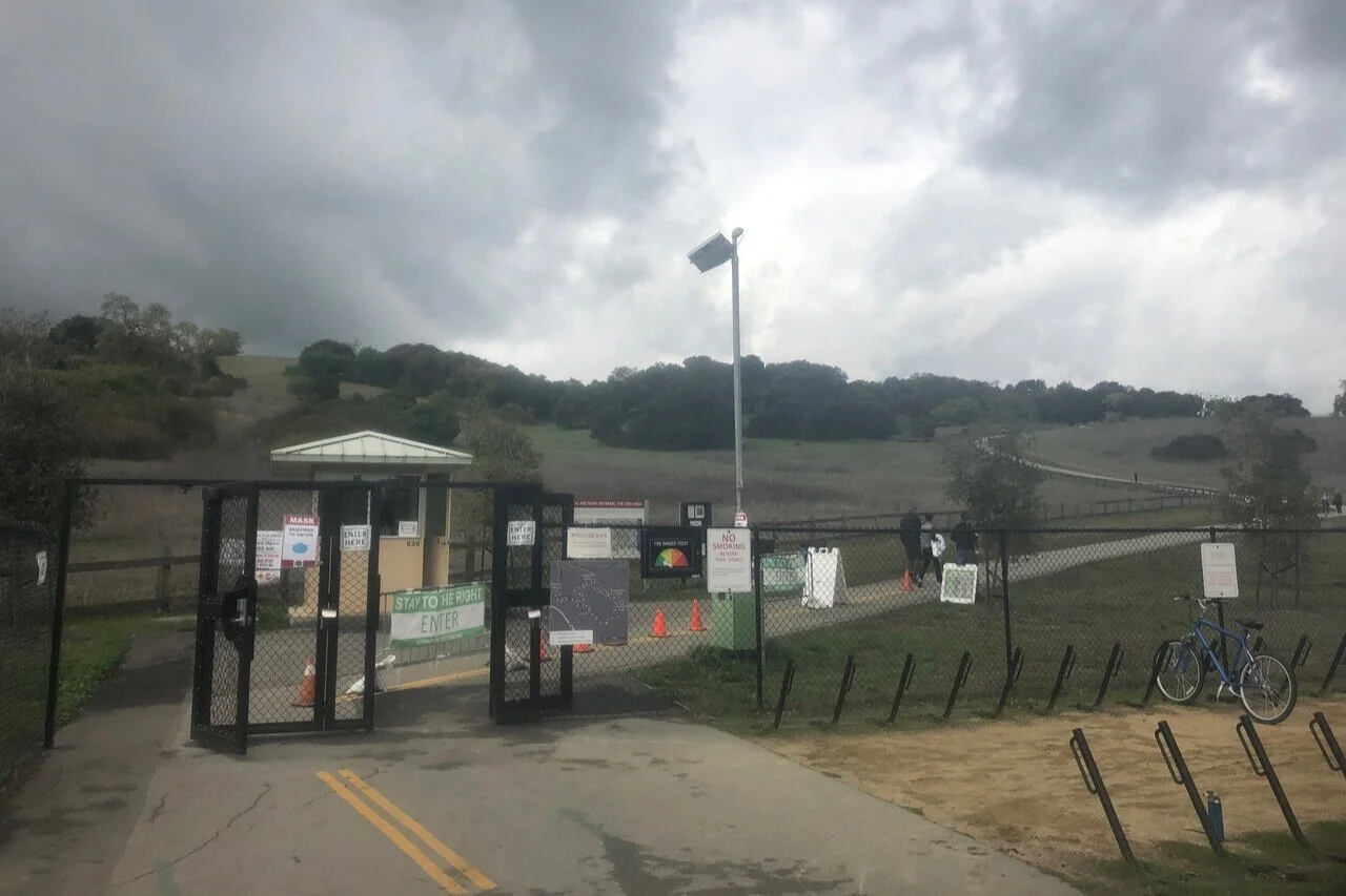
The Stanford Avenue gate.
After you enter through the Stanford Avenue gate (see interactive map below), you begin a short climb, which leads you to a junction with the main loop trail. The elevation you gain immediately brings you views of the Stanford University campus to the north. Scan the suburban treetops for raptors such as Red-tailed Hawk, Red-shouldered Hawk, and White-tailed Kite, and the occasional Steller’s Jay. Also watch for Band-tailed Pigeons flying overhead here and elsewhere along the loop. At closer range, look and listen for Song Sparrows in the tall grass along either side of the trail. This short leg of trail between the Stanford Avenue gate and the junction with the loop trail seems to be the Song Sparrow stronghold in the Stanford Dish area.

White-tailed Kite by Peter Hart
When you reach the trail junction at the top of the hill, take a right in order to follow the loop counterclockwise. This route takes you along the lower part of the loop first, with hilly oak woodland on your left and backyards on your right. Acorn Woodpecker and California Scrub-Jay are conspicuous as they fly among the oak trees, while wintering flocks of White-crowned and Golden-crowned Sparrows forage along the edges of the trail. This part of the loop is also a good place to look and listen for backyard birds such as Dark-eyed Junco, Spotted Towhee, California Towhee, American Robin, Cedar Waxwing, and Pine Siskin. These species tend to be less prevalent along the upper part of the loop, where the habitat is more open.
As you follow the trail over a series of rolling hills, the backyards on your right give way to shrubbier habitat. Look for Anna’s Hummingbirds perched on top of the shrubs, and keep an eye and ear open for California Thrasher and Ash-throated Flycatcher. Keep scanning the skies for raptors, including those already mentioned as well as Turkey Vulture, Cooper’s Hawk, and the occasional Bald Eagle or Golden Eagle. If you want to add a Peregrine Falcon to your list, check through your binoculars for the nesting pair on Stanford’s Hoover Tower. Though it is about a mile away, you still may be able to pick out one or both of the falcons. They usually perch on the ledges just below the red dome.

The trail traverses rolling hills between the Stanford Avenue and Gerona gates.
After walking about 1.1 miles, and descending the last of the rolling hills, you reach a trail junction at the northernmost point of the loop, where a short spur trail (leading from the Gerona gate) enters on the right. Turn left to continue counterclockwise on the loop. You now begin climbing more steadily. Denser oaks on the right side of the trail harbor Chestnut-backed Chickadee and Bushtit, while the shrubby habitat on the left side of the trail is particularly good for Ash-throated Flycatcher, which arrives in late April.

American Kestrel by Peter Hart
As you continue climbing, you will start to see various power lines and antennas, which you should scan for raptors, Western Bluebirds, European Starlings, and swallows. Near the top of the climb, enjoy the vista northward, stretching to San Francisco, Oakland, and beyond on a clear day. This segment of trail is a good place to look for Wild Turkeys, as well as deer. And of course, look and listen for migrant songbirds! As I write this in March, I look forward to the many more voices that will be joining the chorus in the coming weeks. Migrants to look and listen for include Blue-gray Gnatcatcher, House Wren, Orange-crowned Warbler, and Lazuli Bunting. House Wrens are particularly abundant, so make sure to listen for their bubbling song. Plenty of year-round residents, such as Oak Titmouse and Bewick’s Wren, should be sounding off, too. Finally, always be alert for a rarity! An Indigo Bunting was found here in June 2019.

House Wren by Luis Villablanca
When you reach the Stanford Dish itself, a spur trail comes in on the right. This spur trail leads past the dish, continues downhill through pastureland, and eventually reaches the Piers gate, near San Francisquito Creek and Alpine Road. If you have some extra time and energy, you can extend your trip by following this spur trail. Around the dish, look for Say’s Phoebe, which has summered and probably nested here in recent years. A few other birds to look for along this spur trail are described in the “Ready for More?” section. Once you are content with the spur trail, retrace your steps to rejoin the main loop.

A spur trail leads past the dish and down to the Piers gate.

A variety of antennas offer perches for raptors such as White-tailed Kites and American Kestrels. In the background, the East Bay hills are seen across San Francisco Bay.
Just southeast of the dish, you will pass a stand of taller trees favored by Bullock’s Orioles, and a small pocket of forest where Great Horned Owls are occasionally heard hooting. Soon, though, the habitat on your right opens up into pastureland, crisscrossed by fences and dotted with antennas and electrical poles. White-tailed Kites and American Kestrels are particularly fond of the wires and antennas in this grassland area, and I usually see several of each species per visit. Western Meadowlarks sing from the pastures, while Western Kingbirds perch on the fences and wires. Western Bluebirds are omnipresent here and elsewhere along this loop, with total counts of 20+ individuals being a regular occurrence. The grassy habitat along the southeastern extent of the loop is also the place to listen for the weak, insect-like song of the Grasshopper Sparrow. This inconspicuous grassland dweller has been found here regularly in recent years.

Grasshopper Sparrow by Luis Villablanca
As you close in on the end of the grasslands, near the easternmost extent of the loop, take one last look around at the sweeping views of the surrounding area. To the south, views extend past Los Altos Hills to the Santa Cruz Mountains, while the skyline of San Jose is visible to the east, in the shadow of Mount Hamilton. I particularly enjoy looking northeast over the web of salt ponds and adjacent bayside areas. If you look closely, you can even spot the breeding colony of California Gulls in the Palo Alto Flood Control Basin, usually with a few American White Pelicans visible as larger white spots nearby!
When you are satisfied with the views, continue following the loop trail, which descends through a small patch of forest, then leads back to your starting point at the Stanford Avenue gate. Scan the treetops again for any raptors you missed, take another look at Hoover Tower, exit through the gate, and then start planning your next visit!

The trail descends back toward the Stanford Avenue gate, with the Stanford campus as a backdrop.
Ready for more?
To extend this trip, follow the spur trail that leads past the dish and down to the Piers gate. There is pasture on both sides of the trail, which provides excellent opportunities for seeing grassland birds. Lark Sparrows winter here each year, and may linger into April. Other species to watch for include American Pipit, Savannah Sparrow, and Western Meadowlark. After 0.7 miles, the spur trail crosses a cattle guard and enters an area with more trees, including tall eucalyptuses. (This is an excellent place to see Acorn Woodpeckers at close range, including several spectacular granary trees, where the woodpeckers have drilled enormous numbers of holes and stuffed them full of acorns.) The trail reaches the Piers Gate and Los Trancos Creek after about 1 mile, then crosses the San Mateo County line at San Francisquito Creek, ending up at the intersection of Piers Lane and Alpine Road.
Additional hiking is available at nearby Pearson-Arastradero Preserve. Several areas on the main Stanford University campus are also worth a visit, including the Stanford’s Arizona Garden and Mausoleum, arboretum, the main quad, and Lake Lagunita.
Interactive Map
Route Summary: Enter at the Stanford Avenue gate and follow the loop counterclockwise. When you reach the large dish antenna, you have the option to continue down a spur trail toward Piers Lane, then retrace your steps back to the main loop trail. Continue along the loop trail until you return to the Stanford Avenue gate.
Parking
A paved parking area for angled, back-in parking, including 2 ADA-accessible parking spots, is available along Stanford Avenue, just northeast of the intersection with Junípero Serra Boulevard Latitude/Longitude: 37.41070, -122.16050. Additional parallel parking is available farther northeast along Stanford Avenue.
For the Piers Lane spur trail, a smooth dirt parking area (with no designated ADA-accessible parking spots) is available at the intersection of Piers Lane and Alpine Road, near the boundary of Menlo Park. Latitude/Longitude: 37.41404, -122.19297
Extra parking for the Stanford Avenue gate is available on Coyote Hill Road, which is approximately 0.8 miles away, walkable via a paved trail paralleling Page Mill Road and Junípero Serra Boulevard. Latitude/Longitude: 37.40269, -122.15525
Fees: None
Public Transportation: The X and Y lines of Stanford Transportation’s Marguerite Shuttle system stop at the intersection of Campus Drive and Mayfield Avenue, which is a half-mile walk from the Gerona gate and a 1.1-mile walk from the Stanford Avenue gate. The Marguerite Shuttle system connects to VTA and Caltrain service at the Palo Alto Transit Center.
Hours: March entry hours are 6:30 AM - 6:30 PM (must exit by 7 PM). April-August entry hours are 6:00 AM - 7:30 PM (must exit by 8 PM). fall and winter access hours
Facilities: No bathrooms. There is a water fountain along the trail, about halfway between the Frenchman’s gate and the Gerona gate, may be out of service during the pandemic. There are no benches.
Trip Mileage: 3.6 miles to complete the main loop. Following the Piers Lane spur trail adds 1.2 miles each way.
Trail Conditions: Wide, paved trail. Full sun exposure. Total elevation gain for the main loop is approximately 500 feet. Piers Lane spur trail adds 300 feet of elevation gain.
Accessibility: Wide, smooth, paved trail throughout, but with several steep grades.
Bikes: Not allowed on the trails. There are bike racks at the Stanford Avenue gate.
Dogs: Not allowed
More Information:
Stanford Dish Area Hours and general information
Stanford Dish Area Trail map
Stanford University visitor information
eBird hotspot: Stanford Dish Trail
More Resources
For more trips like this one, visit Self-Guided Field Trips.
Visit the SCVAS Birding Resources page for more information on where to bird, our birding community, bird identification resources and more.
Read “What to Look for Now” by SCVAS Executive Director Matthew Dodder.
Banner Photo Credit: Ash-throated Flycatcher by Luis Villablanca
Last Updated: 5/23/2022
Enjoyed this Trip?
Support the work of Santa Clara Valley Audubon Society and become a member. To contact the trip writer with comments, questions or location updates, please email fieldtrips@scvas.org. You can also post in the comment section below. (If you’d like to post anonymously, type your comment, select “Post Comment”, then simply provide a name, like “Guest”, and select “Comment as Guest”.)