Panoche Valley (Winter):
A Desolate Paradise
by Matthew Dodder
There’s no winter birding experience quite like Panoche Valley. After 21 years of leading trips to it—from both the Hollister and Central Valley sides—I can say this all-day excursion is truly worth the effort of getting there. It is nearly guaranteed to provide the brave-hearted with world-class views of Ferruginous Hawk, Greater Roadrunner, Prairie Falcon, Mountain Bluebird as well as a host of less common specialties such as Sage Thrasher, Vesper Sparrow, Bell’s Sparrow. On the very best days, although less and less frequent, one might even find Mountain Plover! The tour however, is long and lonely. One must leave the San Jose area by 6:00 AM in order to arrive at the tour’s beginning by 8:00 AM and plan on a long day with few restroom facilities and even fewer opportunities to purchase food. It is a remote, desolate and mostly uninhabited landscape cut by a narrow, barely-paved Dutch-crunchy road that bisects enormous swaths of dry rolling ranch lands and deserted flat earth. It’s a magical, barren place!
It’s important to remember this area is also HUGE—spanning both Fresno and San Benito Counties. Directing birders to hyper-specific locations is usually unhelpful. To do so forgets the reality that birds move within this enormous theater making every fence, power tower, and isolated tree a potential stage for their performance. The unfortunate fact remains that one often sees birds only at a great distance (a spotting scope is helpful)… but what fantastic birds they are! Learn the habitat preferences of the birds you seek before you go, and this report will direct you to some areas where that landscape can be found.
Trip Covers: December - January
Key Birds: Greater Roadrunner, Ferruginous Hawk, Burrowing Owl, Long-eared Owl, Merlin, Prairie Falcon, Loggerhead Shrike, Horned Lark, Rock Wren, Sage Thrasher, Mountain Bluebird, Bell’s Sparrow, Vesper Sparrow, Tricolored Blackbird
How to Bird
One can approach this area from either Hollister or Highway 5. This account will begin at the intersection of Highway 5 and Little Panoche Road in Fresno County (Trip Start: 36.77779, -120.72736). Make sure you have a full tank before arriving at the trail’s start. There are very few places to hike on this all-day tour, so most birding is done by pulling off the road and scanning from beside your car. Remember there will be the occasional non-birder’s car wanting to pass you so keep an eye on your rear view mirror when slowing down or stopping. Bring enough food and water to last. If you begin early in the day and leave the valley by early afternoon, you should be home before dinner. There is little or no cell coverage on this trail, so I recommend printing out this summary to assist you during your visit.

Prairie Falcon on the the valley floor. Photo by Matthew Dodder.
Route Overview: From exit 379 on I-5, travel southwest along Little Panoche Rd for 20 miles stopping at various pullouts and points of interest. At the end of Little Panoche Rd, make a left onto Panoche Road to explore the ranches, fields and open areas on Recalde and New Idria Roads. Backtrack to the intersection of Panoche Rd and Little Panoche Rd, then start your way home by continuing northwest on Panoche Rd to the town of Paicines located Hwy 25. Refer to the interactive map towards the bottom of this guide for suggested birding stops.
A Note about Water and the Weather: Keep in mind that life along this trail is closely related to the presence of water. Dry years obviously produce very different birding results than wet years. Some birds will be easier to find in one or the other condition… Either way, there will be birds, but not always the ones you’re hoping to see. During the tour, you will be passing through wide open, exposed areas where it can be very cold or windy during winter months. It can also be surprisingly warm if the sun is out. Be prepared for both. If it is wet or muddy, be aware some back roads are best avoided, and never cross a running creek unless you have a 4WD vehicle.
Little Panoche Reservoir
Stop 1: Little Panoche Rd, gravel parking lot, pit toilet (36.78486, -120.79842)
At about 4 miles from the start of the trail, you will reach the first “real” birding stop (Stop 1: 36.78486, -120.79842). A wide gravel parking lot puts you atop the dam with beautiful views of the area. I recommend using a spotting scope to scan the water below you. This is likely the only area you will encounter today that has significant water so various Ducks, Grebes, Herons, Egrets and Shorebirds (even Wilson’s Snipe) may be added to your day’s arid lands list. The real indications of the habitat you will drive through next will be Say’s Phoebe, Rock Wren, and Loggerhead Shrike—they hint at the barren earth and rock that is ahead. On very lucky days one may find Greater Roadrunner here as well. Carefully scan the earth below the dam, and the scrubland beside the reservoir… If that does not produce a Roadrunner, don’t lose hope. There are many other opportunities today!

Little Panoche Reservoir. The walkable dam is out-of-frame on the left. Photo by Matthew Dodder.

Greater Roadrunner by Brooke Miller
The Sparrow Crawl
Stop 2: Little Panoche Rd, pullout, no facilities (36.77712, -120.83541)
Five thousand yards of dry, scrubby terrain will pass your car window as you drive to the next stop. You will notice the hundreds of scattering “little brown jobs”, and you may begin to wonder where you should stop to get a better look—how you’re going to know what you’ve been missing… My advice is to slow to a crawl and view the hordes of Sparrows through your window. If you open your door, they’ll all scatter. But if you must exit your vehicle, do it slowly and watch for cars passing quickly. The birds will likely be a mix of the following species: White-crowned Sparrow, Savannah Sparrow, Lark Sparrow and the occasional Vesper Sparrow. One particularly good spot to watch for these birds is at about two miles after the reservoir (Stop 2: 36.77712, -120.83541)
One of many areas to search for Sparrows. Photo by Matthew Dodder.
Rare Riparian Zone
Stop 3: Little Panoche Rd, pullout, no facilities (36.75551, -120.85745)
About 2 miles later, you will pass close to a section of Little Panoche Creek (Stop 3: 36.75551, -120.85745). The presence of water will be obvious when you see the green foliage and muddy banks hosting reeds and other riparian plants. It’s best to stop here and explore for a few minutes. You may detect Common Yellowthroat, Marsh Wren, or Song Sparrow—all water-loving species. Oddly, the hill across the road is good for Rock Wren and Greater Roadrunner… On a recent visit, we had a Ferruginous Hawk being harassed by a Prairie Falcon in the sky overhead here.

Little Panoche Creek comes close to the road in some places. Photo by Matthew Dodder.
Cottonwoods and Barns
Stops 4 and 5: Little Panoche Rd, pullouts, no facilities 36.74747, -120.86297 and 36.74138, -120.87018)
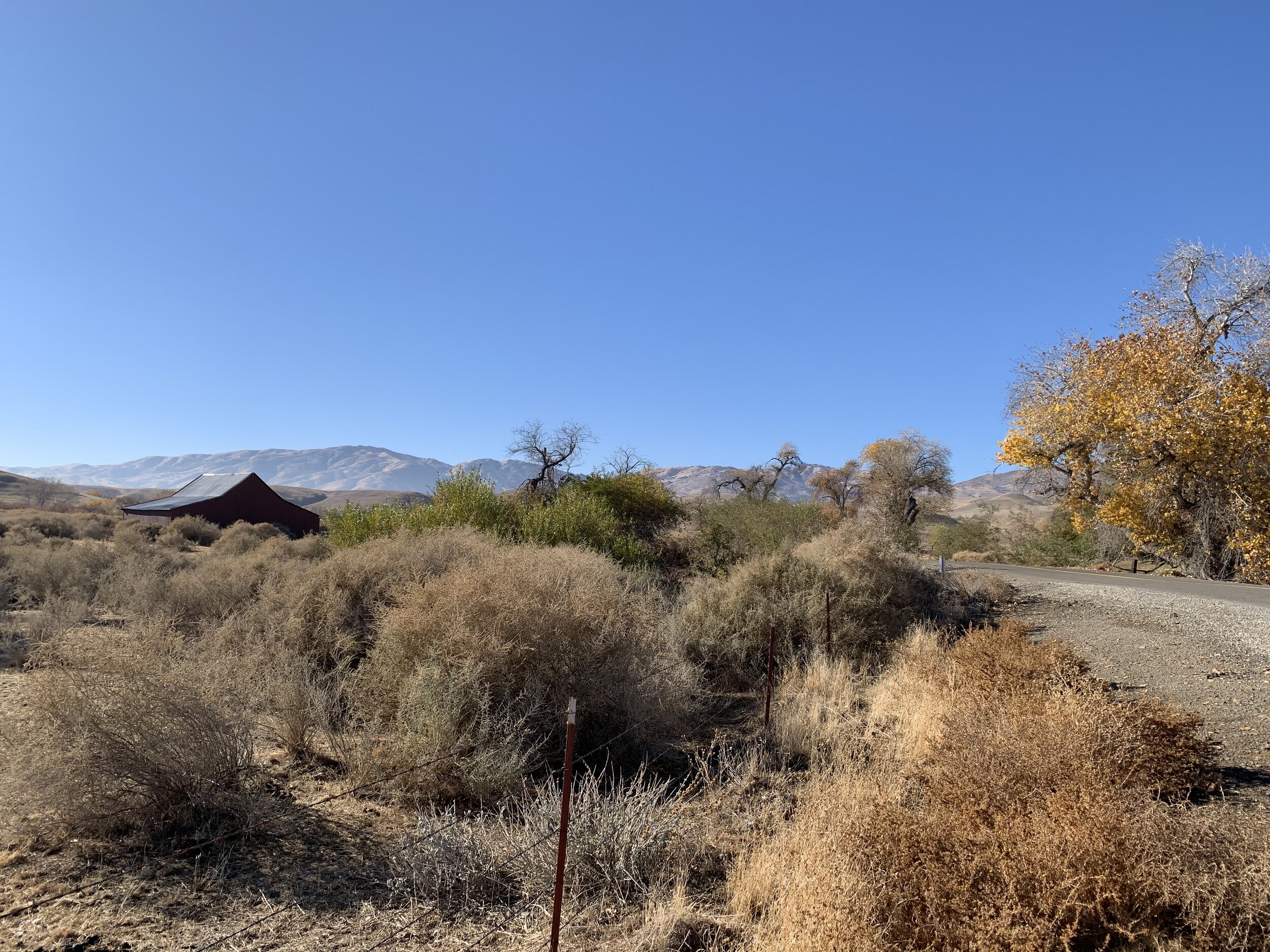
Up the road two miles further, you will reach a small barn behind a barbed wire fence (Stop 4: 36.74747, -120.86297). A stroll along the road will put you among the trees and beside dense scrub where California Quail and California Thrasher are usually found, as well as all the Sparrows previously mentioned. It’s worth searching the trees for sleeping Barn or Great Horned Owl. The flat area near the second larger barn (Stop 5: 36.74138, -120.87018) is worth scanning thoroughly for Horned Lark, Vesper Sparrow and Greater Roadrunner.

The smaller red barn. Photo by Matthew Dodder.

Cottonwoods. Photo by Matthew Dodder.
Dry Washes
Stop 6: Little Panoche Rd, pullout, no facilities (36.73069, -120.8708)
Half a mile after the large barn, you will pass over the creek. On your right (west) there is a deeply eroded section with hundreds of ground squirrel burrows and Owl-friendly caves at or below eye level (Stop 6: 36.73069, -120.8708) With some patience you will see Antelope Squirrel and Rock Wren. If luck is with you, you may also see Burrowing Owl, and yes Greater Roadrunner again!

Watch for Rock Wren, Burrowing Owl and Antelope Ground Squirrel here. Photo by Matthew Dodder.
Panoche Hills (BLM)—the wild wild lands
Stop 7: Bureau of Land Management area off of Little Panoche Rd, vault toilet and picnic table (36.70909, -120.81173)
About 1.5 miles after the eroded creek and Burrowing Owl habitat you will see a gate and kiosk marking the entrance to the BLM road leading into oblivion. Head up this road about 4 miles to the new overlook. Anywhere along this road, especially in the flatter sections watch for Horned Lark and brilliant, sky-blue Mountain Bluebirds. It’s fun to remember that that extraordinary blue is not due to pigment of any kind, but rather tiny particles that disrupt the sun’s light and create blue, much like the way Rayleigh scattering in our atmosphere makes the sky blue. So in a very real sense, when you see those marvelous Mountain Bluebirds, you are essentially seeing a part of the sky at ground level.
Much of the area has been grazed heavily so the shrubs that Sage Thrasher and Bell’s Sparrow prefer are mostly gone at the lower elevations. Still it’s worth keeping an eye for those species all the way to the top. A restroom and fenced parking area at the top provides views of the valley below and a great place for a picnic lunch (Stop 7: 36.70909, -120.81173). The plateau is sprinkled with Mormon Tea, the dominant shrub and a nice stand-in for silver sage, which both Bell’s Sparrow, the Bell’s subspecies A.b.canascens, and Sage Thrasher like. The Thrasher is just a wintering species, the Bell’s Sparrow is resident. There are usually target shooters beyond the overlook so exploring the area beyond the gate is frightening, but generally safe. Some reports of the very rare Sagebrush Sparrow are from the area beyond the overview.

Mountain Bluebird by Brooke Miller
Typical Mountain Bluebird habitat. Look for bits of the sky hovering over the dirt. Photo by Matthew Dodder. Photo by Matthew Dodder.

View from the top of the BLM road. Photo by Matthew Dodder.

The perfect lunch stop if it’s not windy, cold, rainy, or deafening with gunfire… Photo by Matthew Dodder.

Sage Thrasher by Tom Grey
Mercey Hot Springs
Stop 8: Little Panoche Rd, commercial campground, $ for bathrooms and picnic tables (36.70531, -120.86059)
Return to Little Panoche Road after exploring the BLM Road. Continue half a mile up the road and you will see the entrance to Mercey Hot Springs on your right (Stop 8: 36.70531, -120.86059). As you might imagine, in a treeless landscape, this grove attracts a lot of birds seeking shelter. For many years, the desert resort here was the go-to spot for wintering Long-eared Owls that forage on the abundant rodents in the fields. The birds enjoy the dense cover of the tamarisk trees during the day and can occasionally be seen in astonishing numbers. Years ago, my class counted 45 Long-eared Owls in the campground as well as 3 Barn Owls. Birding this area involves checking in with the office, signing a waiver and paying a fee. I eventually stopped taking my group there because the fee became prohibitive. In addition, recent reports indicate only a couple of the Long-ears still utilize this area during the winter months.
Corral
Stop 9: Little Panoche Rd, pullout, no facilities (36.68025, -120.85591)
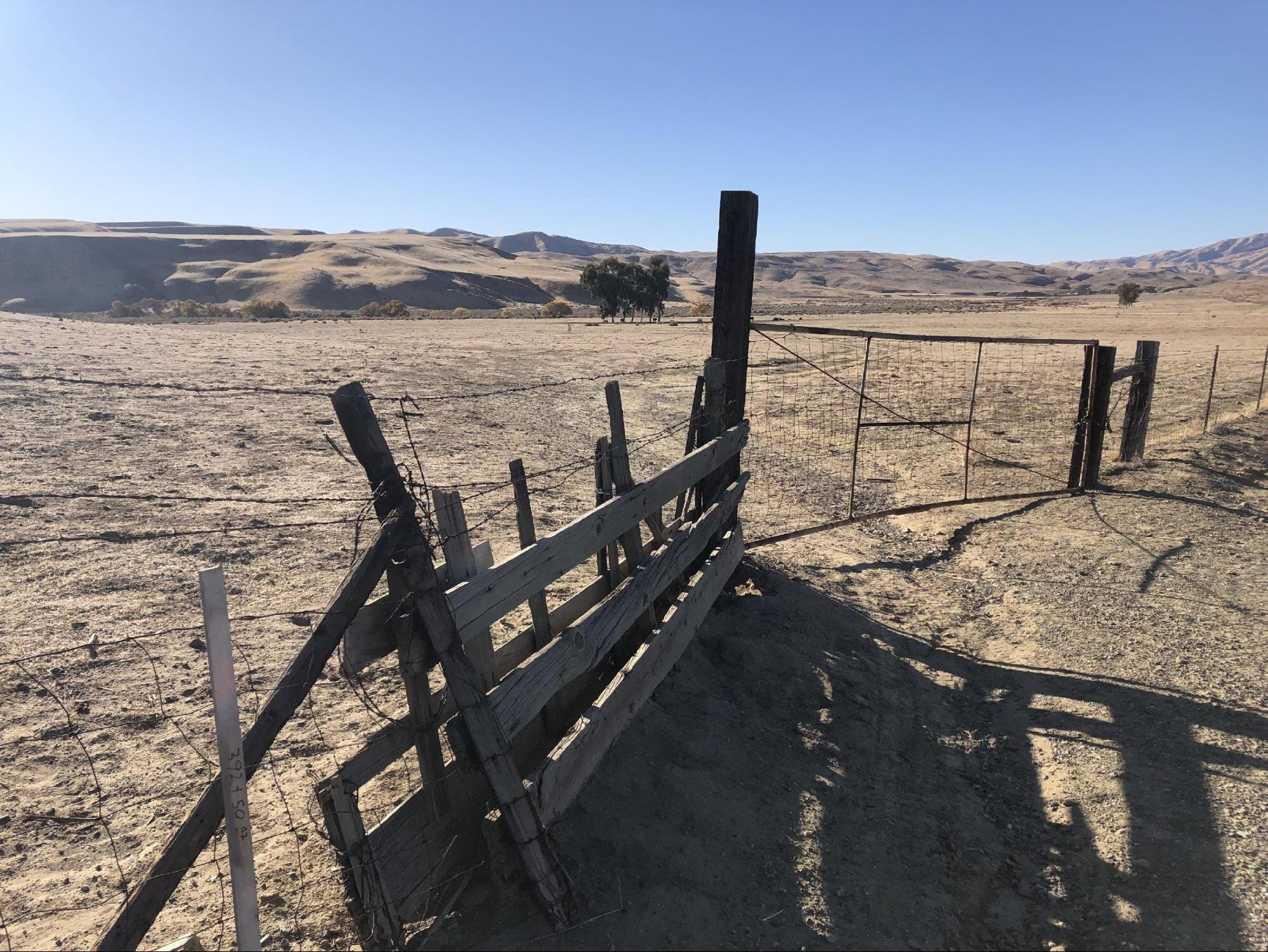
Less than 2 miles after Mercey Hot Springs you will cross into San Benito County and see an old corral (Stop 9: 36.68025, -120.85591). The water tanks and trough provide perches for Raptors, while the ranch land attracts American Pipit, Horned Lark and potentially Burrowing Owl. Scan any burrows you see along the hillside, and as everywhere on this trail, watch for Greater Roadrunner.

The old corral less than 2 miles after Mercy Hot Springs. Photo by Matthew Dodder.

No Burrowing Owl on this visit, but Cricket sees a Barn Owl sleeping in a cave. Photo by Matthew Dodder.
Shotgun Pass
Stop 10: Little Panoche Rd, large gravel pullout, no facilities (36.66425, -120.87291)
About a mile and a half up a windy road to the top, you will reach a steep downward section. For many years, birders have enjoyed Shotgun Pass, this narrow cut between the rocky hills that descends into Panoche Valley. The target species here has always been Chukar, a reclusive Old World ground bird that was introduced in California for game hunters. I have seen them at Shotgun Pass a total of three times with my class. Three times out of 21 years… That’s not a great record. I’d go so far as to say, don’t count on it. Anyway, there are Rock Wren and Greater Roadrunner here, but I suggest parking at the bottom in a large gravel turn out (Stop 10: 36.66425, -120.87291) and walking quietly up the road, always watching for traffic. Don’t park or stop on the road as non-birder vehicles seem to show up whenever you stop. Be sure to enjoy the view from the road as you drop into the valley. It is stunning, although less so now because of the enormous solar panel array.

Shotgun Pass is not a good place to stop your vehicle. Park at the bottom. Photo by Matthew Dodder.

The hillside on Shotgun Pass where the Chukar lives… supposedly. Photo by Matthew Dodder.
Panoche Valley Proper
The long, 4-mile straight away running north-south ahead of you leads to the junction with Panoche Road. To this point, you have been traveling on Little Panoche Road. At any point in the huge earth pan beside you, now violated by a massive solar array, could produce something good anywhere along its length. Watch particularly for Horned Lark, Mountain Bluebird, Golden Eagle, Bald Eagle, Ferruginous Hawk, Prairie Falcon, and Lark Sparrow. Usually there is little enough traffic, allowing you to pull off and look around.

Panoche Valley lies just ahead. Photo by Matthew Dodder.
East Panoche Road
Stop 11: Panoche Elementary School, pullout, no facilities (36.60615, -120.85892)
From Little Panoche Road, turn left (east) onto Panoche Road. Watch every phone pole and fence post for any Raptors—Ferruginous Hawk or Prairie Falcon are found, as well as Golden Eagle, American Kestrel, Merlin and of course, Red-tailed Hawk are all found here regularly. In a mile you will come to the small Panoche Elementary School (Stop 11: 36.60615, -120.85892) where you can park and scan the adjacent fields. To the north and east it is possible to find Mountain Plovers. They are more difficult to find now as their numbers have dropped alarmingly in recent years. In good years you may find them running and stopping around the innumerable cow plops and ground squirrels. Patience is required and a spotting scope is useful.

Ferruginous Hawk by Chuq Von Rospach

Panoche Elementary School, a good place to stop and scan the fields. Photo by Matthew Dodder.

The corner of Norton Rd. and Panoche Rd. offers good opportunities to find the nearly mythic Mountain Plover. Photo by Matthew Dodder.

Mountain Plover by Brooke Miller

Recalde Road, where any bush or barbed wire might contain a Vesper Sparrow. Photo by Matthew Dodder.

Vesper Sparrow by Brooke Miller
Recalde Rd
Stop 12: Recalde Rd, pullovers, no facilities (36.602467, -120.837010)
Continue east about a mile on the Panoche Road and straight through onto Recalde Road. In the fields and scrub beside the road, we have often found Vesper Sparrow (Stop 12: 36.602467, -120.837010). But again, there is so much habitat favored by this species in this large area, it might show up in many places. If the area is entirely dry (with no hint of moisture) it is safe to cross the creek ahead of you. The road will pass through additional Mountain Bluebird and Mountain Plover habitat and eventually rejoin Panoche Road at Douglas Ranch (Stop 13: 36.59595, -120.81768) in about a mile. If there is ANY water in the creek, turn around and return to Panoche Road before continuing your adventure.
The Ranches
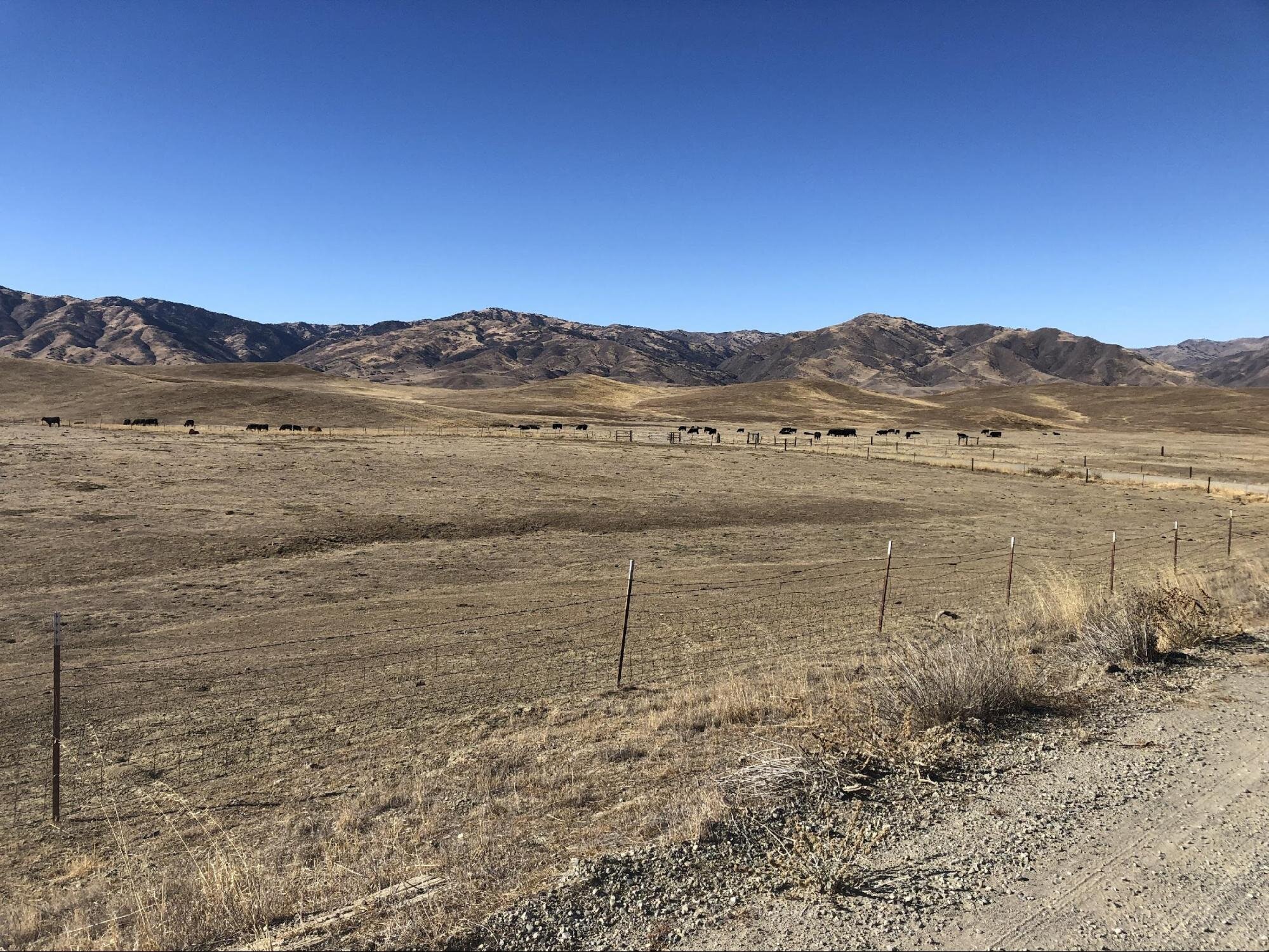
Stops 13 and 14: Panoche Road, pullovers, no facilities
However you get here, Douglas Ranch (Stop 13: 36.59595, -120.81768), as well as the nearby Claravale Farm (Stop 14: 36.59644, -120.83411), are good places to look for Tricolored Blackbirds. Both properties are on Panoche Road and birded from your car window. This area has also produced Cassin’s Kingbird occasionally and Mountain Bluebird on many of our trips.

Claravale Farm may attract hundreds of Tricolored Blackbirds. Photo by Matthew Dodder.

Tricolored Blackbirds by Tom Grey

Just another day at the Ranch. Photo by Matthew Dodder.

Merlin by Tom Grey
Silver Creek
Stop 15: Panoche Road, pullout, no facilities (36.59492, -120.75802)
If you continue east about 3 1/5 miles on Panoche Road beyond Douglas Ranch you will reach Silver Creek (Stop 15: 36.59492, -120.75802). The creek must not be crossed unless you have a 4WD vehicle and the water level is low. But even without crossing into these hinterlands it can be a productive section to explore. If you haven’t found Vesper Sparrow yet, you may find it here in the scrubby edges. Prairie Falcon and Ferruginous Hawk are frequent here and Mountain Plovers are occasionally found on the Silver Creek Ranch property on the north side.
New Idria Road
Stop 16: Griswold Hill Recreation Area off of New Idria Rd, parking area, pit toilet and picnic table (36.56237, -120.83499)
Backtrack to the “Y” intersection with New Idria Road (36.59488, -120.8279). Turning south on New Idria leads you beside the dry Griswold Creek and through prime Prairie Falcon and Ferruginous Hawk terrain. A restroom awaits you at the Griswold Hills Recreation Area parking lot (Stop 16: 36.56237, -120.83499). Rock Wren will likely be present and across the road on the hillside you may find Greater Roadrunner. There are often target shooters in this area, but they are mostly harmless.
A note about your drive home through Hollister
We usually head home after stopping at Griswold but also make a few quick stops along the way for Rufous-crowned Sparrow, Canyon Wren, Phainopepla and Lewis’s Woodpecker. As you can imagine though, the trail between Panoche Valley and Hollister deserves a chapter all its own. It is dominated by a rich oak savanna habitat and offers chances to see a very different set of birds. The stretch from I-5 to Panoche Valley is primarily ranch lands and rocky hills and, for me at least, it is where a most exceptional winter birding experience is found.
Interactive Map
Summary of GPS coordinates
Trip Start: Exit 379 on I-5 (36.77779, -120.72736)
Stop 1: Little Panoche Reservoir (36.78486, -120.798420)
Stop 2: Sparrow Crawl (36.77712, -120.83541)
Stop 3: Little Panoche Creek (36.75551, -120.85745)
Stop 4: Cottonwoods and Small Barn (36.74747, -120.86297)
Stop 5: Cottonwoods and Large Barn (36.74138, -120.87018)
Stop 6: Dry Washes (36.73069, -120.8708)
Stop 7: Panoche Hills BLM Restroom and Picnic Spot (36.70909, -120.81173)
Stop 8: Mercy Hot Springs (36.70531, -120.86059)
Stop 9: Old Corral (36.68025, -120.85591)
Stop 10: Panoche Valley Pullout (36.66425, -120.87291)
Stop 11: Panoche Elementary School (36.60615, -120.85892)
Stop 12: Recalde Road (36.602467, -120.837010)
Stop 13: Douglas Ranch (36.59595, -120.81768)
Stop 14: Claravale Farm (36.59644, -120.83411)
Stop 15: Silver Creek (36.59492, -120.75802)
“Y” intersection with New Idria Road (36.59488, -120.8279)
Stop 16: Griswold Hills Recreation Area parking lot (36.56237, -120.83499)
Parking Fees: None
Park Hours: None
Facilities: Porta-potty at Panoche Reservoir, pit toilets and picnic tables at Panoche Hills BLM summit lot and at Griswold Hills lot. Bring your own toilet paper just in case. No cell phone service.
Heads-up! The area has limited to no cell phone service. To print or download this guide before you go, select the text you want (don’t include the banner photo), then print to PDF, or use a free service such as printfriendly.com, which lets you shrink or remove photos.
Trip Mileage: 200 miles round-trip from the our home in Mountain View
Trail Conditions: Rough pavement and unpaved gravel; mostly exposed terrain
Accessibility: Not suitable for wheelchairs
More Information: links to trail maps, park websites, ebird hotspot, All About Birds for special birds, etc. Examples:
More Resources
For more trips like this one, visit Self-Guided Field Trips.
Visit the SCVAS Birding Resources page for more information on where to bird, our birding community, bird identification resources and more.
Read “What to Look for Now” by SCVAS Executive Director Matthew Dodder.
Banner Photo Credit: Panoche Valley by Matthew Dodder
Last Updated: 04/19/2022
Enjoyed this Trip?
Support the work of Santa Clara Valley Audubon Society and become a member. To contact the trip writer with comments, questions or location updates, please email fieldtrips@scvas.org. You can also post in the comment section below. (If you’d like to post anonymously, type your comment, select “Post Comment”, then simply provide a name, like “Guest”, and select “Comment as Guest”.)