
Sanborn County Park (Spring):
John Nicholas Trail
by Luis Villablanca
The John Nicholas Trail in the hills of Los Gatos is a fairly flat, wide trail belonging to Upper Sanborn County Park. It is surrounded by native forest, including oak, redwood, fir and pine which provide a nice cover to be enjoyed year-round. This is one of the best places in Santa Clara County for a chance at seeing Pileated Woodpecker or Pacific Wren. In the spring, it’s a great place to find mountain birds returning from the tropics to nest in the area.
Key Birds: Band-tailed Pigeon, Pileated Woodpecker, Cassin’s Vireo, Pacific Wren
Trip covers: April - June
How to Bird
The trail has several access points, but for this guide we will start from the Black Rd trailhead. The trail is very popular among mountain bikes, so it is recommendable to arrive very early in the morning to be able to find a parking spot.
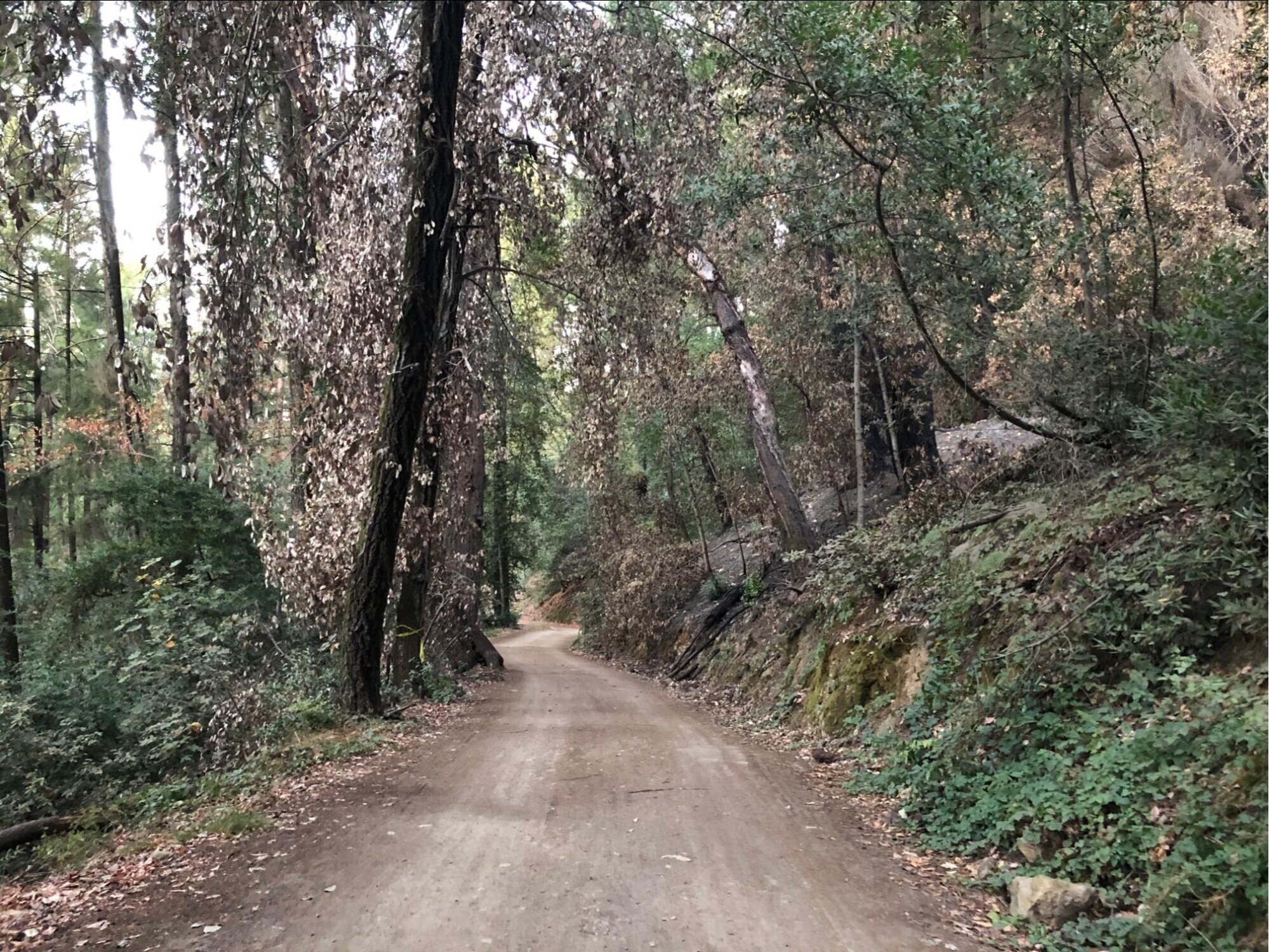
John Nicholas Trail. Photo by Luis Villablanca
Walk the trail for approximately 1.8 miles to Lake Ranch Reservoir. Along the way, pay attention to the birds calling in the forest. I am often not able to see many of them, but I can recognize their calls or songs, so I know they are there. Besides ubiquitous birds like Dark-eyed Junco, Chestnut-backed Chickadee and Steller’s Jay, other resident birds may include Brown Creeper, Hairy Woodpecker and Acorn Woodpecker.
Just as you start the hike, you may find some of the spring residents, like Cassin’s Vireo, Hutton’s Vireo and Pacific-slope Flycatcher. Once on the trail, you can also listen for Warbling Vireo, Orange-crowned Warbler, Wilson’s Warbler, Western Tanager and Black-headed Grosbeak.

Cassin’s Vireo. Photo by Luis Villablanca
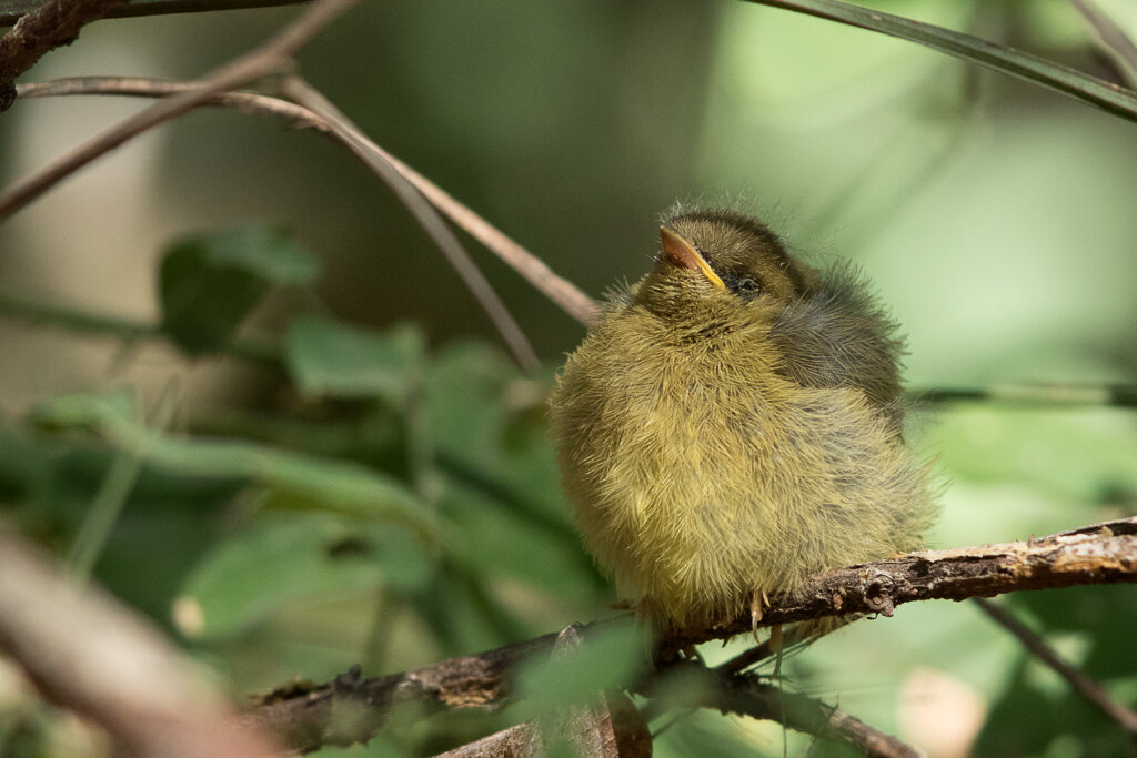
Wilson’s Warbler fledgling, John Nicholas Trail. Photo by Luis Villablanca

Western Tanager, John Nicholas Trail. Photo by Luis Villablanca
This trail may also offer views of some birds which are harder to find in the county, like Pacific Wren, Band-tailed Pigeon and Pileated Woodpecker. At some of the switchbacks there are water streams which may or not carry water into the ravine below. Around these areas pay attention to the distinctive call or the jumbled song of the Pacific Wren, which can sometimes be seen moving on the floor of the forest. This is a tiny brown bird which likes shady spots, so it can be hard to spot.

Pacific Wren, John Nicholas Trail. Photo by Luis Villablanca
If you hear a hooting call, similar to a great horned owl, it is most likely a Band-tailed Pigeon resting on a branch. They are very skittish and usually fly away when spotted. Another bird which can often be heard but rarely seen along the trail is the Pileated Woodpecker. Listen for their wuk-wuk calls given in flight. It is often hard to see them, but sometimes they will do a flyover further down by the reservoir.

Pileated Woodpecker, Lake Ranch Reservoir. Photo by Luis Villablanca
When you reach Lake Ranch Reservoir, you can choose to continue on the trail or to walk along the trail that hikers have made below near the water and do the other side on the way back. Both sides provide different habitat for birds, so you will probably find more species if you cover both. The bottom side is closer to the water, which will give you a better view of water birds, including American Coot, Mallard, Great Blue Heron, and Pied-billed Grebe.

Lake Ranch Reservoir. Photo by Luis Villablanca
On the shore you can find birds foraging around the reeds, including Bushtit, Song Sparrow, Lesser Goldfinch and Dark-eyed Junco. Around the upper trail you may be able find Spotted Towhee, California Scrub-Jay, California Towhee, and other species. Also, across the reservoir you can find Red-Winged Blackbirds nesting in the reeds by the shore.

Pied-billed Grebe with chick, Lake Ranch Reservoir. Photo by Luis Villablanca
Once you are done birding around the reservoir, you can return back to the Black Rd. access.
Ready for More?
You can explore further along the John Nicholas Trail, continuing towards the Sunnyvale Mountain trailhead located by Skyline Blvd. However, the trail past the reservoir becomes steep and goes for another 3.5 miles, so it can be strenuous.
Another option is to explore the PG&E service road which runs on the east side of the reservoir. The habitat along that road turns from oak forest into chaparral, giving you a chance to find different species, like Lazuli Bunting, Ash-throated Flycatcher, Wrentit, California Scrub-Jay, California Thrasher and California Quail.
Interactive Map
Directions: From CA-17 in Los Gatos, exit Bear Creek Rd. Continue straight onto Montevina Rd, in 0.3 miles make a left onto Black Rd. Continue for 3.8 miles. The small parking lot will be on the right with additional parking in pullouts before and after the park entrance. Latitude/Longitude: 37.205810, -122.037514. This location gets very busy on the weekends, arrive early.
Parking: The small parking lot will be on the right with additional parking in pullouts before and after the park entrance. No ADA parking.
Fees: None
Public Transportation: Not available
Park Hours: 8 am until sunset
Trail Hours: Sunrise to sunset
Facilities: There is a portable toilet located near the trailhead. There are several picnic tables at the reservoir, limited to no cell phone service.
Heads-up! The area has limited to no cell phone service. To print or download this guide before you go, select the text you want (don’t include the banner photo), then print to PDF, or use a free service such as printfriendly.com, which lets you shrink or remove photos.
Trip Mileage: The walk to Lake Ranch Reservoir is 1.8 miles one way. Round trip under 3.6 miles.
Trail Conditions: The trail is shady and slopes gently downward and is wide and well maintained making it easy to cover.
Accessibility: This trip is not wheelchair accessible.
Bikes: Bikes are allowed but not recommended for this trip.
Dogs: Allowed on leash, except on the PG&E service road
More Information
Sanborn County Park Trail Map
eBird hotspot: Sanborn CP - John Nicholas Trail
All About Birds: Pacific Wren, Pileated Woodpecker
More Resources
For more trips like this one, visit Self-guided Field Trips.
Visit the SCVAS Birding Resources page for more information on where to bird, our birding community, birding identification resources, and more.
Read “What to Look for Now” by SCVAS Executive Director Matthew Dodder.
Banner Photo Credit: Redwoods by Eve Meier
Last Updated: 3/23/2022
Enjoyed this Trip?
Support the work of Santa Clara Valley Audubon Society and become a member. To contact the trip writer with comments, questions or location updates, please email fieldtrips@scvas.org. You can also post in the comment section below. (If you’d like to post anonymously, type your comment, select “Post Comment”, then simply provide a name, like “Guest”, and select “Comment as Guest”.)