
Henry Coe State Park Headquarters (Spring):
Woodlands and Wildflowers on the Slopes of the Diablo Range
by Edward Rooks
At Henry Coe State Park, you are in the wild, among an intact community of native flora and fauna. There are beautiful panoramic views of the hills around Gilroy, reaching to the Santa Cruz Mountains and within this giant of a park you have long vistas of mountain ridges and valleys like Sycamore Canyon and Pine Ridge. In spring, migrant birds are returning and many birds are nesting, so there is always something exciting to find. Abundant, diverse spring wildflowers and their pollinators make for a beautiful and interesting distraction.
Trip Covers: April - June
Key Birds: California Quail, Wild Turkey, Golden Eagle, Red-tailed Hawk, Acorn Woodpecker, Northern Flicker, Western Wood-Pewee, Pacific-slope Flycatcher, Ash-throated Flycatcher, Hutton’s Vireo, Cassin’s Vireo, Steller’s Jay, Spotted Towhee, Bullock’s Oriole, Orange-crowned Warbler, Black-throated Gray Warbler, Western Tanager, Black-headed Grosbeak
How to Bird
Henry Coe State Park is situated in the Diablo Range above Morgan Hill. It is the second largest state park in California. This hilly park consists of a series of high ridges separated by steep walled canyons, with occasional level valley bottoms and distinct peaks. Most of the ridges run around 2,000 to 3,000 feet (610 to 910 m) in elevation, with canyon bottoms usually around 1,000 to 1,500 feet (300 to 460 m) above sea level.

Henry Coe State Park, Coe Ranch Entrance
Over 150 species of birds have been recently recorded in the park. Among these are Red-tailed Hawk, Golden Eagle, Turkey Vulture, Wild Turkey, California Quail, Scrub Jay, Steller’s Jay, Acorn Woodpecker, Western Bluebird and Common Raven. Migrants that return in the spring include Black-throated Gray Warbler, Townsend's Warbler, Hermit Warbler, Wilson's Warbler, Western Tanager, Black-headed Grosbeak and Lazuli Bunting. Less common species include Red Crossbills which have been seen feeding on cones in pine trees. And, in 2020, a California Condor was recorded flying over the park.
Wildlife in the park is abundant. Large mammals making their home within Coe include Columbian Black-tailed Deer, Wild Boar, Coyote, Bobcat, and Mountain Lion.
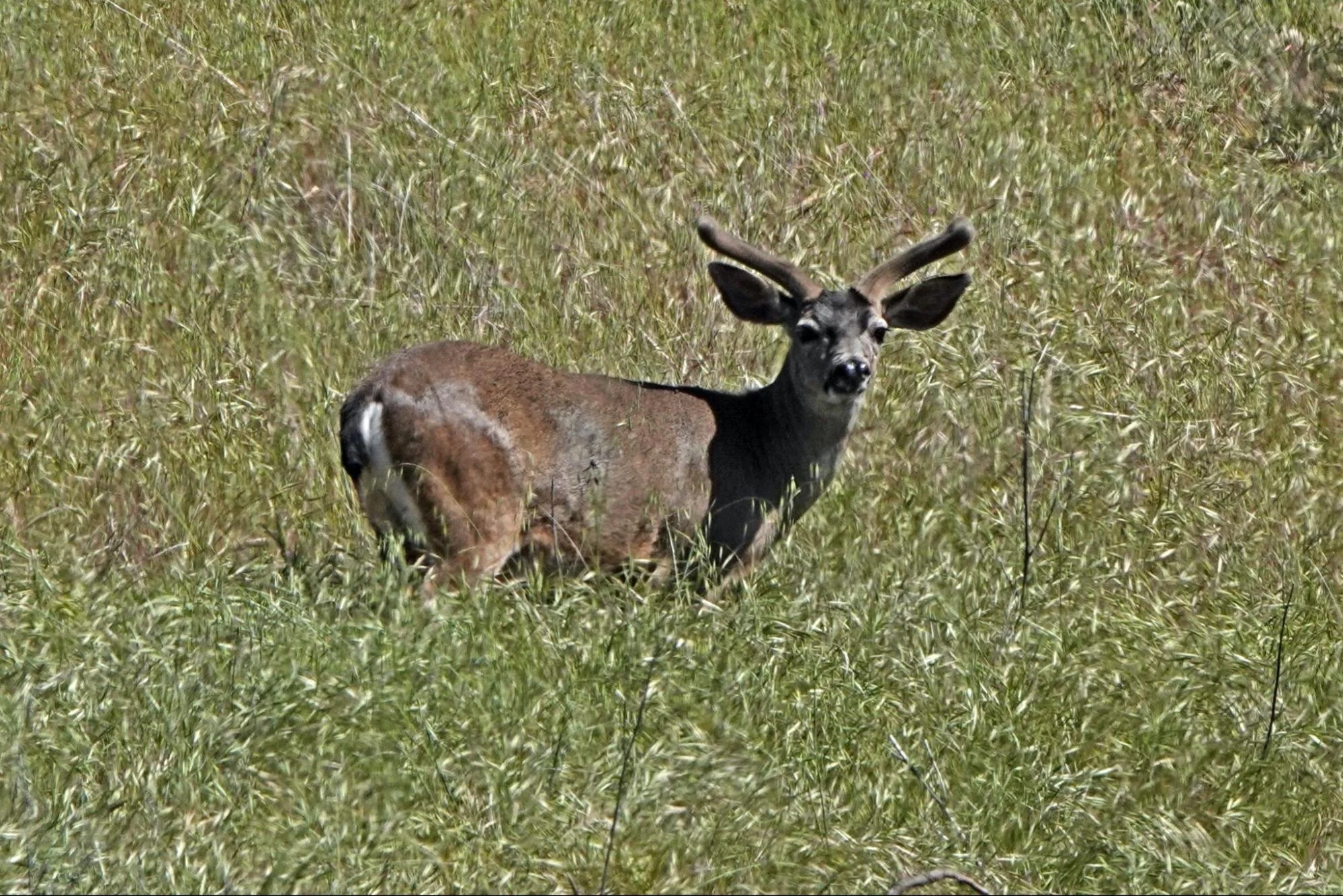
Columbian Black-tailed Deer on Pine Ridge
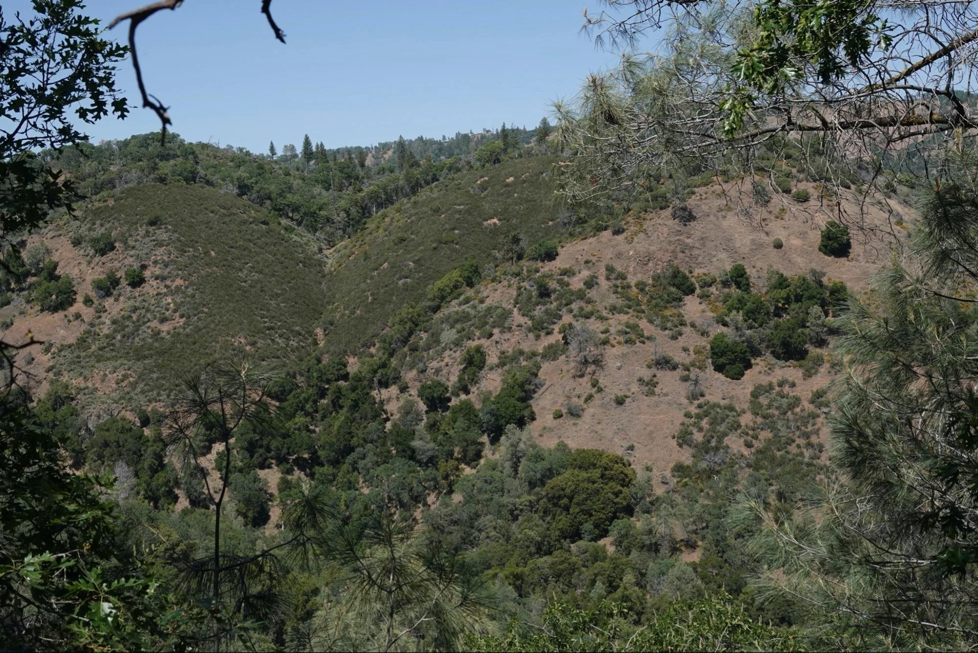
Henry Coe State Park is notable for a mostly intact native flora. There are forested ridge-tops and slopes interspersed with chaparral and grasslands, with some creeks supporting distinct riparian vegetation. Native trees which dominate the park include Valley Oak, Blue Oak, Coast Live Oak, Canyon Live Oak, Interior Live Oak, Gray Pine, Ponderosa Pine, Pacific Madrone, Big Berry Manzanita, California Laurel and California Buckeye.
Blue Oak is the most common and widespread tree. Ponderosa pines dominate parts of three ridges in the west: Pine, Middle and Blue Ridge, usually crowning the summits. Chamise is the most abundant shrub in Coe Park, covering acres of south-facing hot, dry slopes with poor soils.

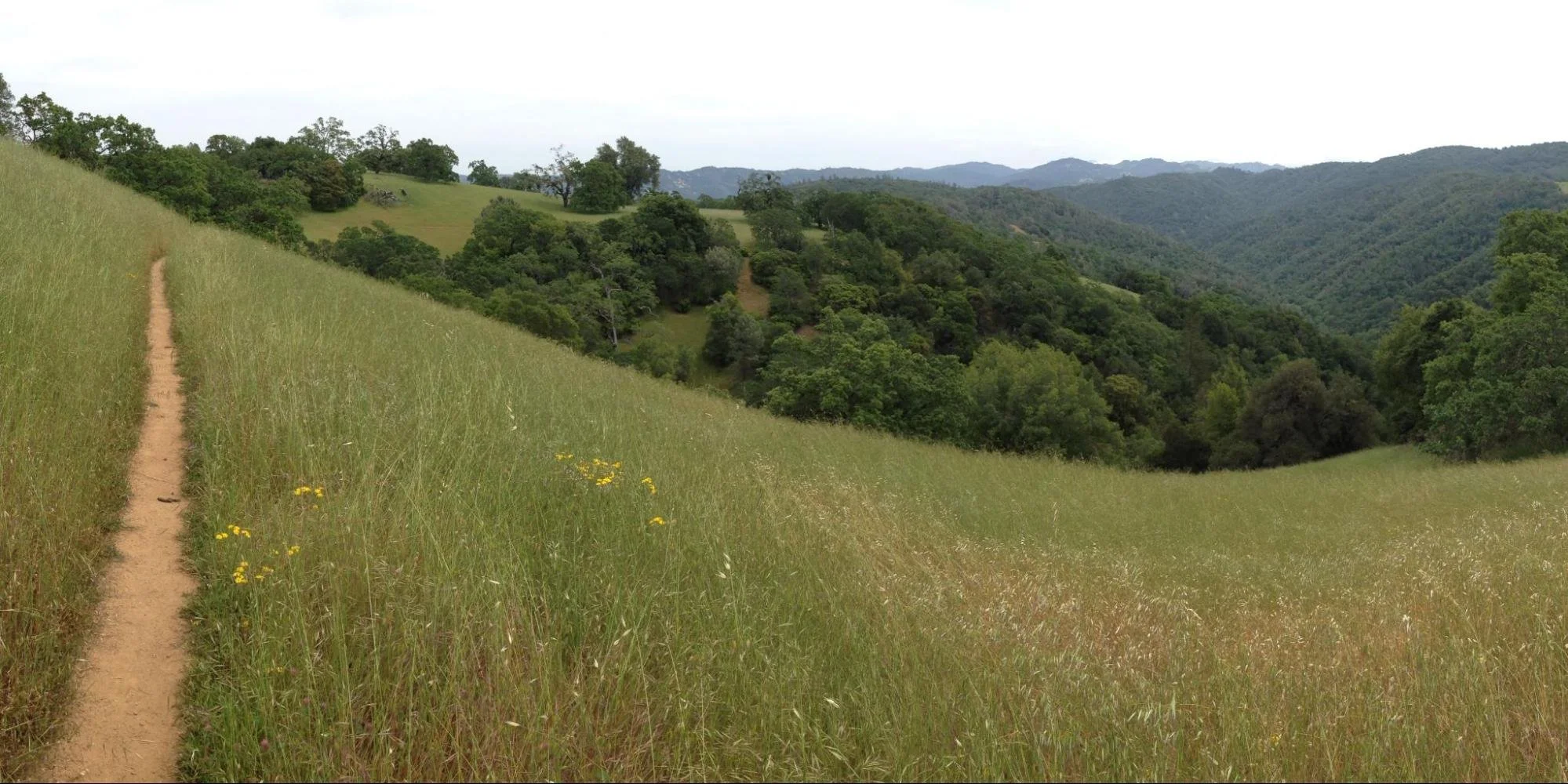
Mixed woodland and grassland along Pine Ridge seen from the Springs Trail
Grasses, chaparral and woodland along the dry, south-facing slope of Middle Ridge, seen from Forest Trail.
The park protects part of the California interior chaparral and woodlands ecoregion, which forms an elliptical ring around the California Central Valley. This region occurs on hills and mountains ranging from 300 feet (91 m) to 3,000 feet (910 m). It is part of the Mediterranean forests, woodlands, and scrub biome, with cool, wet winters and hot, dry summers.
Wildflowers are diverse and everywhere. Lupines, Poppies, Goldfields, Baby Blue Eyes, Mariposa Lilies, Larkspurs and Hyacinths are just a few. You can find the current Henry Coe wildflower list online at https://coepark.net/natural-sciences/wildflowers.

Bowltube Iris on Hobbs Road at Monument Peak.
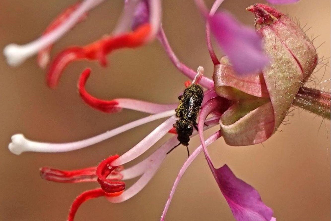
Beetle on Elegant Clarkia flower on Flat Frog Trail.
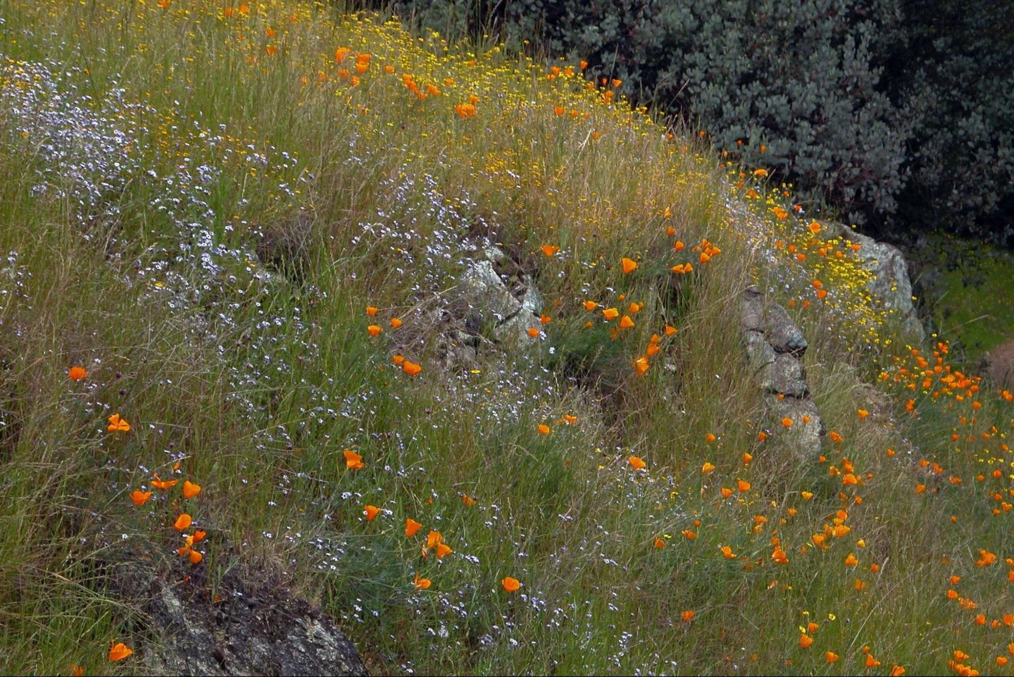
Poppies, goldfields and popcorn flowers along Manzanita Point Road.

Large-flowered Leptosiphon on the Corral Trail.
I have three routes that I recommend: the Ponderosa Loop Trail, the Springs Trail/Forest Trail loop, and the Frog Lake loop. Try the Ponderosa Loop Trail for views and pine habitat, the Spring and Forest Trail loop for sheltered woodlands with dappled shade, or Frog Lake Trail for a longer hike with a nice spot for a picnic lunch near the lake.

The Visitor’s Center at Henry Coe State Park Headquarters
Before heading out on any of these trails, spend some time exploring the headquarters area (#1 on interactive map) for Acorn Woodpeckers in the trees, Hermit Thrushes, California Quail, Wild Turkeys, Anna’s Hummingbirds, Nuthatches, and Black Phoebes, while you will likely also see Red-tailed Hawks flying overhead. You might get lucky and see a Golden Eagle.

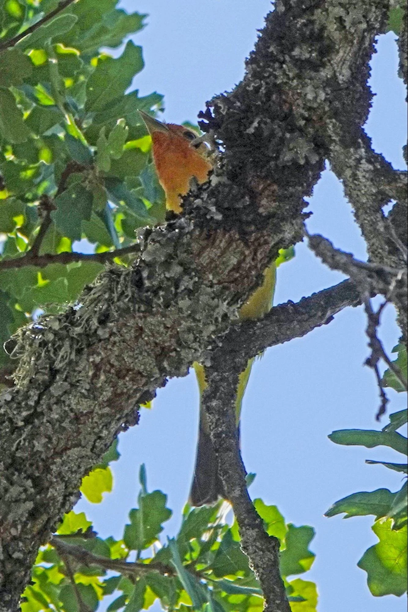
Acorn Woodpeckers are noisy and almost everywhere in Coe Park.
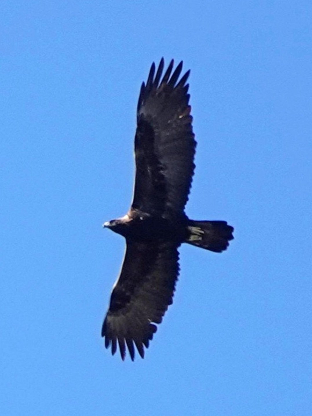
Golden Eagle flying over Pine Ridge

California Scrub Jay at Henry Coe State Park Headquarters.
Option 1: Ponderosa Loop Trail (2.7 mile loop/ 400 ft elevation gain)
Target Birds: Purple Finch, Orange-crowned Warbler, Black-throated Gray Warbler, Townsend’s Warbler, Hermit Warbler, Western Tanager, Black-headed Grosbeak
If you only have time for a short and relatively easy walk, Ponderosa Loop Trail is a 2.7 mile loop trail with an elevation gain of 400 ft. This loop gets you out into the woods, among the stately Ponderosa Pines and gives you beautiful panoramic views. Walking sticks are recommended for those who need them on steep trails.

Ponderosa Pines on Pine Loop Trail, on Monument Peak, with views of Coyote Ridge, Coyote Valley and the Santa Cruz Mountains.
From the Visitor's Center (#1 on interactive map), walk 0.1 miles up Dunne Ave, turn right on to Manzanita Point Road (Ranger’s driveway). Walk 0.1 miles to a gate (trailhead shown on map). Monument Trail is a narrow foot path to the left of the gate. There is a Monument Trail sign. The path is cut smooth, but coated in gravel that can roll and cause you to slip. The climb up to Ponderosa Trail is somewhat steep. On the ridge, turn left onto Ponderosa Trail (#2 on map). This is a 1 mile long loop trail among the Ponderosa Pines with panoramic views of the Coyote Valley and Santa Cruz Mountains (#3). When you return to Monument Trail (#2), continue left for 0.2 miles to Hobbs Road (#4). Turn Right on Hobbs Road and walk up to Monument Peak (#5). After exploring the peak and checking out the monument, return to the headquarters via Hobbs Road. It descends very steeply down to Manzanita Point Road. Take extreme care not to slip on the road gravel.
On this route, during your hike uphill through grassland habitats you will have wide views from a high vantage, placing you above the trees in the valley and facing the canopy of a nearby ridge. You will be able to see birds flying between trees and above the canopy such as Turkey Vulture, Red-tailed Hawk, American Kestrel, Band-tailed Pigeon, Northern Flicker, Acorn Woodpecker, Steller's Jay and California Scrub-Jay. Birds you hear calling include White-breasted Nuthatch, Hermit Thrush and Purple Finch. When you walk under the oak canopy and when you get up on the ridge under the Ponderosa Pines, keep an eye and ear out for leaf-gleaners like Chestnut-backed Chickadee, Oak Titmouse and Townsend’s Warbler. Nuttall’s Woodpeckers and White-breasted Nuthatches might be seen on the branches and trunks, while jays, Spotted Towhees, California Towhees and Dark-eyed Juncos are often seen scratching around in the leaf litter. Acorn Woodpeckers, Northern Flickers and nuthatches seem to dominate the pines, while jays, hermit thrush and towhees own the understory, but less common surprises like Black-throated Gray Warbler and Hermit Warbler in the canopy are what we all hope to find.

Female Purple Finch along Hobbs Road.

Hermit Warbler in Valley Oak on the Monument Trail

Tucked away in the trees on Monument Peak, you will find the Henry Coe Monument.
Option 2: The Springs Trail / Forest Trail Loop (3.7 miles, 320 feet elevation gain)
Target Birds: Golden Eagle, Hairy Woodpecker, Western Wood-Pewee, Pacific-slope Flycatcher, Ash-throated Flycatcher, Hutton’s Vireo, Hermit Thrush, Purple Finch, Lark Sparrow, Bullock’s Oriole, Orange-crowned Warbler, Black-throated Gray Warbler, Townsend’s Warbler, Western Tanager, Black-headed Grosbeak, Lazuli Bunting
These trails are two of the most popular trails in Henry Coe State Park and are all fairly level, but gradually drop in altitude. There are lots of wildflowers in the spring. These trails meander through sheltered woodlands with dappled sun and occasional openings that give you great views of surrounding ridges and valleys. Spring Trail runs along the south-west slope of Pine Ridge, so it is more exposed to the sun. Forest Trail is on the north-east slope of Pine Ridge, so it has more canopy cover and shade.

Corral Trail trailhead at Henry Coe Headquarters.
At the Visitor’s Center, start on the Corral Trail (pictured above, trailhead shown on map). You will pass a small bridge over a spring and continue to drop into a riparian and oak woodland. Birds depend on such springs for water, so stop and if there is water search for quail, hummingbirds, nuthatches, jays, towhees, sparrows and finches. About a half mile out, you will be in open grassland with old Valley Oaks and a large Ponderosa Pine.

Orioles, buntings, flycatchers and gnatcatchers are among the great variety of birds that can be found in the large Valley Oak trees along the Springs Trail on Pine Ridge.
Springs Trail, Pine Ridge
Acorn Woodpeckers are one of the more common birds in this environment, but you will also see Turkey Vultures, Red-tailed Hawks, Flickers and Oak Titmice. At the trail junction turn right on to Springs Trail (#6 on map). You will walk through a mix of woodland and open areas with a diversity of birds and wildflowers. You will also soon cross a couple natural springs, so be aware and approach them slowly. I have seen woodpeckers, nuthatches, towhees and sparrows drinking at these springs and seeps. Once I saw a Red-shouldered Hawk attack the birds at a spring. And, on more than one occasion, I have seen a Golden Eagle circling above, near the end of Spring Trail.
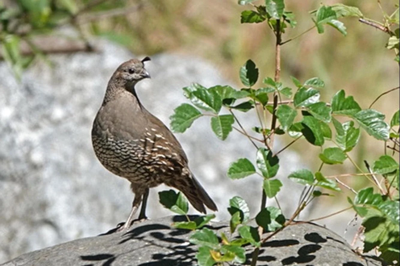
California Quail, Springs Trail

Spotted Towhees can be found drinking at springs, foraging in leaf litter, or skulking in the shrubs and trees on any of these trails.

Lark Sparrow, Manzanita Point Trail, Pine Ridge
Leaf gleaners like vireos, chickadees, juncos and warblers will suddenly show up in a loose, mixed flock, picking their way through the canopy, hunting for moths, caterpillars, other insects and spiders. You will also need to be vigilant. Most birding is done by listening for scratching, tapping, whistling and the small sounds birds make. If you spot lots of movement in the canopy, concentrate on one bird at a time. They like to hide so don’t get frustrated, just stick with it. You’ll lose some and you’ll get some.

Townsend’s Warbler in Bay Tree; one of the many leaf gleaners that can be found along Forest Trail.
Spring Trail ends at the intersection with Manzanita Point Road and Poverty Flat Trail. Cross over these trails to Forest Trail (#7 on map).

Black-headed Grosbeak in Valley Oak on Flat-Frog Trail.
Forest Trail meanders through shaded woodlands with occasional views of Middle Ridge and Blue Ridge. Keep your eyes out for Nuttall’s Woodpeckers, Hairy Woodpeckers and Hutton’s Vireo. Once the migrants arrive you’ll have a chance of seeing Western Tanagers, Black-throated Gray Warblers and Black-headed Grosbeaks. Grosbeaks will become common as they nest along these shady slopes. At each end of the Forest Trail, you'll find a box with self-guided nature trail pamphlets. When you reach the Corral Trail (#8), return on it or take Manzanita Point Road back to park headquarters.

Large Manzanita trees grow along the narrow Forest Trail, interspersed with oak trees, Gray Pine and lots of understory plants, including poison oak.
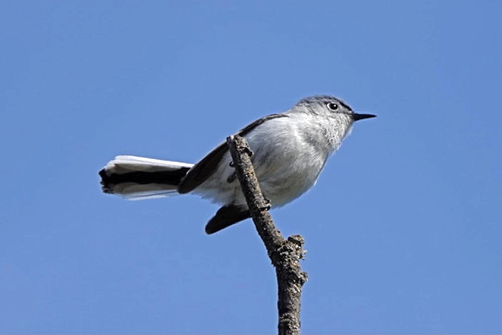
Blue-gray Gnatcatcher, Springs Trail.

Bullock’s Oriole on Valley Oak along the Corral Trail
Option 3: Frog Lake Loop (4.5 miles, 640 ft elevation gain)
Target Birds: Hairy Woodpecker, Western Wood-Pewee, Pacific-slope Flycatcher, Ash-throated Flycatcher, Hutton’s Vireo, Oak Titmouse, Bewick’s Wren, Western Bluebird, Hermit Thrush, American Robin, Townsend’s Warbler, Western Tanager, Black-headed Grosbeak
Walking poles and/or sturdy boots with good tread are recommended. Carry ample water to drink. During the spring, the wildflowers along these trails can be spectacular in their abundance and variety, so you may want to bring a wildflower guide with you. There is good birding all along this loop, but you can not predict exactly where you will find the hot spots since they move as the mixed flocks of birds shift from tree to tree, gleaning leaves for insects, or foraging in the leaf litter. If you spot activity in the canopy, stop and spend time straining your neck to figure out each and every bird you can get in your binocular’s view. There is often a “surprise” species, or two, that you did not see at first.

Frog Lake.
From the Headquarters/Visitor’s Center, start at Manzanita Point Road 0.1 mile uphill. Hike up the drive a few hundred feet to a gate and turn left on the narrow, marked Monument Trail (trailhead shown on map). Hiking over Monument Peak to Frog Lake gives you a chance to visit the Henry Coe Monument. Spend time on the peak looking past the Acorn Woodpeckers, Northern Flickers and White-breasted Nuthatches on the pines at Monument Peak. These birds are common and will distract you from the less noisy Spotted Towhees, Hutton’s Vireos and Purple Finches. Red-shouldered Hawk is sometimes seen and often heard on this ridge.
Western Tanager in Blue Oak along Hobbs Road.
When you come to the Monument Trail/Hobbs Rd junction (#4 on map), turn left and follow Hobbs Road down hill towards Frog Lake. This oak and manzanita woodland is a good bird watching area, but you have to stop often and be quiet to hear the bird activity. Woodpeckers, flycatchers, nuthatches, chickadees, vireos, tanagers, grosbeaks, or warblers might suddenly appear in the canopy above you. Be very careful on the steep gravel road. After about a mile of steep downhill hiking through a mix of Manzanita and Oak trees you'll reach the Little Fork of Coyote Creek. Cross the creek, and at the trail intersection (#9) you can stay on the road for a quarter of a mile to the campsite and toilet (shown on map), or turn right on the narrow trail, and follow it to Frog Lake (#10).

Western Wood-Pewee, Pine Ridge.
Spend some time at Frog Lake. You might want to plan to lunch on a bench at the campground near Frog Lake. Red-winged Blackbirds are often seen at the pond and swallows occasionally visit the area. Bird watching near the lake can be very good with Nuttall’s Woodpeckers and Hairy Woodpeckers, Oak Titmice, Chestnut-backed Chickadees, Western Tanagers, Black-headed Grosbeaks foraging in the trees. Walk slowly, stop and listen quietly. Give the birds a chance to adapt to your presence.

Violet-green Swallow above the campground near Frog Lake.

Female Wilson’s Warbler along Flat Frog Trail.
On your return trip, soon after you recross the Little Fork of Coyote Creek, take a left on Flat Frog Trail (#11). This trail is on the north east slope of the ridge and is mostly wooded with oak and pine. There are stretches with lots of large manzanitas as well. You will be looking for woodland birds like woodpeckers, nuthatches, titmice, juncos and towhees, but Black-headed Grosbeaks nest in some of these trees and their calls can often be heard.

Sara Orangetip nectaring on fiddleneck flowers at the Little Fork of Coyote Creek.
About two miles later, you'll arrive at "Grand Junction" (#8). Cross the Manzanita Point Road and follow the short spur trail to get to the Corral Trail. Turn right to get back to park headquarters (#6). From late April, along the Corral Trail, you will want to keep your eyes and ears peeled for Ash-throated Flycatchers and Lazuli Buntings in the oak trees and shrubs.

Ash-throated Flycatcher in Valley Oak, Pine Ridge.

Lazuli Bunting

Looking for birds, you will also spot other interesting animals like this female Blue-eyed Darner resting on Blue Oak along the Flat Frog Trail.
Ready for More? After spending the day at Henry Coe, you can continue birding on your drive home while you enjoy the views of the valley below. There are ranches and woodlands all the way down the mountain and some good bird watching along the way. Try parking at a pullout or two.
Interactive Map
Directions: From US-101 in Morgan Hill, exit onto East Dunne Ave. Drive east on East Dunne Ave for 3 miles to a fork in the road, at the entrance of Holiday Lake Estates. At the fork, keep to the right on the now much narrower East Dunne Ave. This intersection is tricky as the road to Holiday Lake Estates seems larger and easier to follow. There is a brown Henry Coe State Park sign to help guide you. Drive east along East Dunne Ave, a narrow, winding road that circles around the east side of Anderson Reservoir, for 9.4 miles to Henry Coe State Park Headquarters.
Parking: Parking space is limited during the spring season, so arrive early, or carpool. There is a small paved parking lot that holds over a dozen cars at the Headquarters and Visitor’s Center. There is also a second parking lot off Dunne Ave just before the headquarters buildings. There is an even larger “Entrance Parking Lot”, used for overflow parking, off East Dunne Ave, about 0.4 miles (#12) before you get to the Park Headquarters buildings. Weekdays are usually much less busy.
Fees: Cash only day pass or state park pass. See park website for more information.
Public Transportation: This park can not be accessed via public transportation
Park Hours: Open 24 hours. Park entrances are always open, 365 days a year including holidays.
Facilities: There are a couple of picnic tables and bathrooms at the headquarters building. There are also toilets in the nearby campground. There is another toilet along Hobbs Rd at the Frog Lake Campground.
Cell phone service is poor to non-existent so print out a park map or pick one up at the headquarters before heading out.
Trip Mileage: variable
Trail Conditions: Manzanita Point Road and Hobbs Road are wide, dirt, ranch roads. They are very steep in sections. Extreme care must be taken not to slip on gravel in steep sections. Bring hiking poles if you need them. These roads offer little shade, so bring lots of water and a hat.
Monument Trail, Ponderosa Trail, Flat Frog Trail, Forest Trail, Springs Trail and Corral Trail are narrow hiking trails in woodland, but these trails tend to follow contours, so they are not as steep as ranch roads. You must learn how to recognize Poison Oak. Poison Oak grows in shaded woodland and is almost unavoidable in places.
Accessibility: This trip is not accessible.
Bikes: Bicycles are allowed on Manzanita Point Road, Hobbs Road and Flat Frog Trail. Flat Frog Trail is too narrow and has too much poison oak to allow hikers and bikers to share the trail safely, so be careful.
Dogs: Dogs allowed only at the Coe Ranch Entrance in the Coe Ranch Campground, paved areas, and the ½-mile Live Oak Trail that connects the visitor center to the Entrance Parking Lot. If camping in the Coe Ranch Campground, dogs must be with you in your tent or vehicle at night. Dogs are not allowed anywhere else inside the park.
More Information
eBird hotspot: Henry Coe SP--NW Region (HQ and trails access)
More Resources
For more trips like this one, visit Self-Guided Field Trips.
Visit the SCVAS Birding Resources page for more information on where to bird, our birding community, bird identification resources and more.
Read “What to Look for Now” by SCVAS Executive Director Matthew Dodder.
Banner Photo Credit: All photos by Edward Rooks
Last Updated: 5/04/2022
Enjoyed this Trip?
Support the work of Santa Clara Valley Audubon Society and become a member. To contact the trip writer with comments, questions or location updates, please email fieldtrips@scvas.org. You can also post in the comment section below. (If you’d like to post anonymously, type your comment, select “Post Comment”, then simply provide a name, like “Guest”, and select “Comment as Guest”.)