Charleston Road Marsh (Fall/Winter/Spring):
A Bayside “Migrant Trap”
by Adam Burnett
A “migrant trap” close to the bayfront, Charleston Road Marsh is worth visiting for a chance to find fall migrants dropping in, seek out songbirds spending the winter skulking in the shrubs, or enjoy some colorful spring travelers on their way back north. Peaceful and rarely very crowded, this marsh is an underappreciated and under-birded gem with great potential for bringing in migrants common and rare.
Trip Covers: September - May
Key Birds: Willow Flycatcher, Hermit Thrush, Fox Sparrow, Orange-crowned Warbler
How to Bird
Adjacent to the Google Campus in Mountain View, Charleston Road Marsh is a half-mile-long strip of trees, shrubs, and marshy vegetation, 100 yards from Stevens Creek and about a mile from the closest salt ponds along San Francisco Bay. Though called a marsh, it offers little habitat for waterbirds—instead, its claim to fame is its propensity for attracting migrant songbirds.
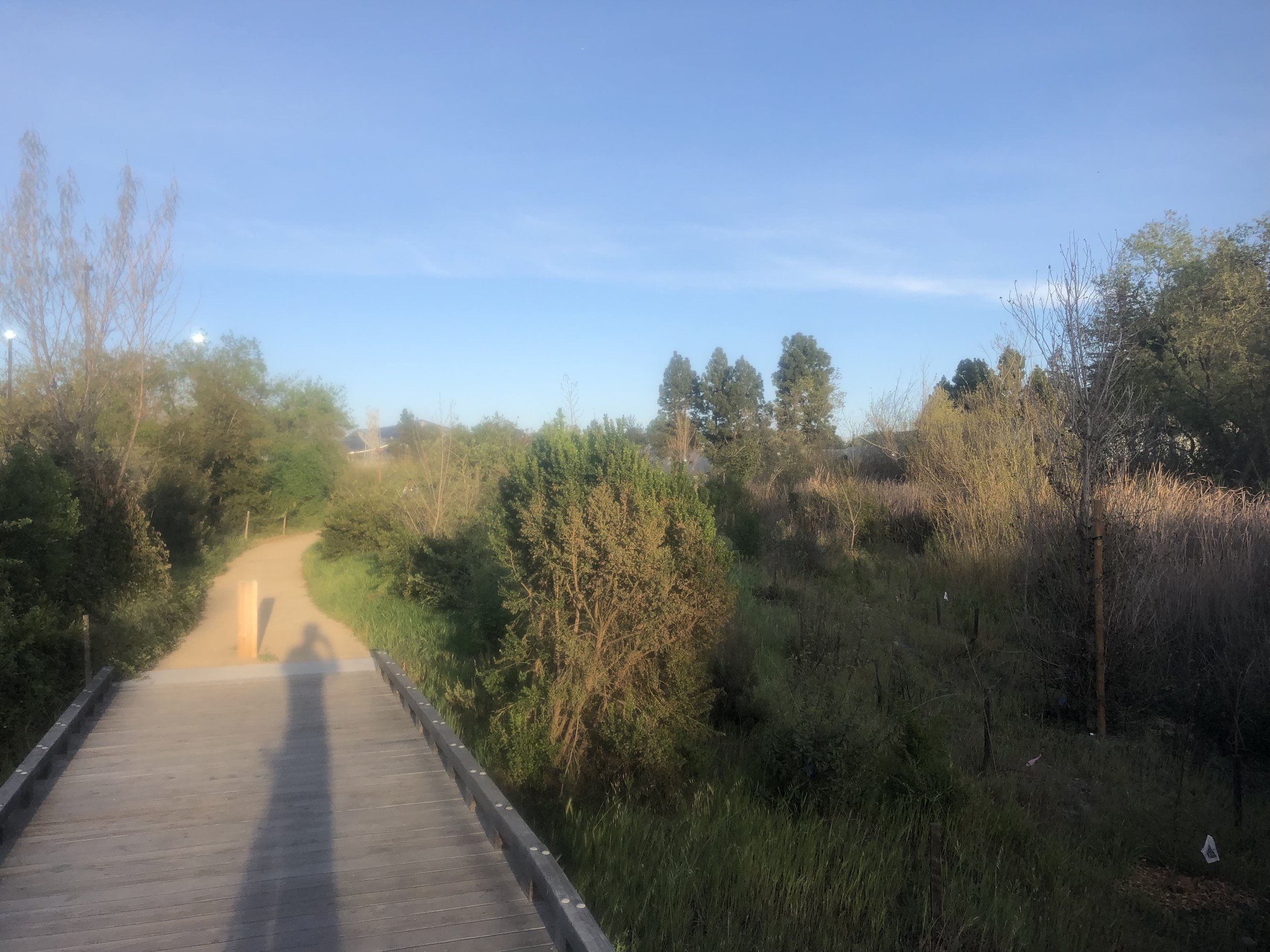
This self-guided field trip starts at the northeast corner of the marsh and leads you clockwise on the 1.1-mile loop trail around the marsh’s perimeter. This trail, labeled “Fitness Trail” on Google Maps, is flat and generally wide, with a packed sand surface punctuated by a couple wooden boardwalks. I usually visit on weekends or on weekday evenings, and I rarely see more than a couple other people there, so crowds are not a concern.
As you enter at the northeast corner of the marsh (#1 on the interactive map), a pump station lies straight ahead (#2 on map), pumping water between the marsh and Stevens Creek. Next to the pump station is an opening in the vegetation, with a tiny area of open water. This is perhaps the single best spot along this trail for finding migrant songbirds, as they like to hop through the bushes at the edge of the open area, hawk flying insects from perches overhead, or fly down to the water to bathe and drink. It may be most attractive to birds at times when water is scarce elsewhere, such as the period of fall migration before the first winter rains.

The small, open, wet area by the pump station at the east end of the marsh.
After checking out this clearing, work your way clockwise along the trail, keeping the marsh on your right and the adjacent parking lots on your left. Shortly after leaving the pump station, you will encounter a short, curved boardwalk leading out into the marsh (#3). Following it may provide closer views of some of the songbirds hanging out in the marsh vegetation, including Song Sparrows and Common Yellowthroats. These two species are common here, but their fellow wetland-dwelling songbird, the Marsh Wren, seems to be mostly absent. Perhaps the areas of marsh vegetation here are too small and confined for its liking. An occasional Green Heron is just about the only waterbird that visits the marsh, possibly to hunt the Pacific chorus frogs that are sometimes audible here.

A short, curved boardwalk leads out into the marsh.
A couple hundred yards farther along, the trail reaches Charleston Road (#4). Follow the road’s concrete sidewalk for about 50 yards, then take a right turn (#5) to rejoin the sandy path around the marsh, keeping the marsh on your right.
Continuing clockwise around the marsh, you reach one footbridge (#6) and then another (#7), both of which span the short distance across the marsh. These bridges offer a different viewing angle into the marsh, plus the convenience of shortening your loop around the marsh if you so choose. In this same area, along the western portion of the south edge of the marsh, there are a few casuarina trees. These trees, native to Australia, often are full of seeds, which Lesser Goldfinches and Pine Siskins like to eat.

A casuarina tree overhangs the sandy path along the south side of the marsh.

One of the footbridges crossing the marsh.
A bit farther along, the trail reaches North Shoreline Boulevard (#8). To continue your clockwise loop around the marsh, turn right and walk about 20 yards on the sidewalk of North Shoreline Boulevard, then turn right again to rejoin the trail around the marsh (#9). As you walk back eastward along the north side of the marsh, the trail passes over a couple short boardwalks, though the ground here is mostly dry. A bottlebrush hedge borders the eastern part of this trail segment, near the northeast corner where you started your loop, and is worth checking for hummingbirds and nectar-drinking warblers.

A stretch of trail leads over a boardwalk along the north side of the marsh.
Another short boardwalk passing through a weedy and shrubby area.
As a vegetated bayside location that draws in good numbers of warblers and other migrant songbirds, Charleston Road Marsh can be considered a “migrant trap”. Migrant traps typically are patches of suitable habitat surrounded by unsuitable habitat. What habitat is suitable depends on the bird in question. For most songbirds, a migrant trap could be an offshore island, or a lush oasis surrounded by desert. Classic California examples include San Francisco’s famous Farallon Islands and Death Valley’s Furnace Creek Ranch. Migrating birds are sometimes funneled by geographic features such as coastlines or mountain ridges, so peninsulas and mountain passes also can be good places to look for migrant songbirds: for example, Point Reyes or, closer to home, the “saddles” at Loma Prieta. The modest Charleston Road Marsh can hardly claim to measure up to these hallowed birding sites, but its location near the shore of San Francisco Bay, and its status as an isolated pocket of thick shrubby vegetation surrounded by parking lots, probably help it pull in more than its fair share of migrant songbirds.
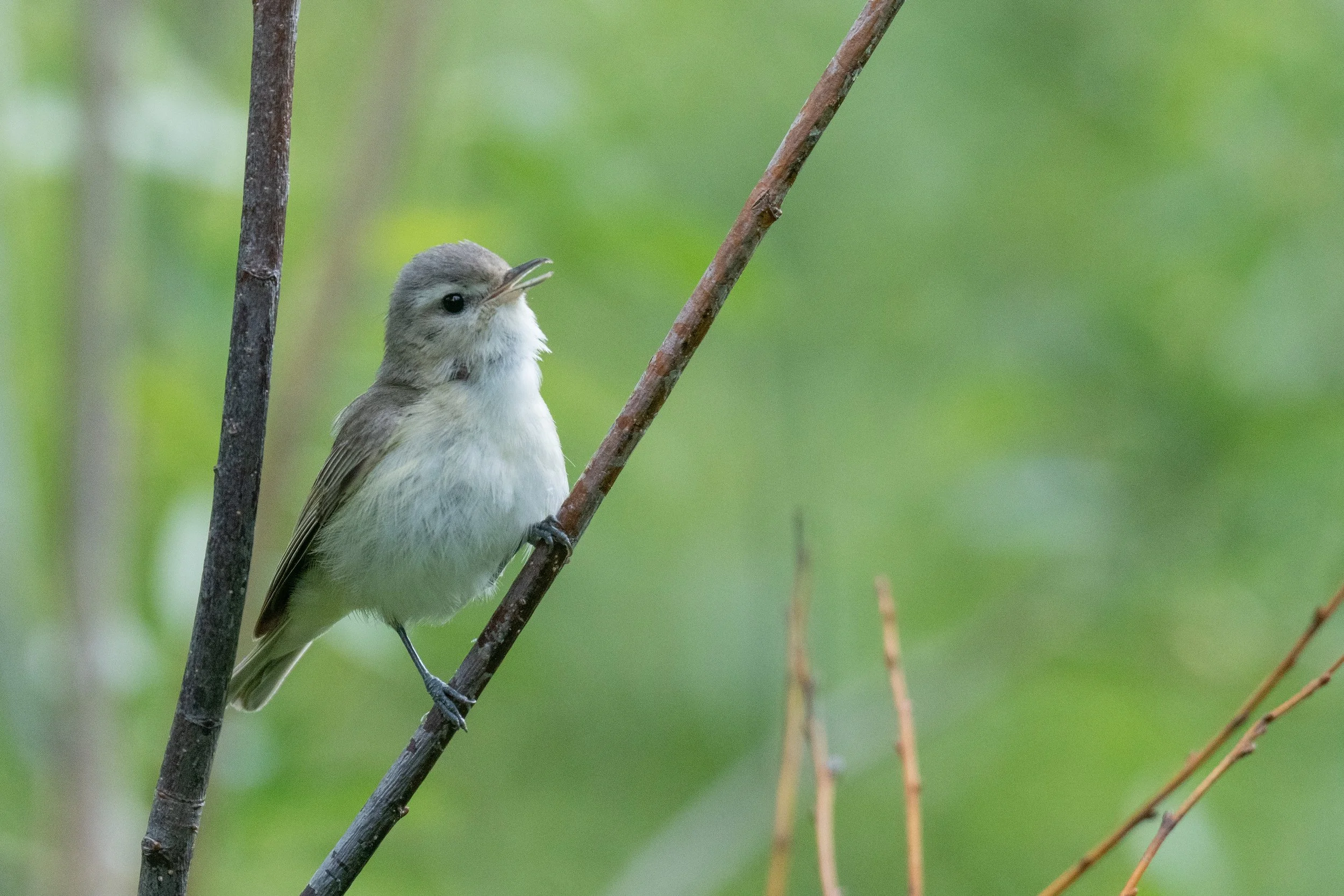
Now, what migrant songbirds occur here? The most common warblers here are Yellow Warblers, which are numerous fall migrants in September before heading farther south, and Yellow-rumped Warblers, which arrive for the winter in mid-September and stay through April. Other regular spring and fall migrants include Pacific-slope Flycatcher, Warbling Vireo, Orange-crowned Warbler, Wilson’s Warbler, and Western Tanager. Winterers include Ruby-crowned Kinglet, Cedar Waxwing, White-crowned Sparrow, Golden-crowned Sparrow, Lincoln’s Sparrow, and Townsend’s Warbler.

Yellow Warblers are one of the fall migrants that can be found in this area. Photo: Teresa Cheng
Another common winterer at this marsh is the Fox Sparrow, often found scratching in the undergrowth. Take care to distinguish this species from the superficially similar Hermit Thrush, which is also numerous here. The Hermit Thrush has a slender bill adapted for eating fruit and insects, while the Fox Sparrow’s yellowish bill is thick and wedge-shaped, useful for cracking seeds. The Fox Sparrow also has diamond-shaped, spotty streaking on its whitish underparts, extending to its flanks, with the streaks being the same reddish-brown color as the bird’s back. The Hermit Thrush has smaller, circular spots on its underparts, more confined to its throat and upper breast, and the spots are dark brownish black, much darker than the Hermit Thrush’s medium brown back and reddish wings and tail. Though the “Sooty” subspecies of Fox Sparrow is the only expected one here, any of the other three—“Red”, which breeds in the taiga; “Slate-colored”, which breeds in the Rockies; or “Thick-billed”, which breeds in the Sierra Nevada—could show up here as a rare migrant. The “Slate-colored” Dark-eyed Junco, also a taiga breeder, is another subspecies worth watching out for as a rarity here.

Hermit Thrush by Rachael Lee. Note the slender bill adapted for eating fruit and insects.
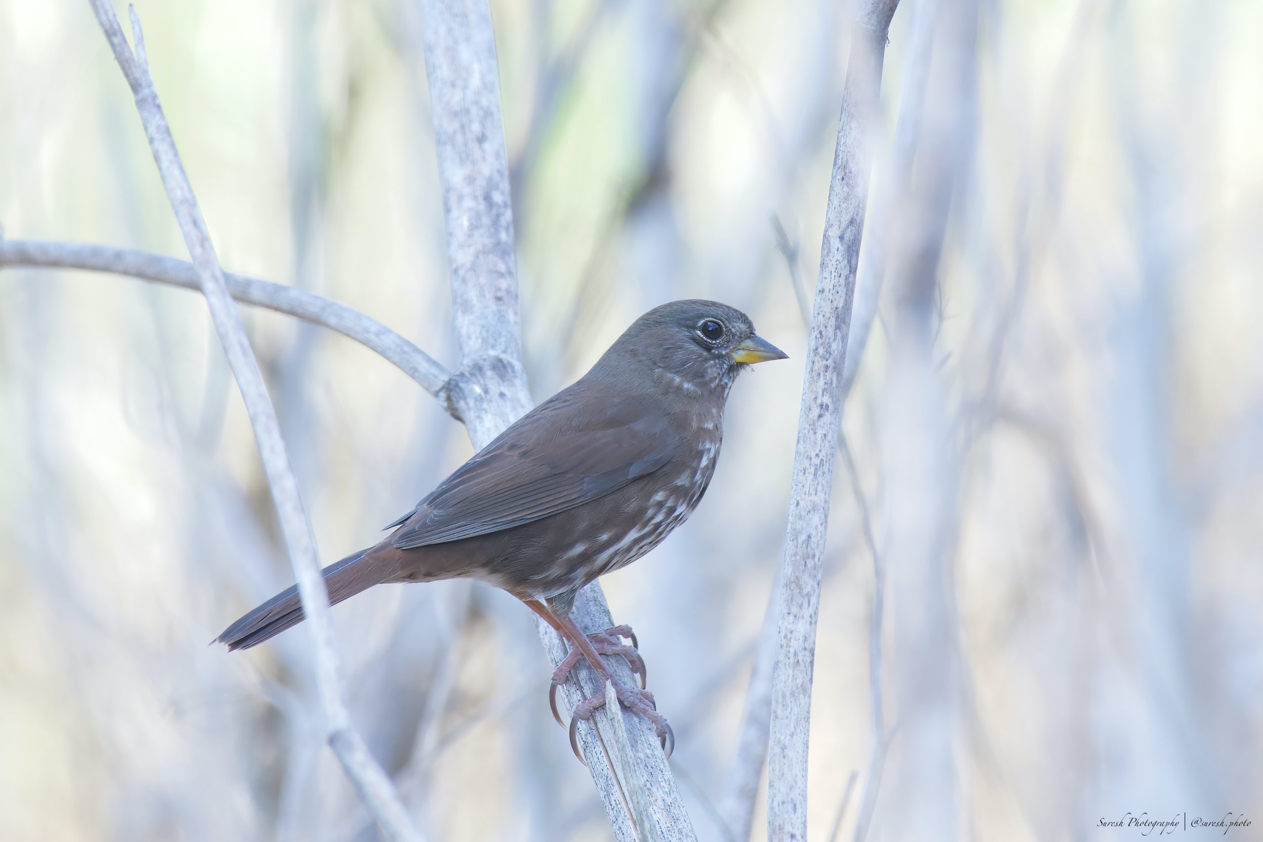
Sooty Fox Sparrow by Suresh Thirumalai. Note the thick and wedge-shaped bill which is useful for cracking seeds.
Speaking of subspecies, if you see an Orange-crowned Warbler here in fall or winter, pay close attention. The most common subspecies here is “lutescens”, which breeds in the Bay Area and elsewhere along the West Coast, and has a yellow-green head similar in color to the rest of the body. If you are lucky, your Orange-crowned Warbler may instead be one of the “Gray-headed” subspecies, either “orestera” (which breeds in the Interior West) or the nominate “celata” (which breeds in the taiga). Even the fourth subspecies, “sordida”, is worth watching for, though conclusively identifying it would require careful observations and preferably photos. The main “sordida” field mark to look for is olive-colored streaking on the undertail coverts.

The “lutescens” subspecies of the Orange-crowned Warbler, common in the Bay Area. Photo: Luis Villablanca
The shrubby wetland habitat of Charleston Road Marsh is particularly good for Willow Flycatcher, an uncommon migrant that primarily passes through in late August and September. Scarcer warbler migrants to watch for include Black-throated Gray Warbler, Nashville Warbler, Hermit Warbler (seen here in 2012), and MacGillivray’s Warbler (seen here in 2020), plus any of a wide range of warblers from Eastern North America that show up in Santa Clara County on occasion. Three Scaly-breasted Munias appeared here in November 2019, perhaps dispersing northward from the small population in southern San José or the larger population in Southern California. Another exciting rarity, though one that will not add to your species list, was an apparent hybrid Nuttall’s x Downy Woodpecker seen here and along the adjacent stretch of the Stevens Creek Trail for a few months in 2020. The rarest birds found at this location so far have included Plumbeous Vireo (2019), Clay-colored Sparrow (2019), Orchard Oriole (2020), and Ovenbird (2015). Northern Waterthrush used to be fairly regular here, sometimes overwintering, but has not been reported here in a few years. Hopefully they will return!

Willow Flycatchers are an uncommon migrant that primarily passes through in late August and September. Photo by Brooke Miller.
As you work your way around the marsh, keep all these migrant birds in mind, common and rare, and be ready for the unexpected to show up at any turn. If it never does, you can always come back another day! Trying this spot out on different days throughout the fall, winter, and spring will allow you to see the changing seasons reflected in the arriving and departing birds. Visiting this spot in midsummer will probably be less exciting for migrant songbirds, but may feature some Snowy Egrets, Great Egrets, or Black-crowned Night-Herons flying overhead as they commute between foraging areas along the bay and their rookery at nearby Shorebird Way. There is always something going on here—birds are always on the move.
Ready for More? Several other bayside birding areas are nearby, including the Stevens Creek Trail, the Shoreline Kite Flying Area, Shoreline Lake, and Coast Casey Forebay. Also nearby is the Shorebird Way heronry, worth a visit in spring or summer—look for nesting egrets and night-herons in the trees above the eastern portion of Shorebird Way.
Interactive Map
Directions, Parking, and Bikes:
Since this is a small, out-of-the-way spot surrounded by corporate buildings, it has less in the way of obvious parking or other amenities for visiting birders compared to other birding sites. The parking lots adjacent to the marsh are reserved for employees of Google and the other adjacent businesses. But, free public parking is available nearby at Shoreline Amphitheatre Lot C (shown on the interactive map: 37.424243, -122.079702). This lot is across the street from the Google Visitor Experience. Please note that parking is not allowed at Shoreline Amphitheatre Lot C on concert days. From Lot C, walk south on N Shoreline Blvd for ½ block to reach the marsh. You’ll be starting at point 9 on our interactive map.
Another parking option is the Shoreline Kite Flying Area (37.429813, -122.077312), located 0.6 miles to the north of Charleston Marsh along North Shoreline Boulevard (also shown on the interactive map). By foot or bike, the parking lot for the kite flying area is 0.6 miles from the northwest corner of the marsh and 0.9 miles from the northeast corner, where this self-guided field trip begins. If you are covering this distance by foot, it probably makes sense to walk straight to the northwest corner of the marsh and walk a loop around the marsh starting and ending there.
I usually arrive by bike via the Stevens Creek Trail, exit the trail at Crittenden Lane, then immediately turn left and cut southward through a parking lot to reach the northeast corner marsh. Biking on the trail around the marsh is not allowed, and there are no obvious bike racks nearby, so I usually walk my bike around the trail while birding.
Fees: None
Public Transportation: From the Mountain View Transit Center, take bus route B to the “Shoreline @ Charleston” stop. The west end of the marsh at Charleston Road is about 0.2 miles north of this stop. The Mountain View Transit Center connects to CalTrain and VTA bus and light rail.
Park and/or Trail Hours: Open 24 hours.
Facilities: No bathrooms or drinking fountains are at Charleston Road Marsh. There is a porta-potty at the Shoreline Kite Flying Area parking lot (shown on interactive map), a public bathroom at Charleston Park, and facilities in Google Visitor Experience (check hours).
Trip Mileage: 1.1 miles
Trail Conditions: Flat. Trail surface mostly hard-packed sand, with short stretches of pavement and a couple wooden boardwalks. Partial sun exposure. The trail is wide and rarely crowded.
Accessibility: Wheelchair-accessible.
Dogs: No indication is given as to whether dogs are allowed.
More Information:
eBird hotspot: Charleston Rd. Marsh
More Resources
For more trips like this one, visit Self-Guided Field Trips.
Visit the SCVAS Birding Resources page for more information on where to bird, our birding community, bird identification resources and more.
Read “What to Look for Now” by SCVAS Executive Director Matthew Dodder.
Banner Photo Credit: Warbling Vireo by Vivek Khanzodé
Last Reviewed: 11/29/2023
Enjoyed this Trip?
Support the work of Santa Clara Valley Audubon Society and become a member. To contact the trip writer with comments, questions or location updates, please email fieldtrips@scvas.org. You can also post in the comment section below. (If you’d like to post anonymously, type your comment, select “Post Comment”, then simply provide a name, like “Guest”, and select “Comment as Guest”.)