County Boundaries at the Mouth of San Francisquito Creek
The boundary between Santa Clara County and San Mateo County takes a sudden twist just beyond the mouth of San Francisquito Creek, making it difficult to determine whether a bird is in one county or the other. This location has proven to be an amazing hotspot for birds rarely seen elsewhere in the county, such as Ruddy Turnstone, Red Knot and Black Oystercatcher.
Based on the official map maintained by the County of Santa Clara, most of what you can see from the end of the trail is in San Mateo County, but parts are in our county as well.
The images below can help you figure out whether your bird is in one county or the other. The first two images are screenshots from the official County of Santa Clara SCC Map, the third is a photo taken by Adam Burnett with the county boundary drawn in to illustrate which parts of the mouth are in Santa Clara County.
Other maps have different interpretations of the boundary, as shown below. The SCC Map and OpenStreetMap (the interactive map above) appear to agree though, and are likely the most accurate maps available.

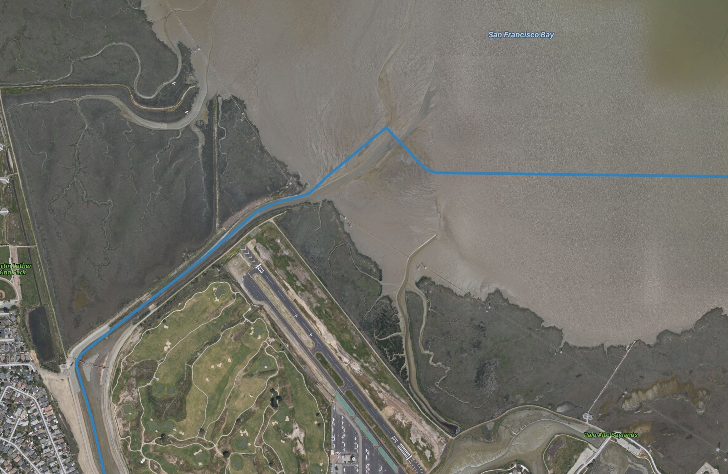
Mouth of San Francisquito Creek, the boundary between San Mateo County and Santa Clara County (source: County of Santa Clara)

Closeup of the southeast point at the mouth of the creek. The pink line is the county (and City of Palo Alto) boundary. The yellow line is a parcel; it’s not clear why it doesn’t match the county line (source: County of Santa Clara)

County lines superimposed on a photo taken at the mouth of the creek. Courtesy of Adam Burnett
Other Interpretations of the County Boundary
Among the difficulties in pinning down boundaries is that they can shift over time. When Santa Clara County was first created, San Francisquito Creek emptied into the bay further south than it does now. After the Palo Alto Airport was built, lower San Francisquito Creek was rerouted to be northwest of the airport to prevent it from flooding, and the county boundary moved with it (source: Bill Bousman).
Different maps show different locations for the boundary, depending on where their data originated. The USGS, the County of Santa Clara and Google Earth all have different interpretations of what happens at the mouth of the creek.
County boundary data based on the United States Geological Survey (USGS) TIGER/Line 2019 Shapefiles. Line curves with the creek. Notice that the 90º angle at the top center is much further out in the bay than shown on the SCC Map (above).

County boundary as shown in Google Earth. Notice the dead-straight line that doesn’t follow the center of the creek (none of it is in our county!) and that the 90º angle in the center is further out in the bay than shown on the SCC Map (above)
The boundary used in OpenStreetMap appears to more faithfully follow the lines shown in the official SCC Map than any of the other online maps. The interactive map at the top of this page uses OpenStreetMap—you can zoom and scroll to examine any part of our county boundary.

Santa Clara County boundary at San Francisquito Creek as shown in the OpenStreetMap editor, using Bing aerial imagery.